
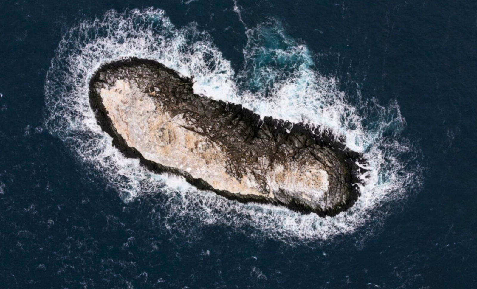
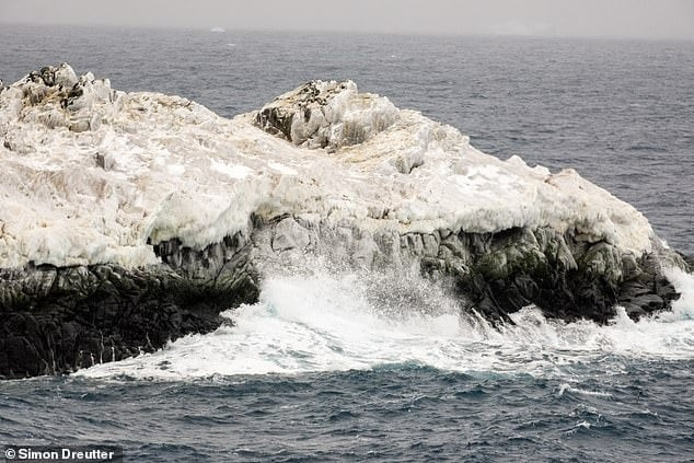
While navigating rough seas, a German research ship stumbled upon a previously undocumented island in one of Antarctica’s least explored regions. This rocky landform, stretching about 130 meters in length and 50 meters across, was identified in February 2026 within the northwestern Weddell Sea—a territory long labeled on maritime maps as an “unexplored danger zone.”
The island had eluded detection via satellite imagery typically used for voyage planning. Initially mistaken for a dirty iceberg, closer examination revealed solid rock protruding from the icy surroundings. Plans are underway to officially name the island and include it on global navigation charts.
Unveiling a Hidden Risk to Navigators
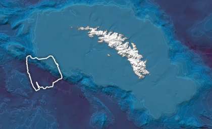
The discovery was made during an expedition organized by the Alfred Wegener Institute aboard the RV Polarstern. A diverse international team of 93 scientists was headed to investigate the flow of ice and water from the melting Larsen Ice Shelf when worsening weather conditions prompted a last-minute detour. Seeking refuge in the lee of Joinville Island, the vessel passed through a region where charts issued a vague caution, as noted in a press release from the Alfred Wegener Institute.

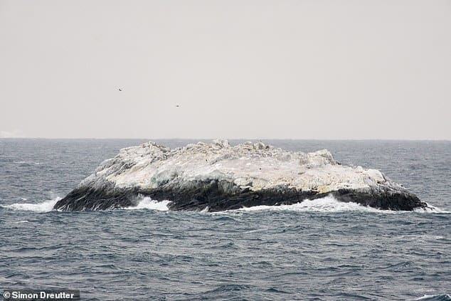
Simon Dreutter, an expert in underwater cartography at AWI, recalled the moment: “We observed an object in the water that looked like a dirty iceberg. On closer look, it became clear it was rock.” Initially, the dark coloration was assumed to be sediment trapped in a typical iceberg, common near the Antarctic Peninsula. Advancing closer revealed the unmistakable angular shape of exposed bedrock.
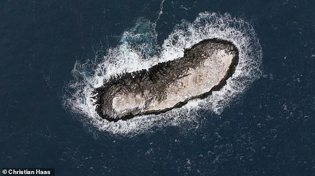
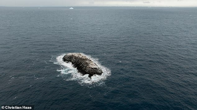
The team used the ship’s multibeam echo sounder and an onboard drone to precisely measure the island. Its dimensions are 130 meters long, 50 meters wide, and 16 meters high. For scale, the RV Polarstern, which is 118 meters long, is slightly shorter than the island. The overall area is about 6,200 square meters.
Reasons Behind the Island’s Absence from Navigation Charts
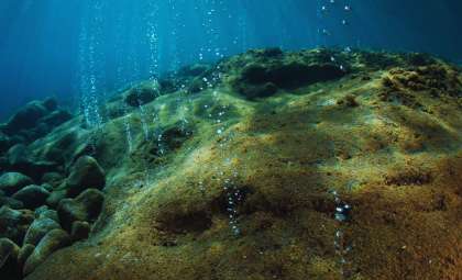
This landform went unnoticed for two main reasons. First, its ice and snow cover camouflage it among the many drifting icebergs scattered across the Weddell Sea. Satellite images simply show a white patch blending with the surrounding ice fields. The icy cap on the rock merges seamlessly with the neighboring sea ice during winter and with floating glacier fragments in summer.
Second, sailors have deliberately steered clear of this zone for decades. Nautical maps label the area as an “unexplored danger zone” due to patchy or unclear data. Dreutter explained, “On our path, the maps flagged a region with unknown navigational risks, but there was no clear information on their nature or origin.” Such warnings often derive from sporadic early explorer reports or gaps in sonar mapping.
The Polarstern team found the island’s location to be about one nautical mile (1.85 km) away from the position marked on existing charts. This discrepancy underscores the importance of conducting direct bathymetric surveys in remote polar waters. While the feature’s existence may have been suspected previously as a submerged hazard, no vessel had ventured close enough to verify it.
Assigning an Official Name to the New Island
The newly found island remains unnamed pending formal recognition. Antarctic Treaty regulations require proposed names to be reviewed and approved by international committees before gaining official status on maps. The AWI has already begun submitting the feature for registration via the German Federal Maritime and Hydrographic Agency.
After approval, the island’s exact coordinates will be documented in nautical charts, scientific repositories, and the Geographic Names of Antarctica gazetteer managed by the United States Geological Survey. This process can span several months to over a year.
As noted by Gizmodo, the public has already offered informal name ideas. Suggestions include Eisberg (the German word for iceberg), reflecting its initial misidentification; Lummerland, inspired by a fictional island from a children’s story; and Bird Rendezvous Island, referencing its potential use as a bird resting spot.
Drawing Parallels to the 2020 Sif Island Discovery
This latest find recalls a similar event in 2020, when the same vessel discovered Sif Island in Pine Island Bay—a rocky island appearing after the retreat of the Pine Island Glacier. That event received wide coverage, including by the Daily Mail.
The two islands differ in origin. Sif Island was revealed as glacial ice shelves thinned and receded, exposing bedrock hidden under hundreds of meters of compressed ice. In contrast, the newly identified Weddell Sea island likely has been continuously present, concealed beneath ice and overlooked due to its remote location.
Geographic authorities have already cataloged Sif Island officially. According to the United States Geological Survey gazetteer, it sits near 75°05’S, 101°12’W. The Alfred Wegener Institute confirmed they will forward the coordinates of the new island to the German Federal Maritime and Hydrographic Agency for inclusion in updated nautical charts. Meanwhile, the RV Polarstern continues its core mission, studying ice changes at the Larsen Ice Shelf.
- Categories:
- Science


0 comments
Sign in to Comment