
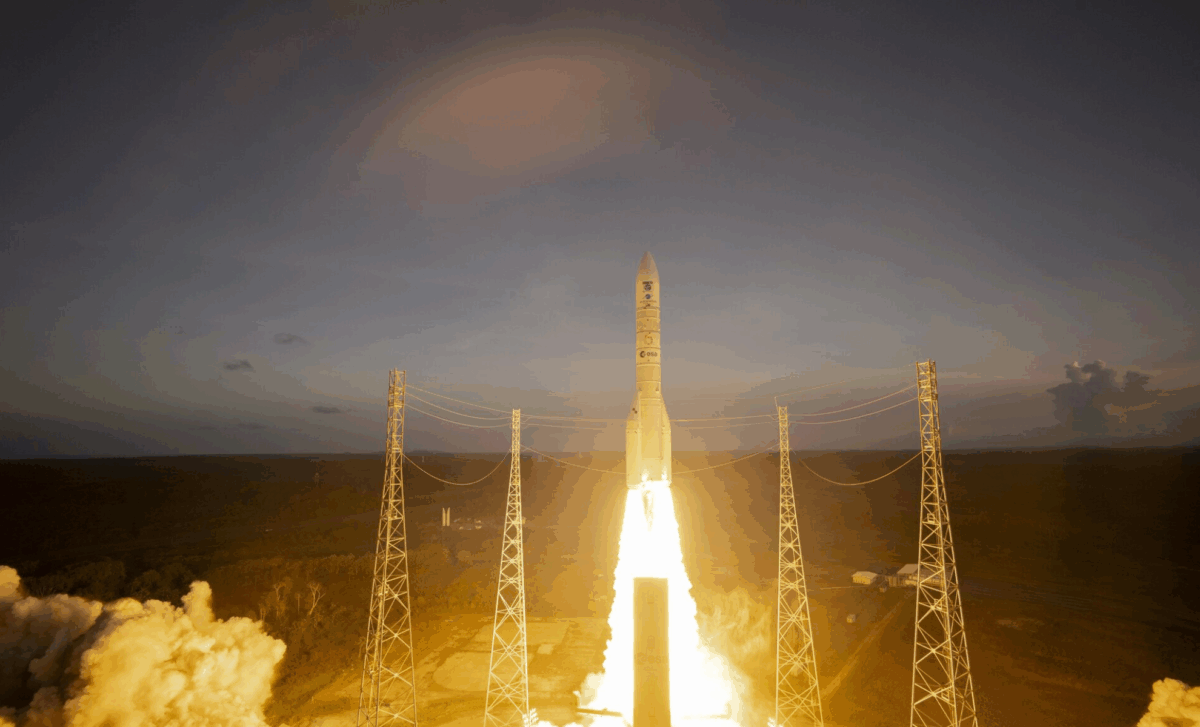
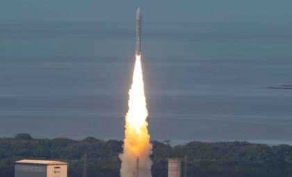
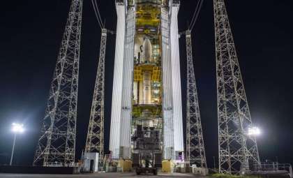
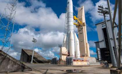
The Copernicus Sentinel-1 program has reached a significant milestone with the deployment of Sentinel-1D, the final satellite in its pioneering first-generation series. Launched on the Ariane 6 rocket, Sentinel-1D will operate alongside its counterpart, Sentinel-1C, enhancing the mission’s ability to observe Earth. ESA provides expert perspectives on how this development will boost environmental surveillance and emergency response systems worldwide.
Transforming Earth Observation with the Sentinel-1 Mission
Since its inception in 2014, the Sentinel-1 mission has transformed Earth monitoring through advanced synthetic aperture radar (SAR) technology. This innovation enables the capturing of detailed images of the planet’s surface regardless of weather conditions or daylight. It supports the continuous tracking of minor yet crucial environmental changes, such as shifting land levels and deforestation, supplying critical data to sectors ranging from conservation efforts to disaster preparedness.
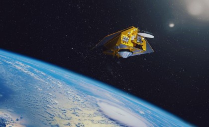
The recent addition of Sentinel-1D completes the initial Sentinel-1 satellite series. Positioned opposite Sentinel-1C, the two satellites function in tandem to optimize data collection globally. Their combined capabilities ensure sustained delivery of precise radar imagery vital for climate research, scientific endeavors, and security applications.

This achievement holds significant promise across multiple fields. The satellite’s advanced monitoring capabilities will assist environmental agencies, relief groups, and governmental organizations in tracking ice dynamics, forest health, and soil movement.
Strengthening Europe’s Space Launch Expertise
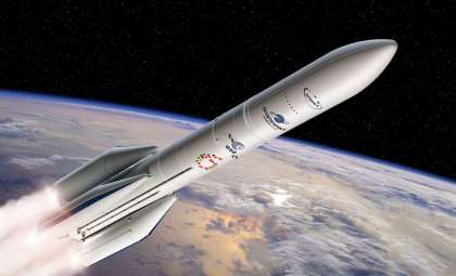
The launch of Sentinel-1D on the Ariane 6 rocket marks a notable advancement for the European Space Agency (ESA) and Europe’s ambitions in autonomous space access. Characterized by its modular design and flexibility, Ariane 6 is Europe’s heavy-lift launch vehicle, crucial for securing independent space operations.
Ariane 6’s capacity to deploy substantial payloads into low Earth orbit is essential for upcoming space exploration missions. Its adaptability allows for a wide range of applications, from detailed Earth observations to missions beyond our planet. The successful liberation of Sentinel-1D thus represents both a technical triumph and a significant milestone in Europe’s space program development.
Sentinel-1D’s Vital Role in Environmental Observation
The Sentinel-1D satellite continues the legacy of its predecessors by employing radar technology to capture data on Earth’s terrain. Radar’s ability to penetrate clouds, rain, and darkness ensures reliable, round-the-clock data gathering. Sentinel-1D will monitor geophysical phenomena such as ground shifts in Europe, tropical forest health, and changes in polar ice, all crucial for advancing climate science and disaster readiness.
Its high-resolution radar imaging will serve as an invaluable resource for scientists studying land subsidence, deforestation trends, and other ecological modifications. The satellite’s data will also support efforts to manage flooding, landslides, and other natural crises by delivering timely, actionable insights.
Backing the Copernicus Initiative of the European Commission
The Sentinel-1 mission forms a key pillar of the European Commission’s Copernicus program, which addresses global environmental challenges like climate dynamics and disaster mitigation. By offering open access to extensive Earth observation datasets, Copernicus empowers governments, industries, and the scientific community to make data-driven decisions.
Sentinel-1D, alongside Sentinel-1C, will extend the program’s reach by continuously providing critical radar data. These satellites supplement data from other Sentinel missions, collectively offering a robust understanding of Earth’s ecosystems and geological processes. ESA highlights the importance of these datasets in tackling and adapting to environmental change.
Cutting-Edge Technology Embodied in Sentinel-1D
Equipped with state-of-the-art instruments, Sentinel-1D is designed to maximize radar data acquisition and analysis. Central to its functionality is the C-band synthetic aperture radar, delivering high-resolution wide-area imagery. Additionally, it carries an Automatic Identification System (AIS) that enhances ship detection and monitoring across maritime regions.
The fusion of AIS and SAR technology equips Sentinel-1D to identify vessels through their radar signatures, even in remote oceanic zones. This enhances maritime safety and efficiency, aiding in the detection of illegal activities such as unauthorized fishing and pollution. ESA underscores how this dual capability contributes to better oversight of global maritime environments.
- Categories:
- Space


0 comments
Sign in to Comment