
Researchers from the University of Hawai’i at Mānoa have uncovered that certain regions of Hawaii are sinking at a startling pace, endangering local communities, businesses, and vital infrastructure. Although the rising sea levels have long been recognized as a challenge for the islands, new evidence indicates that ground subsidence is hastening the risk of flooding, potentially bringing it decades earlier than previously forecasted.
Accelerating Effects of Sea Level Increase
As the planet warms, melting glaciers and ice caps contribute additional water to the oceans. Concurrently, warming causes seawater to expand, driving shorelines inward and intensifying flood occurrences.
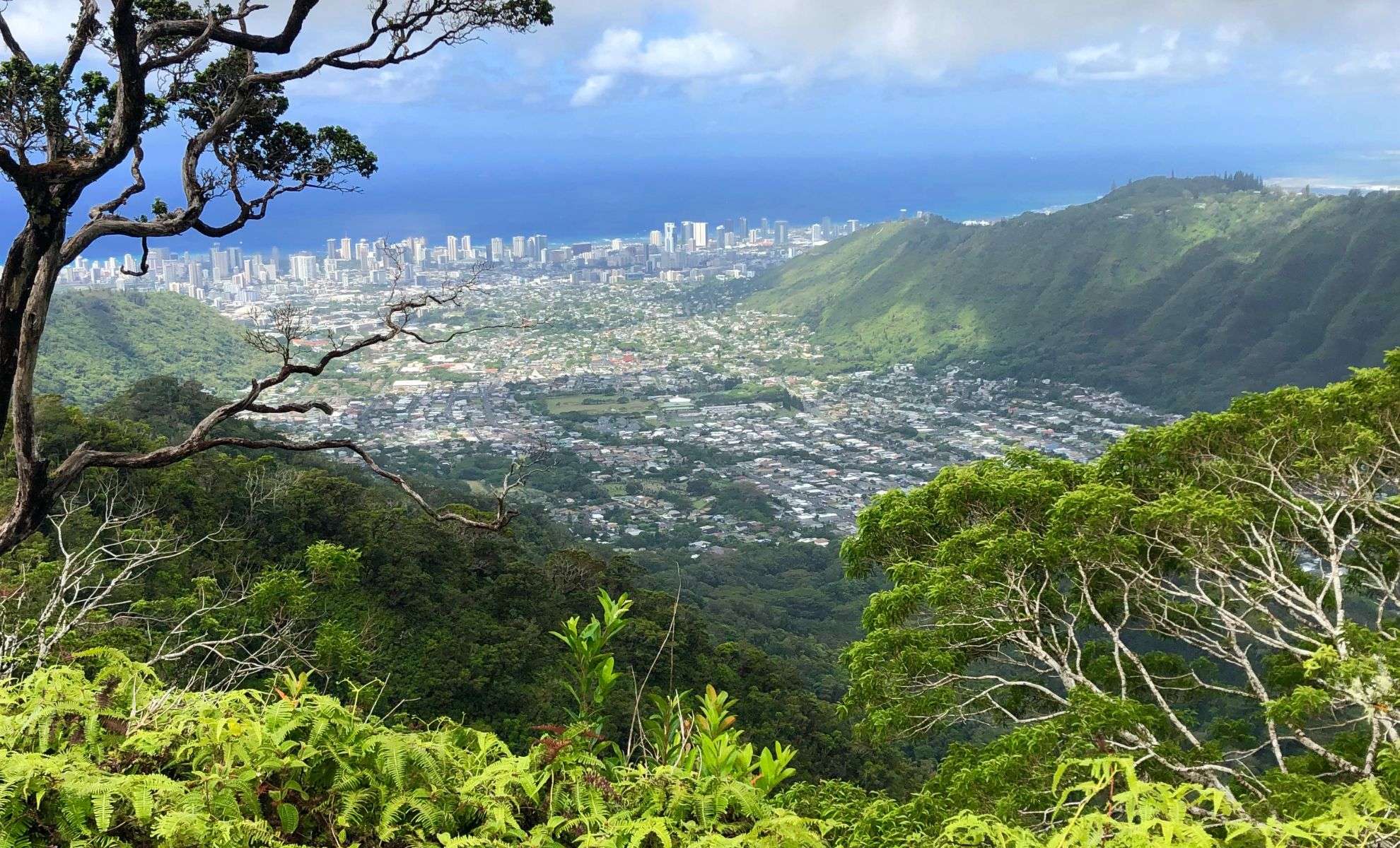
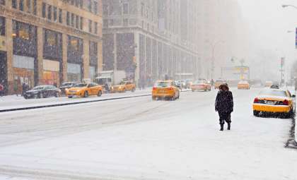
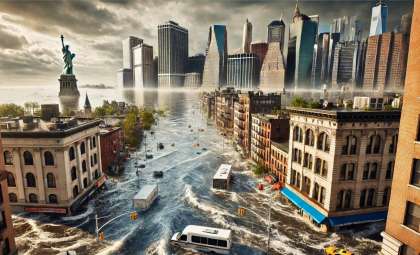
Major coastal metropolises like Miami, Jakarta, and Bangkok are confronting challenges such as frequent flooding, saltwater contamination of agricultural zones, and damage to infrastructure. In Hawaii, the issue is compounded by land not only being submerged by rising seas but also sinking beneath them.

Mechanisms Behind Hawaii’s Accelerated Sinking
Hawaiian islands have been gradually descending over millions of years as they move northwest away from the volcanic hotspot that formed them. This subsidence results from the immense weight of the islands pressing into the Earth’s crust.
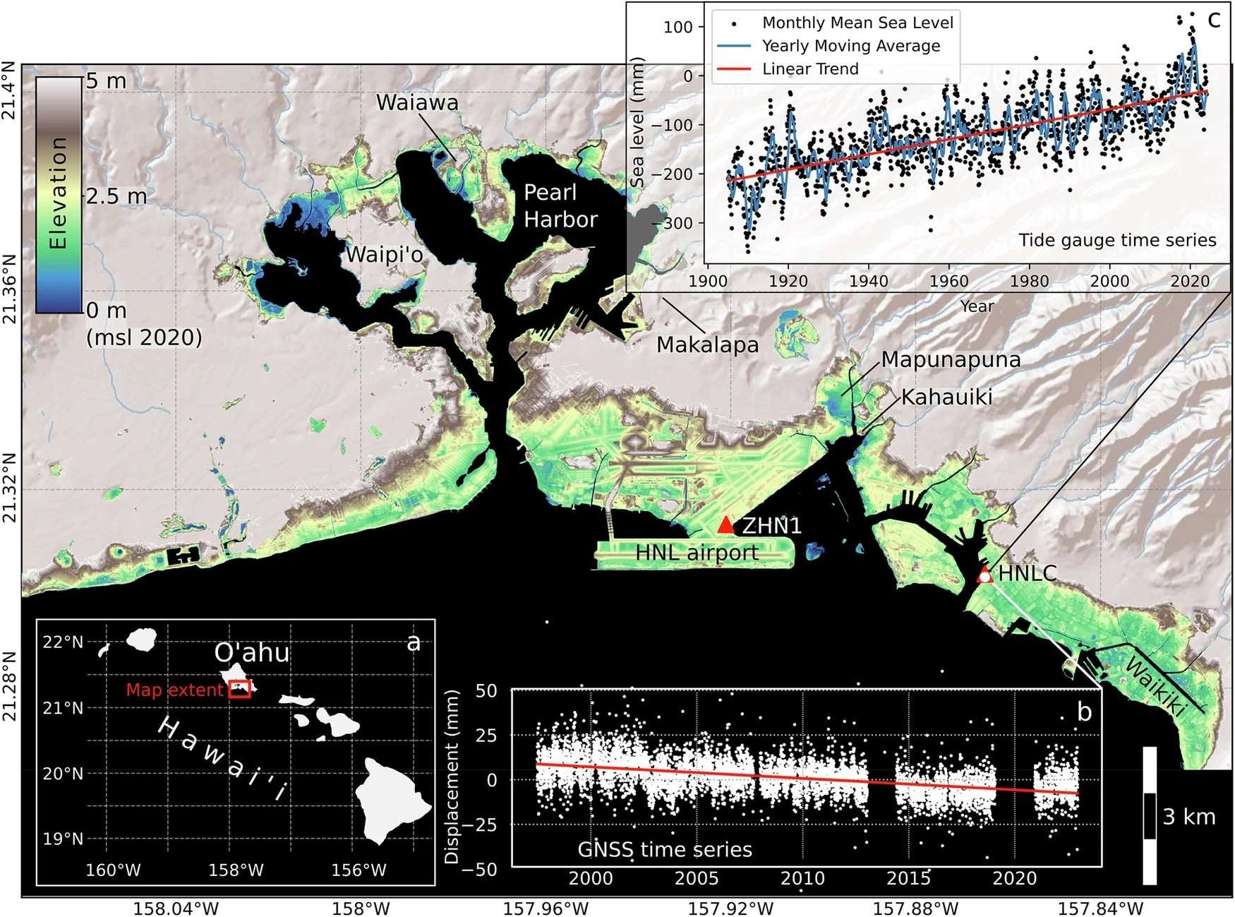
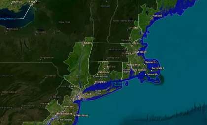
However, scientists have detected that some locations are experiencing this sinking at a much faster pace than anticipated. Certain sectors along Oahu’s southern coastline are descending over 25 millimeters annually, a rate 40 times higher than the island’s average subsidence.
The industrial area of Mapunapuna is particularly impacted, where structures have been erected on soft sediment and reclaimed land. These unstable foundations compress rapidly, leading to uneven land sinking and elevating flooding risk beyond typical sea level rise concerns.
Investigating the Causes Through Advanced Technology
To analyze the interaction between sinking land and coastal flooding, a team from UH Mānoa examined nearly 20 years of satellite radar observations capturing vertical ground shifts across the Hawaiian Islands. By integrating detailed digital elevation data and geospatial techniques, they monitored subtle elevation changes with remarkable accuracy.
Lead researcher Kyle Murray highlighted the critical nature of the results:
“In rapidly subsiding areas, sea level rise impacts will be felt much sooner than previously estimated, which means that we must prepare for flooding on a shorter timeline.”
Findings indicate that since 1905, sea levels around Hawaii have increased by an average of 1.54 millimeters annually. Yet, places like Mapunapuna are experiencing land sinking rates far surpassing this figure, pointing toward an earlier onset of flood-related challenges than current models predict.
Consequences for Hawaii’s Coastal Future
Co-author Phil Thompson warned that escalating land subsidence might boost flood exposure by 50% by 2050 in affected zones, effectively shortening the window for necessary flood mitigation efforts. This acceleration poses serious challenges for urban development, preparedness planning, and infrastructure durability.
Fortifying coastal defenses and improving flood resilience will be vital to reduce the dangers posed by fast subsidence. Strategic reassessment of land use policies and urban growth restrictions might be essential in preventing further construction in vulnerable areas.
Moreover, adopting planned relocation approaches—which involve moving communities and enterprises away from the most at-risk zones—could become indispensable for safeguarding long-term viability.
Enhancing early flood detection and warning systems will also be crucial. With floods likely to occur earlier, upgrading prediction capabilities and emergency responses is key to protecting Hawaii’s inhabitants and economy.
Urgency of Implementing Adaptation Measures
The wellbeing of Hawaii’s shoreline communities, economy, and ecosystems depends heavily on maintaining resilient coastlines. Rising flood threats demand immediate action to integrate scientific insights into policymaking and urban design.
Chip Fletcher, who leads the Coastal Research Center (CRC) and serves as interim dean at the School of Ocean and Earth Science and Technology (SOEST), stressed the practical significance:
“This work directly serves the people of Hawaii by ensuring that local adaptation strategies are based on the best available science, ultimately helping to protect homes, businesses, and cultural areas.”
The complete research has been published in Communications Earth & Environment.
- Categories:
- News ,
- Climate change


0 comments
Sign in to Comment