
Geologists have identified a colossal and ancient rift valley concealed beneath the central United States—a geological feature dating back over a billion years that nearly cleaved the North American landmass. This enormous fissure, called the Midcontinent Rift, emerged around 1.1 billion years ago when tectonic forces began to pull the continent apart. Insights from a 2013 Nature article provide a deeper understanding of this remarkable tectonic episode. While the rift ultimately failed to split the continent, it left a permanent mark on the region’s geological framework.
Origins and Formation of the Midcontinent Rift
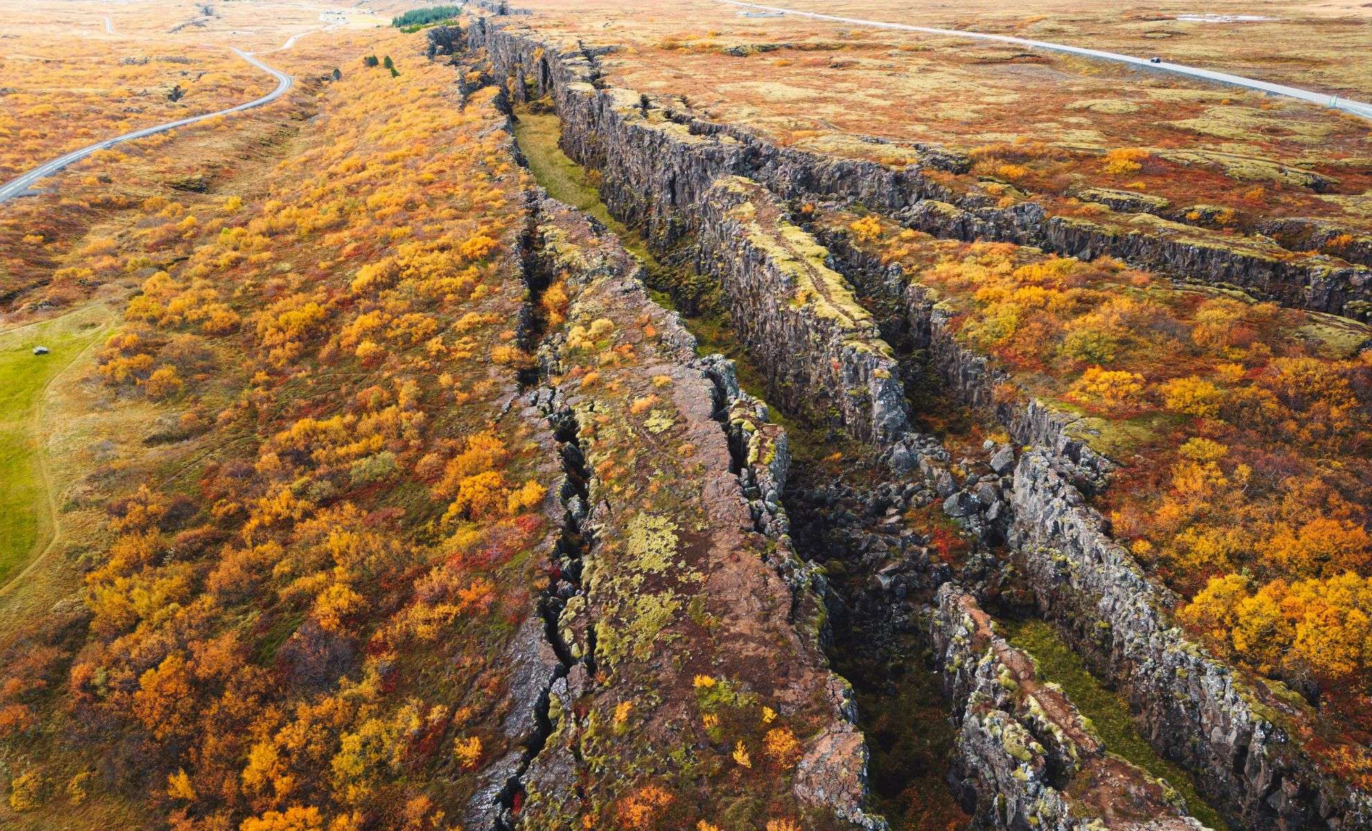
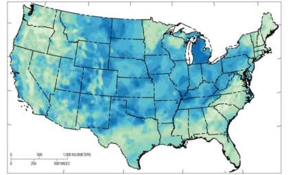
The Midcontinent Rift follows a distinct horseshoe pattern stretching from Kansas north toward Lake Superior before curving south to Michigan. At its maximum extent, the rift spanned about 1,900 miles (3,000 kilometers), forming a basin comparable in scale to the present-day Red Sea. This rifting event began as tectonic plates began to diverge, prompting magma to rise and fill the fissure with molten rock. Rapid cooling of this lava produced thick basalt layers—dense volcanic rock—embedded within the rift valley.
Currently, most of the rift remains buried under extensive sediment deposits, hidden from view. However, near Lake Superior, striking exposures of basalt and copper-enriched rocks appear, vestiges of the intense volcanic eruptions that characterized this period. These mineral-rich formations have been mined for millennia and continue to provide important economic resources today.

An Extraordinary Geological Setback
The intense rifting phase abruptly ceased after approximately 100,000 years, a fleeting moment in geological terms. Scientists still debate why the process never advanced to a full continental separation. Some theories point to tectonic activity elsewhere, such as mountain-building events along the Atlantic margin, as factors that disrupted the rift’s progression. Others propose shifts in mantle flow patterns or the emergence of a sea between ancient cratons Laurentia and Amazonia played roles in the rift’s failure.
G. Randy Keller, professor emeritus of geophysics and former director of the Oklahoma Geological Survey, referred to this as “a spectacular failure.” He noted in the Nature article, “It is remarkable how this structure dramatically reshaped the Earth’s crust around Lake Superior without ultimately breaking the continent.” This phenomenon underscores the intricate forces influencing Earth’s crustal evolution over deep time.
Enduring Geological and Economic Effects
Although the Midcontinent Rift stopped short of splitting the landmass, its impacts persist in the region’s geological formations and natural resource deposits. The volcanic and sedimentary strata from the rifting era have shaped the landscape and enriched mineral reserves, particularly copper deposits on Michigan’s Keweenaw Peninsula linked to ancient volcanic activity.
More recently, researchers have explored the rift’s potential for sustainable energy applications. Water-rock interactions within basalt layers can produce hydrogen, a clean fuel, attracting interest from energy companies in the Midwest. This illustrates how ancient Earth processes continue to inform both science and industry today.
- Categories:
- News


0 comments
Sign in to Comment