
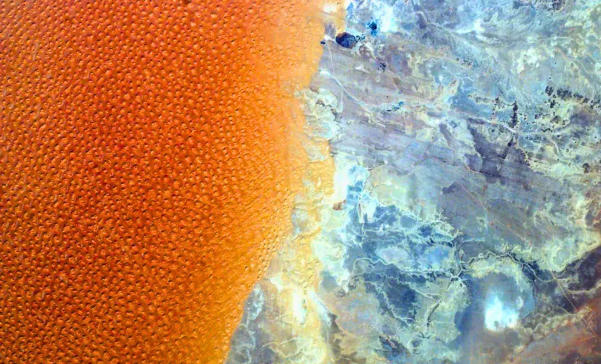
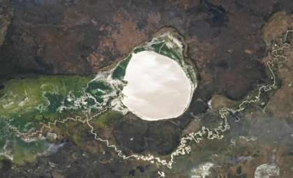
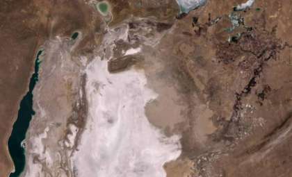
An impressive satellite snapshot from orbit showcases a remarkable contrast between two distinct landscapes where Algeria meets Libya in the Sahara Desert. Expansive “star dunes”—massive, multi-ridged sand structures—border an arid, rocky expanse, forming a captivating natural divide between these two nations. This striking boundary not only marks geographical separation but also reflects complex geological evolution. The image, originally presented by NASA’s Earth Observatory, captures the fascinating interaction between the Earth’s physical formations and political lines.
Unraveling the Formation of Star-Shaped Dunes
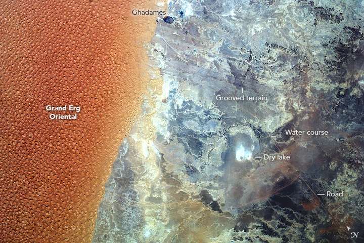
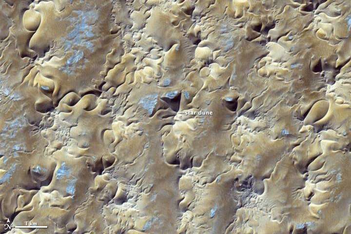
NASA’s satellite imagery reveals the Grand Erg Oriental, among the globe’s largest dune seas, sprawling over about 55,000 square miles in northern Algeria. These dunes display distinctive star-like patterns, sculpted by shifting wind directions, and can tower as high as 300 feet. Such dune shapes arise in environments where winds frequently change course, creating unique multi-branched ridge formations defining this section of the Sahara.
Scientific understanding suggests that the sand within these dunes originates from eroded nearby rocky landscapes, shaped over time by ancient precipitation that loosened sediments deposited in natural basins. This sediment redistribution is believed to have persisted for hundreds of thousands, possibly millions, of years, continuously remodeling the desert’s vast dune system. NASA highlights that this long-term sedimentation process has played a key role in evolving the Sahara’s dynamic terrain.

An Expansive, Stark Rocky Expanse
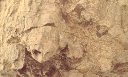
Moving beyond the star dunes, the terrain shifts dramatically into a rocky and barren zone primarily located in Libya. Known as one of the Sahara’s most arid regions, this area features nearly lifeless, weather-sculpted stones shaped by ancient prevailing winds. According to NASA, these winds have left distinctive grooves on rock surfaces, creating an evocative landscape that looks almost extraterrestrial.
At the heart of this rocky desert lies a striking white patch, identified by Earth Observatory as the remains of an ancient lake long dried out, exposing a cracked and forsaken basin. This relic provides a poignant glimpse into the Sahara’s fluctuating climate history, where once-watered regions have transformed into dry desert.
Natural Boundaries Aligning With Borders
The satellite perspective underscores a remarkable natural division closely matching the political border between Algeria and Libya. NASA reports that the sprawling sand dunes reside entirely within Algerian territory, while the adjacent harsh rocky domain falls mostly under Libyan control. This boundary aligns closely with the meeting point of sand and rock, illustrating a rare instance where Earth’s physical contours and human borders overlap precisely.
This convergence highlights how ancient geological forces operate independently of modern political boundaries, reminding us of Earth’s deep natural history. The stark contrast between shifting dunes and rugged rock formations visually expresses the interplay of geography, geology, and human influence shaping this region of the Sahara.
- Categories:
- News


0 comments
Sign in to Comment