
New insights published in Nature Geoscience unveil an unexpected link between Mount Everest’s expansion and the nearby river networks. This connection has been a driving factor in the mountain’s growth over the last 89,000 years.
Scientists from University College London (UCL) together with the China University of Geosciences have uncovered a process called isostatic rebound. This phenomenon occurs when the Earth's crust rises after the removal of surface material, contributing up to 50 meters (164 feet) to Everest’s elevation during this timeframe.
The Arun and Kosi rivers play a vital role in this geological mechanism. These waterways have deeply incised the region by eroding and transporting immense quantities of sediment. This erosion reduces the pressure on the Earth's crust, initiating the isostatic rebound that gradually lifts Everest’s summit higher.

Dr. Matthew Fox from UCL Earth Sciences comments, “GPS data reveal an annual growth of approximately two millimeters, and now we have a clearer understanding of the forces behind this phenomenon.“
Balancing erosion with mountain uplift
At the core of Mount Everest’s ongoing elevation increase lies the intricate balance between river erosion and crustal uplift. As rivers erode surrounding land, the mountains respond by rising, adjusting their height relative to the shifting distribution of mass.
This ongoing geological adjustment highlights the dynamic quality of Earth's crust as it adapts to changes in stress and mass. Dr. Jin-Gen Dai from the China University of Geosciences compares isostatic rebound to a boat rising when weight is removed from it.
This process is observed globally, including in regions like Scandinavia, where the land is still ascending following the melting of ancient ice sheets from the Ice Age. It echoes the perpetual transformation seen in phenomena such as the enormous blue hole recently discovered in the deep ocean, which continues to captivate researchers.
The towering Himalayas: Continuous evolution at the highest altitudes
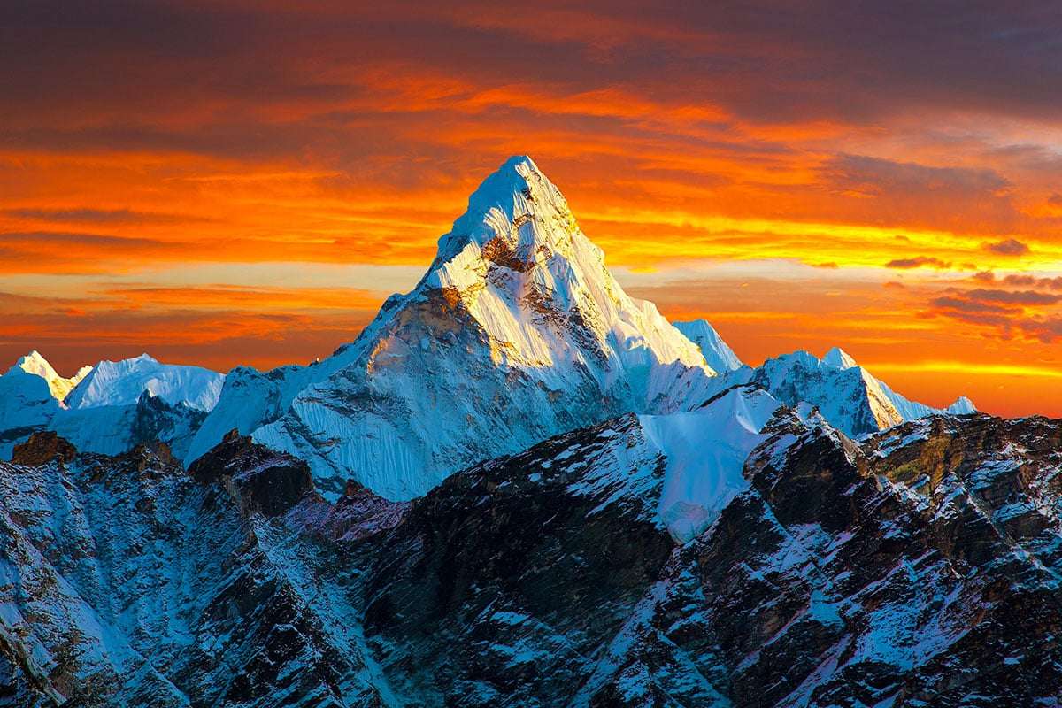
Mount Everest, known locally as Sagarmāthā and Chomolungma, reaches an astounding 8,849 meters (29,032 feet) tall. Its remarkable height surpasses peaks such as K2, Kangchenjunga, and Lhotse, partly due to the uplift effect driven by river erosion.
This uplift is not confined to Everest. Nearby giants like Lhotse and Makalu, ranking as the world’s fourth and fifth tallest mountains, also experience these forces. Makalu, positioned closer to the Arun River, shows a slightly faster uplift rate compared to Everest and Lhotse.
The Himalayas originated about 50 million years ago from the collision of the Indian and Eurasian tectonic plates. This ongoing tectonic pressure continues to push these mountains skyward, creating a landscape as mysterious as the Al Naslaa rock formation in Saudi Arabia.
Below is a comparison of annual uplift rates for these Himalayan peaks:
Mount Everest’s profound cultural and natural importance
More than just a towering landform, Mount Everest carries deep cultural meaning. Sacred to Sherpa and Tibetan peoples, it symbolizes resilience and human ambition. Dr. Dai remarks, “Everest holds a unique place in our minds: it’s the highest point on Earth, giving it immense natural importance and representing the pinnacle of human challenge and endurance.“
The mountain’s steady rise, influenced by ongoing tectonic activity and river-driven uplift, exemplifies the Earth’s dynamic nature. Far from being static, even iconic landmarks are continuously shaped by planetary forces.
As scientific exploration uncovers the complexities beneath Everest’s surface, the mountain stands as a powerful emblem of the ceaseless geological processes transforming our planet. Its ever-increasing height is not merely rock but a symbol of Earth’s constant evolution.
- Categories:
- Science


0 comments
Sign in to Comment