
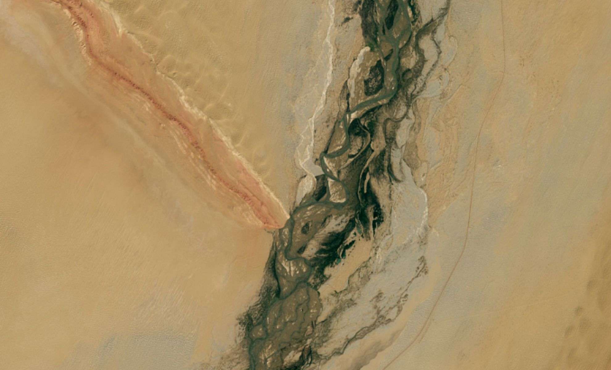
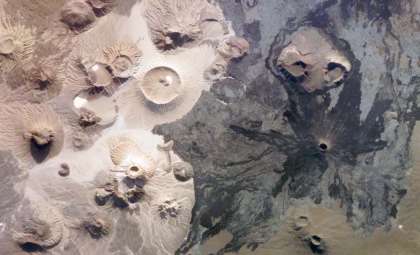
Located in the vast expanse of western China’s Tarim Basin, an extraordinary natural scene unfolds where colorful ridges meet a flowing river amidst desert sands. A captivating photograph captured by NASA’s Landsat 9 on September 11, 2025, reveals the convergence of the Mazartagh Ridge and the Hotan River, blending rocky hues with flowing water. This unique environment, explored in a study published in Geomorphology, illustrates how these natural features influence the broader landscape.
This region, a fascinating combination of barren desert and fertile riverbanks, not only shapes the local sand dunes but also holds significant historical value as an important site along the ancient Silk Road trading route.
A Geological Barrier Amidst the Desert
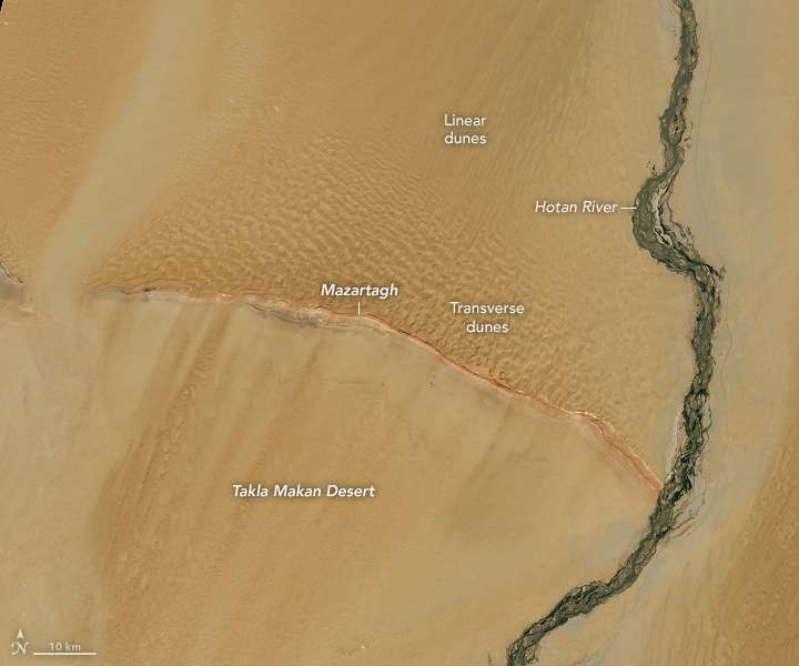
The Tarim Basin, renowned as one of Earth’s driest environments, hosts an unusual juxtaposition of harsh climate and resilient ecology. The Mazartagh, often called the “red-white mountain,” is distinguished by its striking red and white rock layers. Meanwhile, the Hotan River, sustained by glacial melt from the Kunlun Mountains, carves a green, fertile path through the arid landscape.

This intersection offers insight into the dynamic interplay of geological forces, flowing water, and winds shaping the territory and bears long-standing cultural significance. The Mazartagh Ridge extends for 145 kilometers and rises approximately 200 meters above the surrounding sands. Serving as a natural obstruction, it regulates the shifting desert sands.
NASA reports that the ridge captures sand propelled by northeastern winds, preventing its southward drift. This leads to a distinctive dune arrangement: expansive crescent and star dunes appear north of the ridge, while elongated dune forms emerge to the south. This landform is vital in maintaining the desert’s ecological balance.
A Lifeline in the Arid Expanse
Amid the extreme dryness of the Tarim Basin, the Hotan River serves as a crucial oasis. Fed by seasonal glacial melts from the Kunlun Mountains, the river nurtures an unexpected corridor of greenery in one of the planet’s most desolate areas. NASA highlights that despite its varying flow, the river supports vegetation such as poplars, salt cedars, and various grasses along its course.
This narrow but vital stretch of plant life starkly contrasts with the encircling desert. Over centuries, the river has sustained local flora, fauna, and communities, underscoring its ecological significance.
Historical Gateway on the Silk Road
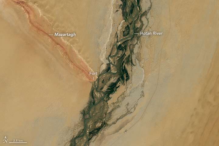
The Hotan River’s importance extends beyond ecology, entwining with the rich heritage of the Silk Road. Its waters historically carried nephrite, a precious jade favored by ancient traders, with locals harvesting jade stones from its banks.
This area was once a crucial hub along the ancient Silk Road, facilitating trade and cultural exchange between Asia and the West. Today, traces of this legacy remain visible through ruins of an eighth-century fort overlooking the river. Constructed during the era of the Tibetan Empire, the fort continues to stand as a testament to the region’s historic significance in global commerce and interaction.
- Categories:
- News


0 comments
Sign in to Comment