
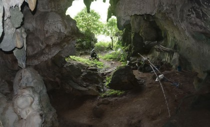
Hidden in a modest cave near Paris, researchers have unveiled what could be the earliest known human-made 3D representation of a landscape. Etched into the stone floor roughly 20,000 years ago, this ancient carving depicts a local valley complete with flowing rivers, rounded hills, and basin-like depressions, all of which dynamically interact with water from rainfall.
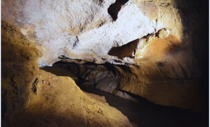
Initially, the floor etchings in the Ségognole 3 cave seemed like arbitrary scratches carved into the rock. However, geoscientists Médard Thiry and Anthony Milnes identified patterns that correspond closely to the terrain features in the nearby environment.
A Miniature Replica of the Valley
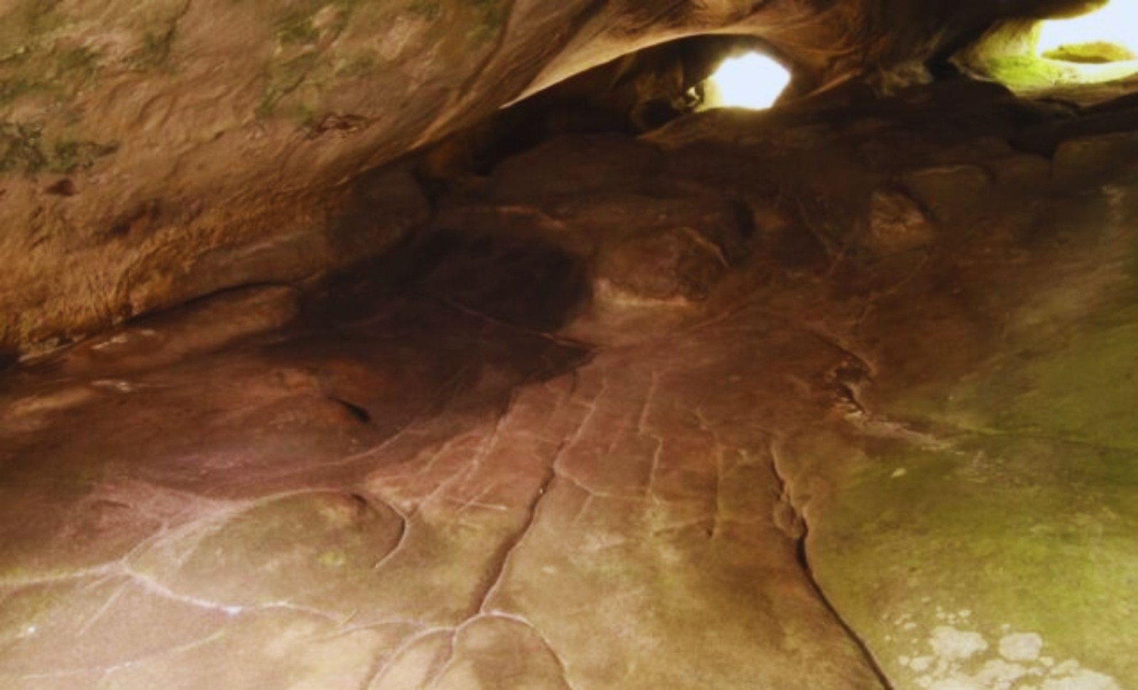
The cave lies within a site well-known for its extensive collection of Paleolithic engravings. This particular space stands apart not for its wall carvings, but for the intricate topographic model on its floor. Crafted by hand and animated by flowing water, the site provides fresh insight into the cognitive abilities of early humans.

As detailed in a ScienceAlert report, water filtering through fractures in the rock courses along the carved channels, dividing and collecting in carved basins. One particular basin, deliberately carved deeper by hand, gathers and directs water throughout the carved terrain.
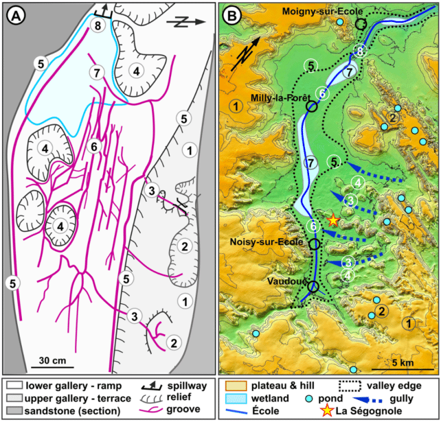
The sandstone channels form branching patterns reminiscent of actual river networks. Thiry and Milnes suggest that these waterways align closely with the École River valley’s layout, mirroring tributaries, ponds, ravines, and hills. While not an exact scale model, the carvings capture the spatial relationships of local geography.
Symbolism in Stone: Water and the Human Figure
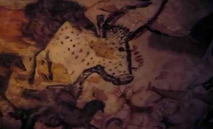
The story deepens with two horse engravings on one sloping wall, separated by a distinctive triangle. This shape is more than geometric—it traces a pelvic form, complete with markings resembling hips and thighs, and includes a central groove guiding rainwater through a feature identified by researchers as a vulva.
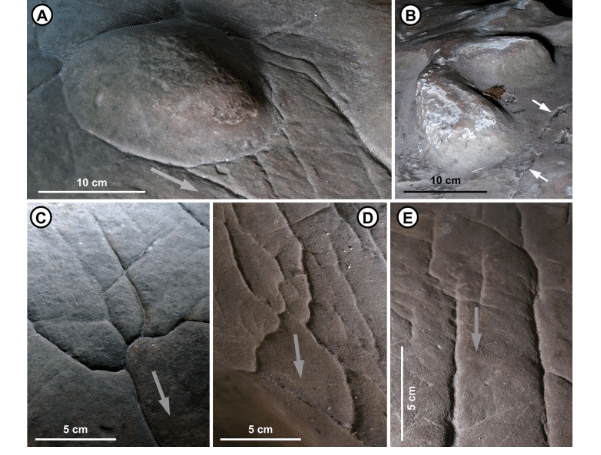
The water channeling through this female figure may symbolize fertility, seasonal cycles, or could have other meanings now lost to history. While researchers remain cautious in their interpretations, the detailed and strategic placement of these engravings hints at intentional symbolism.
“The engraved floor is not quite a map, but more like a miniature model of the surrounding landscape, potentially a world-first 3D model of a Palaeolithic territory,” the researchers pointed out.
Early Human Cognition Revealed Through Art
Creating an interactive landscape carving that integrates with natural water flow demands advanced abstract thought, challenging previous assumptions about cognitive capacities during this period. According to the findings published in the Oxford Journal of Archaeology:
“The accuracy of the drawing of this hydrographical network reveals a remarkable capacity for abstract thinking in those who drew it and in those for whom it was intended,” stated the authors.
While older carved artifacts interpreted as maps exist, they are generally rudimentary and depict localized hunting grounds or campsites. What distinguishes this discovery is its broad geographic scope and its inclusion of diverse natural features. Still, Thiry and Milnes approach their findings with caution, acknowledging that:
“Any interpretation of prehistoric carvings is always subject to caution.”
Should their interpretation hold true, this unassuming cave floor may represent one of humanity’s earliest attempts to conceptualize and replicate the world around them.
- Categories:
- Science


0 comments
Sign in to Comment