
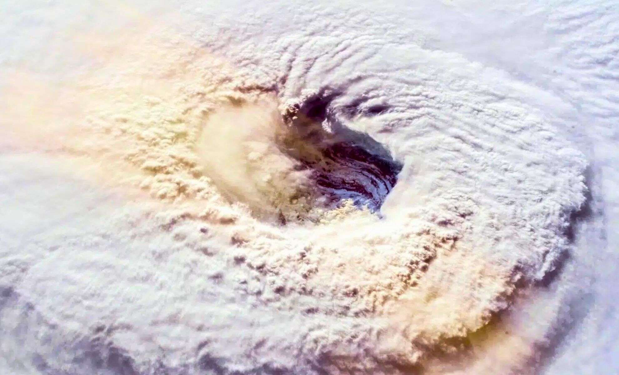
On October 27, as Hurricane Melissa surged to Category 5 intensity across the Caribbean, NOAA’s specialized research aircraft penetrated the tempest’s eye wall. This expedition, part of NOAA’s airborne hurricane reconnaissance efforts, aimed to collect vital atmospheric data that sharpen hurricane prediction models and deepen scientific understanding of powerful tropical cyclones.
The WP-3D Orion, nicknamed Kermit, encountered violent turbulence soon after entering the southwestern segment of the storm, an area notorious for the fiercest winds and severe convection. Andy Hazelton, a University of Miami scientist on board, described the shaking as the most intense he had faced in over ten years of hurricane flights. The crew eventually cut the mission short but transmitted crucial meteorological readings to the National Hurricane Center (NHC) to aid ongoing forecasts.
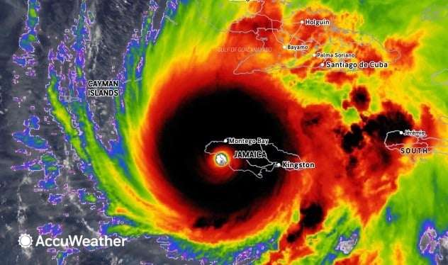
Melissa underwent a rapid intensification, escalating from a tropical storm to a Category 5 hurricane in less than two days. Its remarkably slow progression intensified the storm’s impact, with forecasts estimating as much as 30 inches (76.2 cm) of rainfall in Jamaican regions. The island suffered flash floods, widespread outages, and infrastructure damage, prompting concerns about sustained recovery efforts.

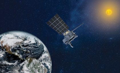
NOAA’s Hurricane Hunter program employs specially equipped aircraft to fly straight into hurricanes, deploying dropsondes—instrument packages that descend through storm layers and relay data on wind velocity, temperature, atmospheric pressure, and moisture back to the plane. While satellites offer extensive coverage, only in situ missions produce the detailed vertical measurements necessary for precise storm modeling.
Warming Oceans Fuel Growing Hurricane Threats
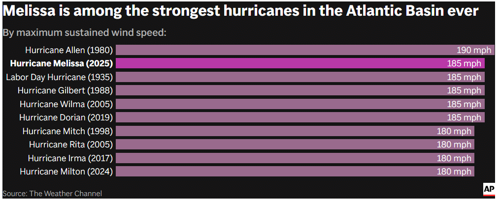
In recent times, scientists have observed an uptick in both the number and strength of major hurricanes in the Atlantic. Over 30% of Atlantic Category 5 hurricanes recorded since 1924 have occurred during the past decade, according to historical NHC records. Rising sea surface temperatures, driven primarily by human-induced climate change, are identified as the key factor behind this trend.
A 2022 Nature Communications study corroborates this pattern, revealing a heightened likelihood of tropical cyclones intensifying by more than 35 mph (56 km/h) within 24 hours. The research highlights that the Atlantic and East Pacific basins are particularly affected, aligning with decades of increasing ocean heat content.
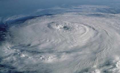
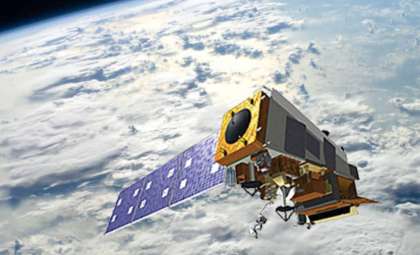
Melissa exemplified this intensification pattern. Imagery from GOES-19 showed a tight, well-formed eyewall typical of fast-strengthening hurricanes. Airborne data from NOAA confirmed these structural changes, enhancing the accuracy of short-term hurricane intensity forecasts.
Crucial Insights from Airborne Data Collection
Despite advances in satellite technology, aerial missions remain unmatched in delivering detailed atmospheric data. NOAA’s WP-3D and Gulfstream IV aircraft capture information at altitudes and resolutions far beyond what satellite sensors provide. These findings feed into numerical weather prediction models, significantly improving forecasts for storm paths and strengths.
During Hurricane Ian in 2022, Kermit recorded vital data. NOAA engineer Nick Underwood shared storm eye visuals showing intense turbulence and fierce lightning within the eyewall—conditions unusual even in a Category 4 hurricane. He remarked on social media, “I’ve flown storms for six years. This was the worst one yet,” underscoring the hazards of these missions.
Such reconnaissance flights are vital for both forecasting accuracy and climate studies. A 2023 report from the National Academies of Sciences stressed the importance of frequent, high-resolution data in training next-generation models that incorporate artificial intelligence and machine learning. Without these precise measurements, predictions could lose reliability as climate conditions evolve.
Slower Hurricanes Pose Increasing Resilience Challenges
Alongside rapid strengthening, the slower pace of tropical cyclones is emerging as a major concern. Storms that linger over land cause prolonged exposure to heavy rain, destructive winds, and coastal surge. This contributed significantly to the devastating floods during Hurricane Harvey in 2017 and similarly affected Melissa’s extended impact on Jamaica.
Forecast models predict that future hurricanes will continue to grow in peak intensity while moving more slowly. These changes tie to shifts in global atmospheric circulation patterns, fueled by warming seas and reduced temperature gradients between the poles and equator.
As AccuWeather Chief Meteorologist Jonathan Porter noted, “Storms are now intensifying quicker and lingering longer—dramatically reshaping the risk profile for coastal regions.” This evolving reality pressures forecasting agencies, emergency response frameworks, and infrastructure resilience—especially in vulnerable areas.
- Categories:
- News


0 comments
Sign in to Comment