

Advancements in weather forecasting have traditionally followed a stepwise progression: improved sensors enabled superior satellites, while more powerful computers allowed for increasingly sophisticated numerical models. Despite these improvements narrowing prediction inaccuracies, significant observational gaps in atmospheric data have persisted.
This paradigm is now evolving. Artificial intelligence has shown remarkable potential to deliver precise, high-detail forecasts much faster than conventional numerical weather prediction (NWP) techniques. In some cases, AI methods provide similar short-term forecasts while consuming significantly fewer computational resources.
However, such progress reveals a fundamental challenge: AI excels with abundant data but cannot compensate for observational scarcity. Forecast accuracy improves where data density is high but remains limited in areas with sparse or no observations.

Large regions of our planet—such as open oceans, polar zones, and significant parts of the Southern Hemisphere—are under-monitored, lacking the observation frequency that AI-based forecasting demands. This imbalance between analytical capabilities and data availability has become a key constraint in global meteorology.
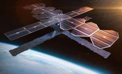
In response, Tomorrow.io has unveiled DeepSky, a next-generation satellite constellation designed to revolutionize the frequency and scope of atmospheric monitoring worldwide.
Enhancing Global Atmospheric Surveillance
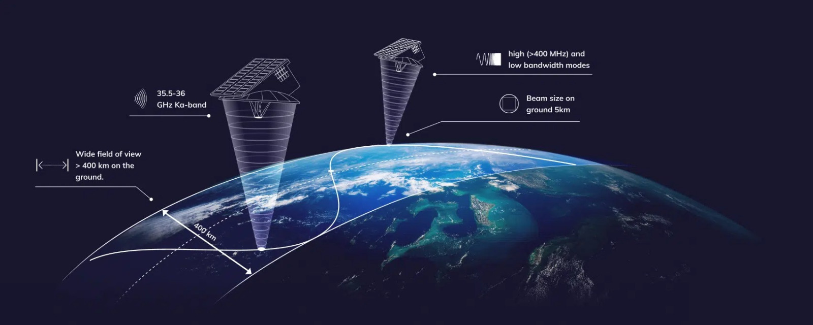
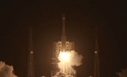
DeepSky marks Tomorrow.io’s second satellite constellation following their initial deployment featuring advanced Ka-band radar and microwave sounding instruments. This new system employs a proliferated Low Earth Orbit (pLEO) design, incorporating multiple satellites flying in coordinated trajectories approximately 500 to 1,200 kilometers above Earth.
A pLEO constellation offers a key benefit: increased revisit frequency. This means satellites can monitor the same geographic area more often, enabling near-continuous observation of rapidly changing atmospheric conditions.

Each satellite in the DeepSky network carries an array of proprietary instruments capable of remote sensing across a broad span of the electromagnetic spectrum. Remote sensing involves observing atmospheric and surface properties without direct contact by measuring emitted or reflected radiation.
Tomorrow.io positions DeepSky as complementing government-operated platforms, such as geostationary satellites which continuously observe fixed regions, along with traditional polar-orbiting satellites that survey the globe but with less frequent revisits.
DeepSky’s design focuses on several critical goals:
- Frequent global revisits to ensure dense temporal coverage
- Diverse sensor payloads on each satellite, minimizing reliance on any single instrument type
- Scalability that lowers cost per observation as the constellation grows
These priorities directly address challenges recognized by meteorological organizations regarding existing observation gaps and refresh rate limitations.
Pathfinder: Validating Space-Based Radar
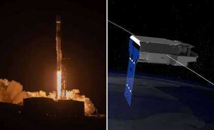
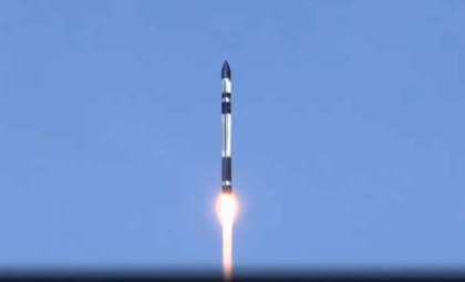
DeepSky builds on the success of Tomorrow.io’s Pathfinder project, which tested commercial space radar technologies in orbit.
The Pathfinder mission includes two Ka-band radar satellites, Tomorrow-R1 and Tomorrow-R2, deployed in sun-synchronous orbits about 550 kilometers above Earth. These satellites feature software-configurable Ka-band radars operating between 35.5 and 36 GHz—frequencies ideal for examining precipitation patterns and vertical atmospheric profiles. They provide vertical resolutions near 250 meters and use clutter suppression techniques to enhance measurements near the surface.
Pathfinder serves primarily as a technology demonstrator and operational benchmark. Its satellites calibrate radar functions, test adaptable pulse settings, and collect scientific-quality data on precipitation, cloud structures, and surface reflections. This data aids in refining algorithms and assimilation methods crucial to scaling operations.
Rather than a standalone system, Pathfinder functions as a proving platform that confirms compact, commercially operated radar satellites can match government scientific missions’ sensitivity and robustness while maintaining duty cycles compatible with real-time forecasting needs.
DeepSky aims to expand upon this groundwork by deploying a large constellation with higher revisit rates and multi-sensor capabilities to broaden observational reach.
AI's Data Dependency in Weather Forecasting
The scientific impetus driving DeepSky stems from the evolution of AI-based weather prediction models. Whereas traditional NWP relies on solving physical equations, AI models infer weather patterns through learned statistical correlations within extensive historical and current datasets.
Research reported in Nature and analyses by the European Centre for Medium-Range Weather Forecasts have demonstrated that AI models can surpass traditional methods under favorable data conditions. Nonetheless, their accuracy is directly limited by the volume and frequency of input observations; insufficient data impedes learning and forecast quality.
Tomorrow.io emphasizes observation density as a critical bottleneck in this AI-driven forecasting landscape. While computing power and model design improve, the company insists that enhanced data frequency, coverage, and diversity will be paramount for continuing gains.
DeepSky’s mission focuses on boosting observational frequency and variety to empower more efficient and impactful forecasting, striving to optimize cost relative to forecast benefit rather than data quantity alone.
From Demonstration to Operational Integration
Tomorrow.io envisions DeepSky serving a wide spectrum of stakeholders, including civil meteorological agencies, emergency and hurricane response centers, defense and security organizations, as well as international collaborators.
The constellation targets or surpasses fundamental observation standards mandatory for governmental users. These standards set minimum thresholds for spatial resolution, revisit frequency, and data reliability essential for operational forecast accuracy.
Building on extensive experience in satellite design, launch management, and data services, Tomorrow.io presents DeepSky as an expansion of existing capabilities rather than purely experimental. The project is in active development with private funding and long-term demand backing, though specifics on number of satellites, deployment timelines, and orbital arrangements remain undisclosed.
Certain technical and institutional challenges remain open, including calibration protocols, schedules for operational rollout, and distinctions between public and commercial data access. Integrating new observational resources into operational workflows is a rigorous process, particularly for mission-critical safety applications.
- Categories:
- News


0 comments
Sign in to Comment