
The Curiosity rover has provided unprecedented close-up images of complex, web-shaped rock patterns on Mars, offering new clues about ancient groundwater activity that might have persisted longer than scientists previously believed. These observations were made on the slopes of Mount Sharp.
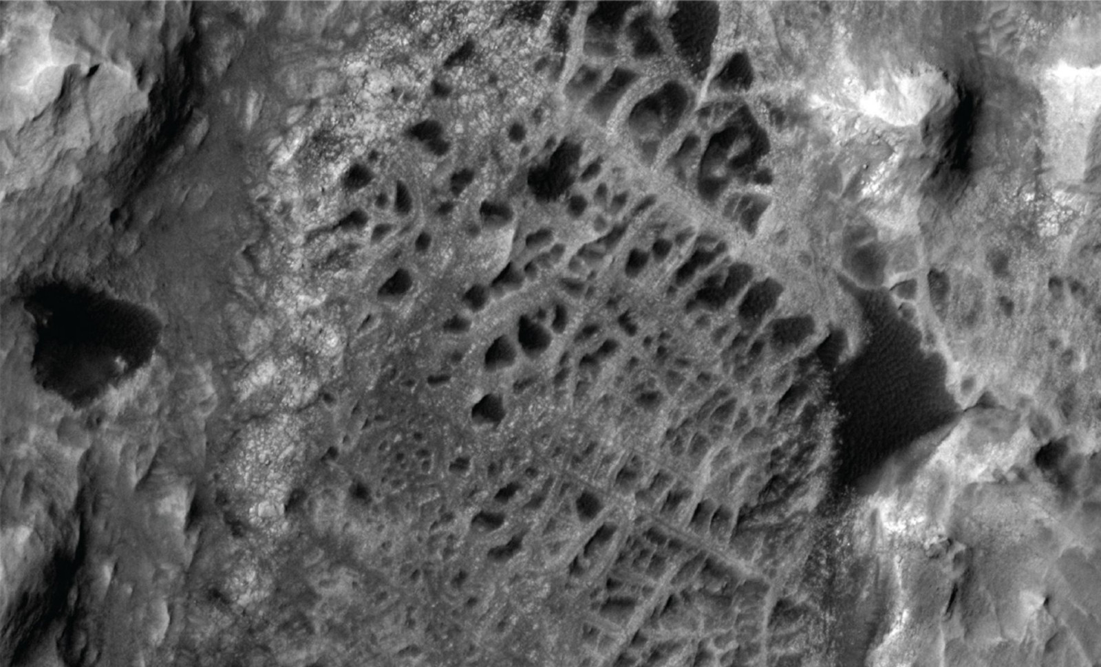
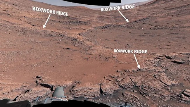
For nearly half a year, the rover has examined a terrain characterized by ridged and sandy depressions known as boxwork formations. Prior to this, these structures had only been visible from space, leaving their composition and formation mechanisms uncertain.
By studying these features in detail, researchers are gaining valuable insights into how subterranean water once flowed beneath the Martian crust. This enhances our understanding of how long Mars may have supported conditions suitable for life.

Decoding Ancient Groundwater Patterns Through Rock Veins
From orbit, these distinctive formations look like massive spiderwebs sprawled across the Martian landscape. On the surface, Curiosity discovered ridges standing between 3 and 6 feet tall, arranged in an intricate network shaped by geological processes tied to water flow. According to a NASA press release, ancient groundwater coursed through cracks in the bedrock, depositing minerals that solidified over millennia.
“Those minerals then strengthened the areas that became ridges while other portions without mineral reinforcement were eventually hollowed out by wind,” wrote the U.S space agency experts.
Curiosity’s analysis also verified that the dark lines spotted in earlier imagery correspond to main fractures. These fractures functioned as channels where water circulated and minerals were deposited.
High-Elevation Formations Indicate Persistent Aquifers
These boxwork patterns appear at elevated locations on Mount Sharp, which rises nearly 5 kilometers and preserves geological layers shaped by varying past climates. Tina Seeger of Rice University points out that these elevated features imply that:
“ the groundwater table had to be pretty high,” she said. “And that means the water needed for sustaining life could have lasted much longer than we thought looking from orbit.”
This evidence implies that underground water may have persisted longer after surface bodies like lakes and rivers vanished. Each sediment layer on Mount Sharp represents a step in Mars' climatic history, alternating dry periods with brief episodes of moisture.
Nodules Reveal Complex Groundwater History
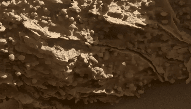
In its survey, Curiosity discovered nodules—small mineral deposits tied to previous aqueous activity. Interestingly, these nodules are found along ridge flanks and depressions rather than the main fractures. Mission researchers suggest this unusual pattern may indicate several groundwater episodes.
“We can’t quite explain yet why the nodules appear where they do,” Seeger stated. “Maybe the ridges were cemented by minerals first, and later episodes of groundwater left nodules around them.”
Curiosity also performed drilling at multiple locations, detecting clay minerals atop ridges and carbonate deposits in hollows, both associated with historic water activity. One sample underwent detailed wet chemistry analysis to search for organic molecules.
- Categories:
- Space


0 comments
Sign in to Comment