
This weekend, a mix of intense weather events is expected to affect large areas of the United States, featuring powerful winds, accumulating snow, and heavy rain. A wind advisory has been issued for sections of New York with gusts reaching 50 mph. Meanwhile, Connecticut will experience light snow late Saturday evening, building upon earlier snowfall from the week. In Houston, thunderstorms and heavy rains heighten the threat of urban flooding. These diverse conditions call for vigilance and preparedness to limit potential impacts.
Strong Winds Up to 50 MPH Forecast in New York
The National Weather Service (NWS) announced a wind advisory on Saturday at 2:19 p.m., effective from 4 p.m. Saturday until early Sunday morning at 7 a.m. This advisory applies to Niagara, Orleans, Erie, Genesee, Wyoming, and Chautauqua counties.
Predictions call for southwest winds between 20 and 30 mph with gusts peaking at 50 mph, raising the likelihood of falling branches and occasional power outages. The NWS cautioned: “Strong winds could displace unsecured objects. Tree limbs may break, causing isolated power interruptions.” Motorists, especially those driving tall vehicles, should remain alert.

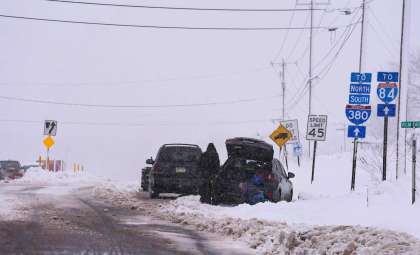
Connecticut to See Light Snow and Moderate Winds
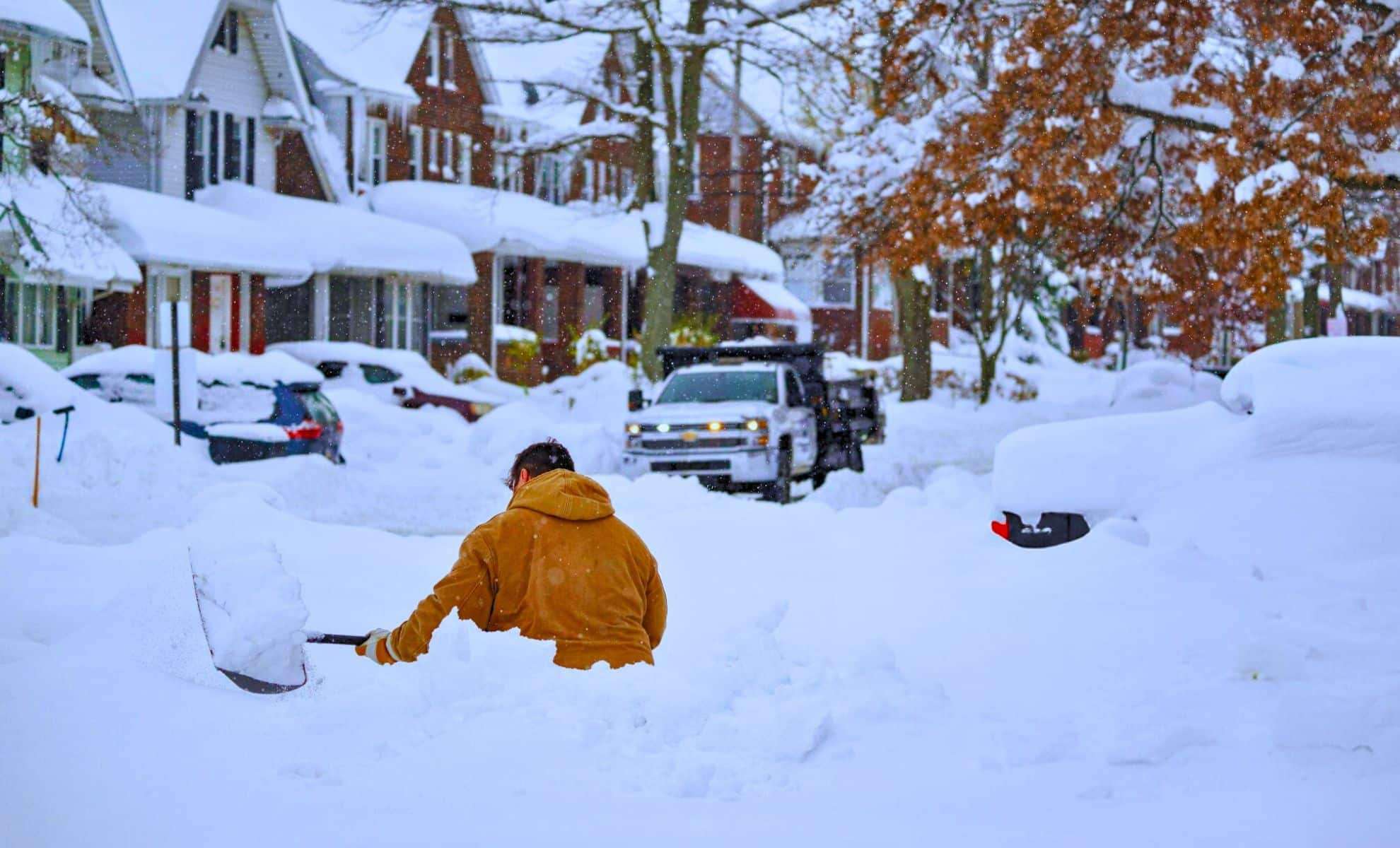
Connecticut is expecting some light snow this weekend, less intense than the 8.5 inches (21.59 cm) of snow reported earlier in the week. Certain locations, such as Litchfield County, may accumulate 1 to 2 inches (about 5.08 cm). Snow is expected to begin between 6 p.m. and midnight, particularly near Hartford and New Haven, tapering off by Sunday midday.
Nighttime temperatures in southern Connecticut will hover in the mid-30s Fahrenheit, paired with gusty winds of 20 to 25 mph (40.23 km/h). A small craft advisory will be active for Long Island Sound from 10 p.m. Saturday until 6 p.m. Sunday due to winds up to 25 knots and waves ranging from 3 to 5 feet (1.52 meters), posing risks for smaller boats.
The NWS forecasts Sunday to be “dry and warmer before more precipitation arrives, including possible rain from Monday to Wednesday.”
Heavy Rain and Flood Threats in Houston Area
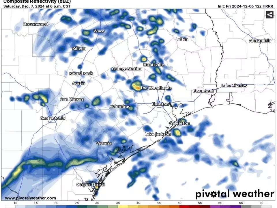
Houston is expected to experience significant rain and thunderstorms during the weekend caused by two weather systems. The first, a coastal low-pressure trough, brings a 40-50% chance of rain on Saturday, with the bulk of rainfall forecasted in the afternoon and evening. Total precipitation could reach 2 inches (5.08 cm), raising the likelihood of urban flooding in vulnerable neighborhoods.
The NWS emphasized that Southeast Texas faces a “marginal risk of minor street flooding” if heavy showers hit. A phenomenon called training storms, where consecutive storm cells pass over the same areas, may increase flood events.
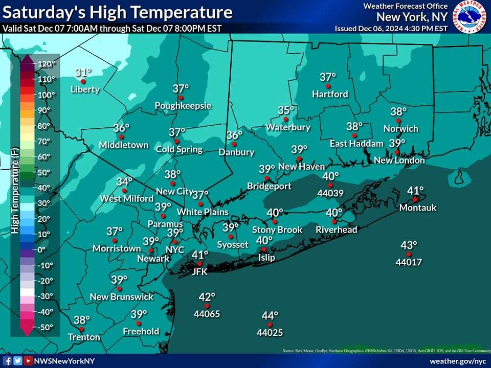
Temperatures will be in the mid-50s on Saturday, rising to about 60°F Sunday as a warm front moves across the region. A second disturbance will bring lighter rain showers Monday, before a strong cold front ushers in colder, drier air Tuesday night. Lows could dip to near 30°F with clear skies helping temperatures fall.
Essential Safety Measures for Residents
Individuals living in impacted regions should consider the following safety tips:
- For New York, secure loose items outdoors and limit travel during peak wind periods.
- In Connecticut, prepare for icy roads and adhere closely to small craft warnings affecting Long Island Sound.
- Houston residents should stay alert to flood advisories and avoid flood-prone areas.
The diversity of this weekend's weather illustrates the unpredictable nature of late-fall and early-winter conditions across the U.S., from blustery winds to snow and heavy rains. Keeping up with local reports is key to staying safe and reducing disruptions.
- Categories:
- News ,
- Climate change


0 comments
Sign in to Comment