
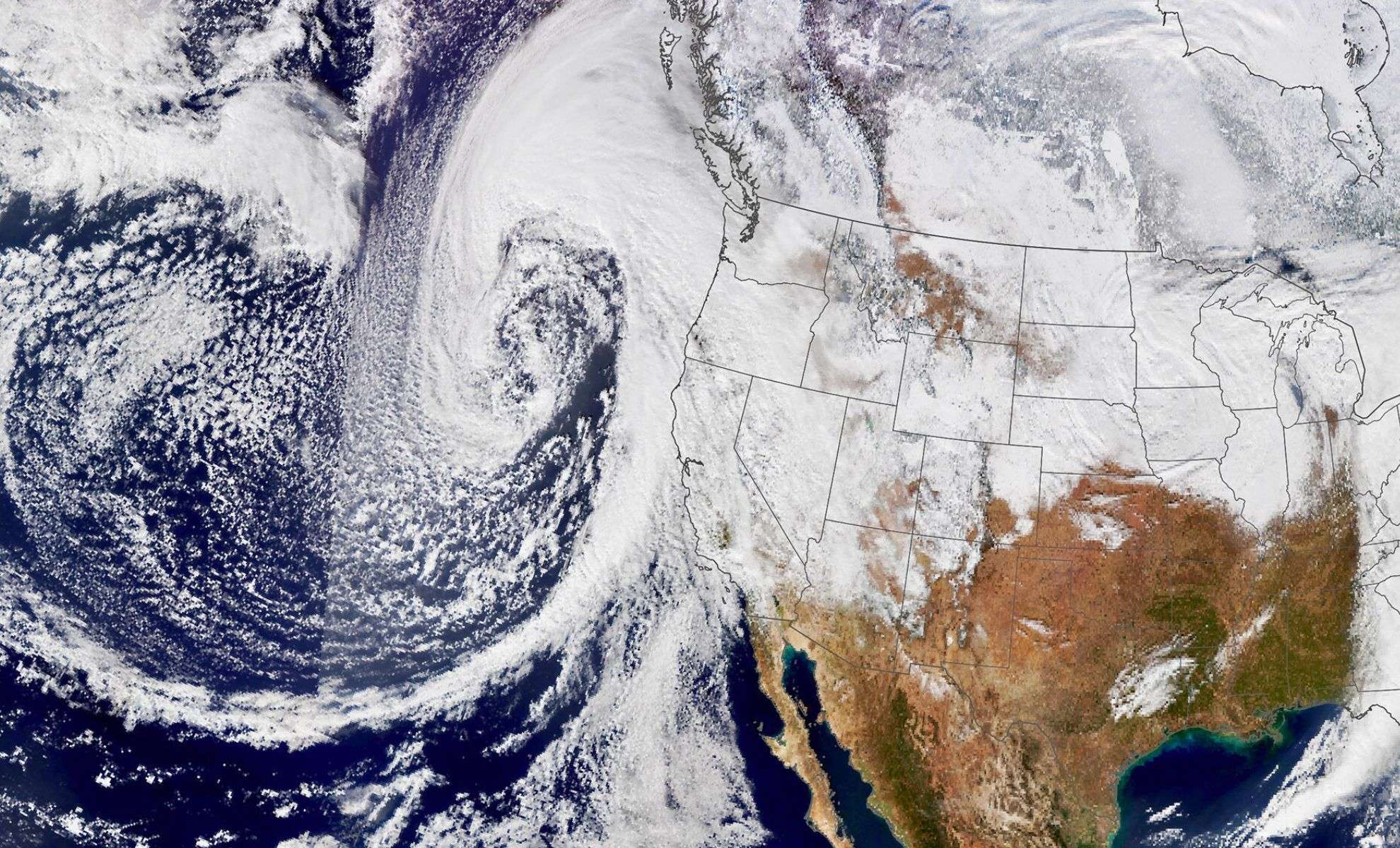
The Pacific Northwest is bracing for a potent mix of severe weather, including strong winds, heavy rain, and extensive snowfall. This weather pattern features a bomb cyclone alongside an atmospheric river, expected to affect large portions of the region and northern California.
Rapidly Intensifying Bomb Cyclone and Moisture Surge Hit the Northwest
A bomb cyclone, noted for a sharp atmospheric pressure drop exceeding 60 millibars within a day, is forecast to unleash gusts reaching 75 mph (120.7 km/h) across northern California, Oregon, and Washington beginning Tuesday. These extreme winds may cause substantial power disruptions and widespread tree damage.
Shortly afterward, a moisture-rich atmospheric river will move into California’s Redwood Coast and adjacent northern mountain areas, resulting in:

- Heavy rainfall accumulation of 5 to over 10 inches in select locations.
- Flooding and landslide risks, especially intensifying on Thursday.
The National Weather Service has issued flood watches for areas including the Sacramento Valley and strongly advises avoiding travel under these dangerous conditions.
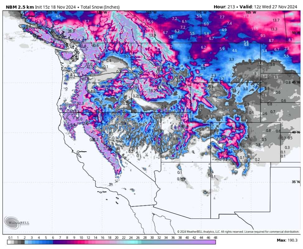
Projected Snowfall Levels in the Northwest and California
Summit Snow Totals in the Pacific Northwest (By November 24)
- Mt. Baker: 48 to 60 inches
- Mt. Rainier: Between 55 and 80 inches
- Mt. Hood: Ranging from 40 to 60 inches
Mid-Elevation Snow Accumulations (November 19-24)
- Crystal Mountain: 22 to 32 inches
- Timberline: From 20 to 34 inches
- Mt. Bachelor: 25 to 35 inches
California Snowfall Estimates (November 20-24)
Two distinct storm systems will bring mixed rain and snow to California starting midweek:
- November 20-21: Snow levels will rise from 5,000 feet (1.52 km) to 9,000 feet (2.74 km), turning snow into rain at numerous resorts:
- Palisades/Sugar Bowl: 6 to 12 inches
- Kirkwood: 3 to 7 inches
- Mt. Rose: 1 to 3 inches
- November 22-24: A follow-up storm will begin with rain, then shift back to snow as snow levels drop to 4,000 feet (1.22 km):
- Palisades/Sugar Bowl: 16 to 25 inches
- Mammoth Mountain: 18 to 26 inches
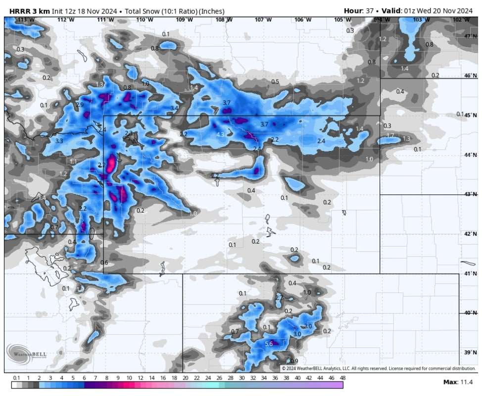
Additional Regional Snowfall Impacts
- Wyoming’s Teton Mountains: Up to 12 inches expected.
- Northwest Colorado: Anticipated 2 to 6 inches by Sunday.
- Utah: Snowfall beginning Saturday, with 25 to 35 inches forecast in the Cottonwood Range by midweek.
The upcoming third system may deliver an extra 10 to 20 inches of snow across the Pacific Northwest and California early next week. Officials urge residents and visitors to monitor updates closely as conditions develop.
- Categories:
- News


0 comments
Sign in to Comment