
Hidden beneath the dense mists of the Pacific Northwest's mountainous terrain, numerous volcanoes loom quietly along the horizon. Though they seem dormant, volcanologists caution that some could erupt without warning, causing catastrophic damage within moments, prompting communities to brace for a possible calamity threatening thousands of lives.
The Overlooked Volcanic Hazard in the Pacific Northwest
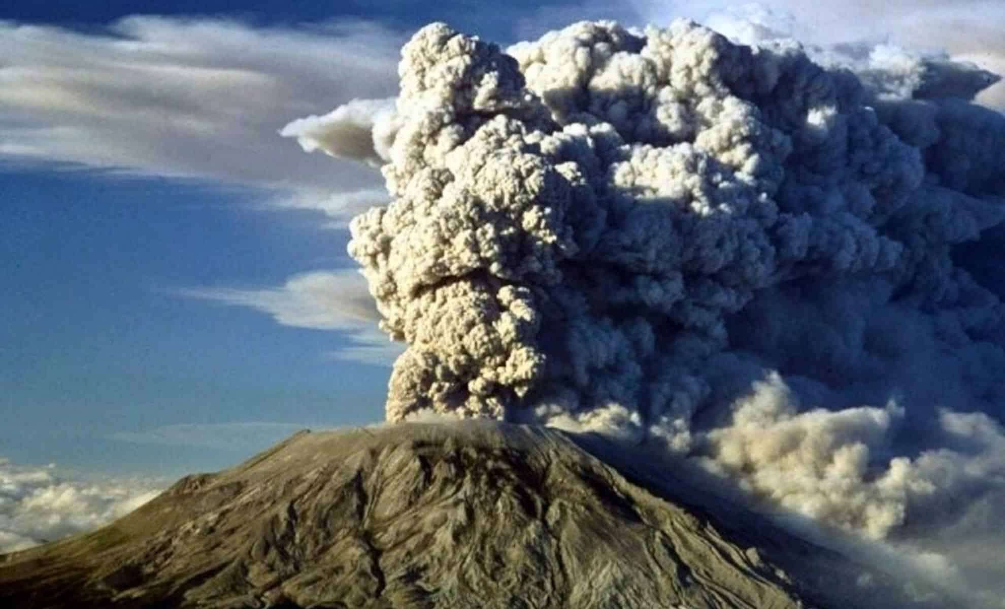
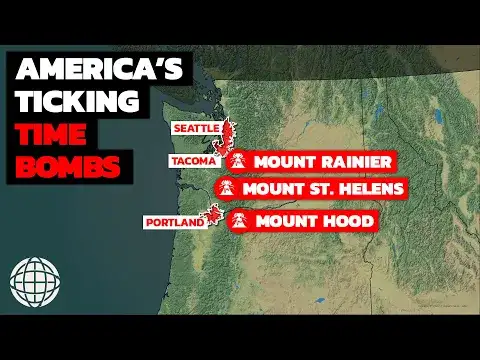
The Cascade Range, a volcanic chain stretching 1,200 miles from British Columbia to Northern California, hosts several of North America's most dangerous volcanoes. The 1980 Mount St. Helens eruption stands as a powerful reminder of this region's volatile nature, yet experts now highlight growing concerns about other significant threats, particularly in Washington State.
Among the riskiest are Mount Baker, reaching 10,781 feet with its last eruption in 1843; Glacier Peak, which is 10,541 feet tall and last erupted in 1700; and most notably Mount Rainier, towering at 14,410 feet, whose most recent eruption occurred around 1450.

Mount St. Helens remains active, having erupted again between 2004 and 2008, illustrating its persistent danger. Nearby, Mount Adams has remained quiet for millennia, with its last known activity estimated between 1,800 BC and 5,600 BC.
Unlike earthquakes, which can sometimes follow discernible patterns, volcanic eruptions lack predictable timing. The unpredictability challenges monitoring efforts, but scientists note increased geothermal, seismic, and gas activities imply an inevitable future eruption.
What Transpires During a Volcanic Eruption?
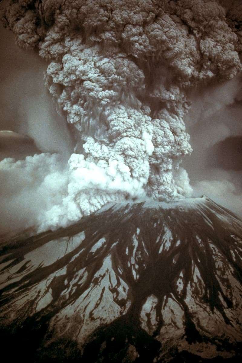
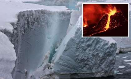
A volcanic eruption typically begins with a violent explosion that propels gas, ashfall, and rock high into the atmosphere. These thick clouds can severely impair breathing, sometimes fatally, due to the fine volcanic particulates dispersed through the air. Volcanic glass and minerals ascend, producing an eruption column that disrupts air travel and blankets wide areas.
The most lethal stage follows: the pyroclastic flow. This swift avalanche of superheated materials barrels downhill at speeds between 100 and 150 mph, with temperatures exceeding 1,500°F, incinerating everything along its path instantly.
During the eruption, volcanic bombs—molten rock fragments—fall over vast territories, destroying structures and injuring living beings in their trajectory. Such volcanic debris also clogs infrastructure, impeding roads and contaminating water supplies.
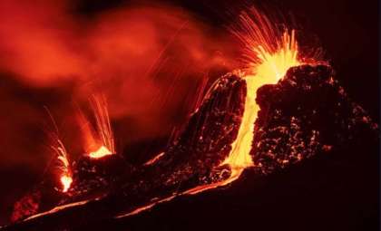
Lava flow begins once activity stabilizes, spreading quickly or accumulating pressure before erupting explosively, depending on its viscosity.
Lahars: Washington’s Most Devastating Volcanic Hazard
In addition to lava and pyroclastic flows, lahars—rapid mud and debris flows—pose an extreme volcanic threat in this region.
These surges, triggered when molten lava melts snow and ice, unleash torrents of ash, rocks, and water moving faster than 120 mph. Traveling quicker than most cars, lahars can obliterate towns in mere minutes.
The immense force of lahars can engulf entire communities beneath dense layers of hardened material, sometimes resembling a swift-moving concrete wave that demolishes bridges, roads, and vital infrastructure.
In Washington, towns such as Orting and Puyallup face heightened danger. If an eruption occurred at Mount Rainier, lahars could roll down its flanks, devastating thousands of residences and businesses. Even Seattle, further away, could suffer severe impacts, including power outages and transportation breakdowns.
Predicting the Next Eruption
The Cascades Volcano Observatory (CVO) continuously monitors seismic and volcanic indicators in real time. By analyzing earthquakes, land deformations, and gas emissions, scientists aim to detect signs of volcanic unrest.
Increased activity often signals magma movement beneath the surface, frequently indicated by earthquake swarms. Elevated emissions of sulfur dioxide and carbon dioxide also suggest magma ascension.
Temperature rises in lakes, vents, and surrounding areas further hint at imminent eruptions, along with visible ground changes like bulging or fissuring caused by internal pressure.
Despite thorough monitoring, pinpointing exactly when an eruption will occur remains impossible. Experts stress that the question is not if, but when, as the Pacific Northwest’s volcanoes persist as active threats with growing potential for disaster.
- Categories:
- Climate change


0 comments
Sign in to Comment