
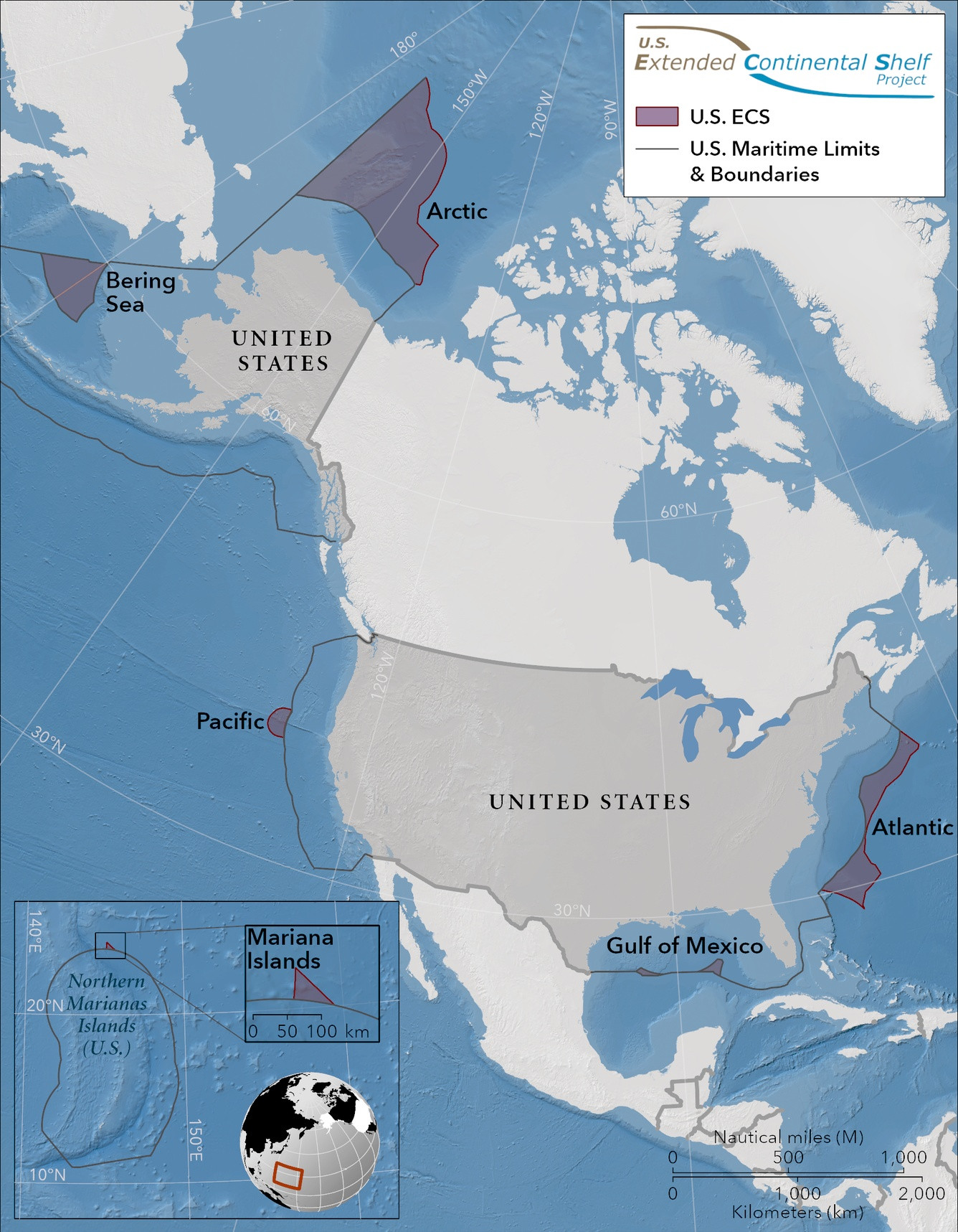
At the end of 2023, the United States significantly boosted its territorial reach by adding approximately one million square kilometers—an area nearly double the size of California. This development, revealed by the State Department on December 19, grants the U.S. sovereign rights over extensive seabed regions in seven offshore zones, extending from the Arctic to the Gulf of Mexico.
This expansion does not involve new landmasses above the sea but rather an extension of the continental shelf beyond the usual 200 nautical mile limit, known internationally as the Extended Continental Shelf (ECS). According to the State Department’s ECS resource page, nations that demonstrate their seabed naturally extends beyond the standard limit can claim jurisdiction over the seabed's surface and subsurface.
Over half of the newly asserted territory lies within the Arctic region, with the rest distributed along the Atlantic and Pacific coasts, the Bering Sea, the Mariana Islands, and two sectors in the Gulf of Mexico.

Competing Claims in the Arctic Ocean
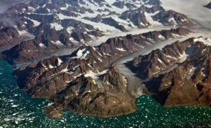
The seabed beneath the Arctic Ocean is becoming a hotspot of territorial interest. Countries including Russia, Canada, Denmark (through Greenland), and the U.S. claim overlapping portions of this underwater territory. Russia has been especially assertive; in 2007, Russian minisubs planted a titanium flag on the seabed at the North Pole, provoking controversy among Arctic states.
Russia’s claim covers about 2.1 million square kilometers. Meanwhile, the U.S. claim in the Beaufort Sea past Alaska overlaps with Canadian assertions, necessitating diplomatic talks in the future.
A representative from Canada’s Foreign Ministry stated, “Canada continues to pursue international validation of the outer boundaries of its extended continental shelf. We maintain regular communication with the U.S. concerning Arctic shelf issues.”
Unconventional Legal Tactics by the U.S.
The U.S. employed a unique approach here. It has never ratified the UNCLOS treaty from 1982, which defines ECS guidelines. Although reviewed by the Senate several times since 1994, the treaty has not been given consent. A comprehensive Congressional Research Service report published in early 2026 details this history.
Despite lacking formal treaty membership, the U.S. invested nearly twenty years and over $100 million collecting geological data to identify its ECS boundaries according to treaty specifications. Then, in December 2023, the State Department declared the new territorial limits without submitting them to the UN commission for approval, diverging from standard treaty member procedures.
Rebecca Pincus, director of the Polar Institute at the Wilson Center, told Radio Free Europe, “This was an unexpected and unconventional strategy. While the U.S. has gained a significant territory of a million square kilometers, the method invites questions about its adherence to international law.”
This maneuver offers a clear advantage: countries that exploit ECS resources under the treaty remit royalties to the International Seabed Authority, but the U.S., as a non-signatory, incurs no such obligations. As noted by The Atlantic in January 2025, “America seems to enjoy benefits without formal participation.”
Elizabeth Buchanan, a polar geopolitics specialist at West Point's Modern War Institute, expressed to RFE/RL, “This undermines the credibility of the international framework the West has forcefully supported and protected.”
Vast Wealth Lies Beneath the Waves
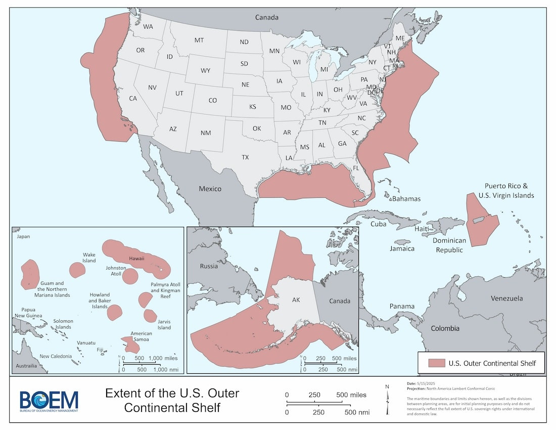
The seabed territory gained is rich in resources. The Bureau of Ocean Energy Management estimates the total technically recoverable deposit of oil within the U.S. Outer Continental Shelf at 65.8 billion barrels, accompanied by 218.4 trillion cubic feet of natural gas. Alaska accounts for 24.1 billion barrels, the Gulf of Mexico 26.9 billion, the Pacific region 10.3 billion, and the Atlantic around 4.5 billion.
BOEM’s Acting Director Matt Giacona emphasized the area’s “immense resource potential.” A 2008 US Geological Survey suggested the Arctic seabed might hold up to 90 billion barrels of oil.
Besides hydrocarbons, valuable minerals vital for electric vehicle batteries—like manganese nodules, ferromanganese crusts, and polymetallic sulfides—are abundant here. The State Department estimates the combined value of these deposits to be in the trillions of dollars.
Scientific Gains from Seabed Exploration
The two-decade-long mapping effort, the most extensive offshore mapping project ever by the U.S., led to important scientific findings.
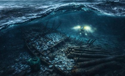
Seismic surveys in the Atlantic unveiled the Cape Fear submarine landslide, a 375-kilometer (233-mile) long underwater avalanche and the largest recorded off the East Coast. In the Arctic, researchers observed ancient glacier scours and pockmarks formed by gas eruptions on the ocean floor.
NOAA charted more than three million square kilometers of seabed in U.S. coastal waters—larger than Alaska, California, and Texas combined—and precisely measured the Challenger Deep depth at 10,994 meters (36,070 feet), the ocean’s deepest known point.
Barry Eakins, a marine geophysicist leading NOAA’s CIRES ECS team, stated, “Having set the boundaries of the U.S. continental shelf, it’s our responsibility to continue exploring, advancing scientific understanding, and managing these regions to protect them for future generations.”
A U.S.-Canada Collaboration in the Arctic
The Arctic portion of the data was largely collected during a joint five-year mission by the U.S. and Canada ending in 2011. The partnership employed two icebreakers: the U.S. Coast Guard Cutter Healy and the Canadian Coast Guard Ship Louis S. St-Laurent.
According to Larry Mayer, U.S. chief scientist on the Arctic mission, “Coordinating icebreaking allowed both nations to obtain more data than operating separately, saved millions by avoiding duplicate efforts, and fostered scientific and diplomatic collaboration.”
Since 2003, the Healy alone has mapped over 320,000 square kilometers (123,000 square miles) of Arctic seafloor, an area the size of Arizona.
Mayer added, “The high-resolution data helped define the U.S. ECS outer limits and identified previously unknown underwater features like seamounts and glacial scours 400 meters beneath the surface.”
With these updates, the extended continental shelf is now officially depicted on U.S. charts. This expansion marks a significant geographical and geopolitical development for the United States.
- Categories:
- News


0 comments
Sign in to Comment