
Researchers have uncovered a vast underground complex dating back over 2,500 years beneath Egypt’s Nile Delta. Located at the ancient site of Buto, this discovery, possibly a temple or tomb, was identified using a blend of satellite imaging and geophysical surveys. This breakthrough underscores how modern technology is enabling archaeologists to probe submerged and difficult sites like never before.
The location known as Tell el-Fara’in, historically tied to Buto, has witnessed continuous occupation spanning from the Predynastic era to the Early Islamic period. The extensive human activity has created complex archaeological layers, further complicated by frequent flooding, challenging traditional excavation efforts.
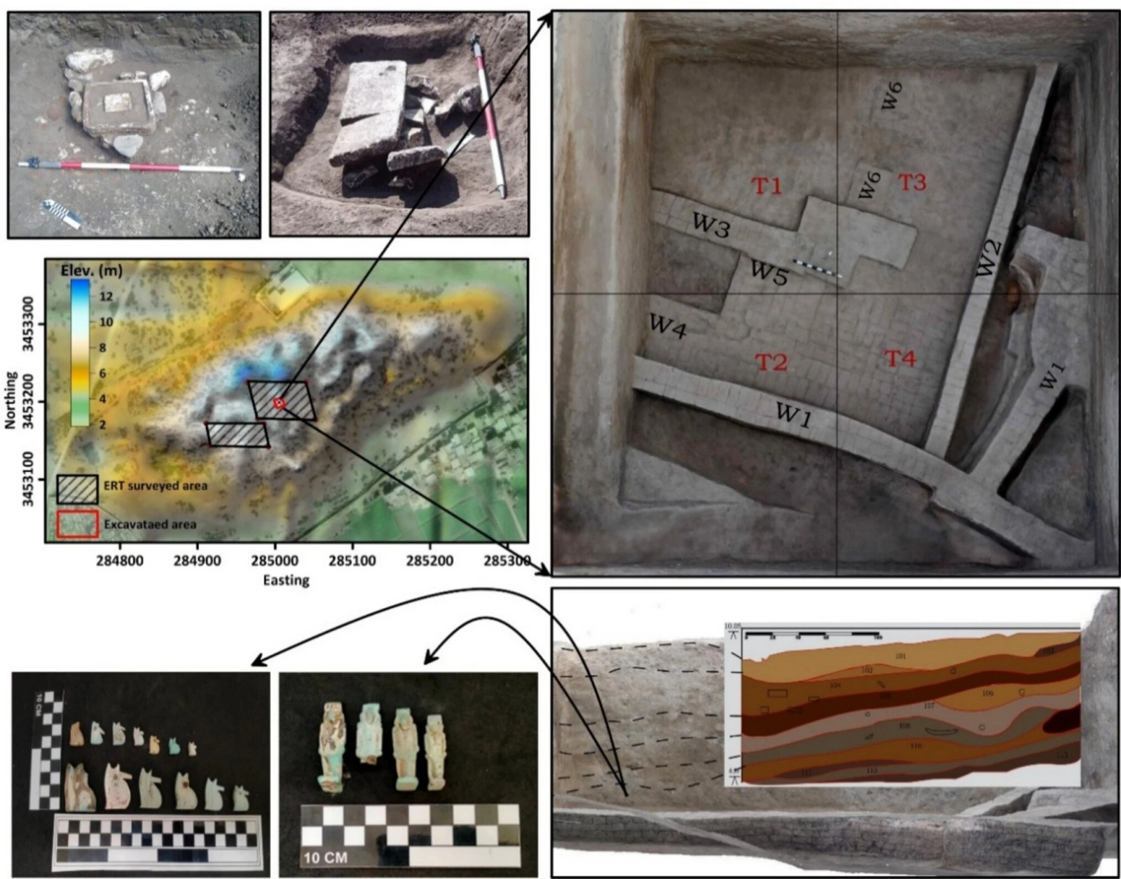
Faced with these challenges, a collaborative team from Kiel University and Egypt’s National Research Institute of Astronomy and Geophysics implemented an integrated methodology. Prior to excavation, they combined advanced remote sensing with precise underground scanning to pinpoint buried remains accurately.

Innovative Subsurface Imaging Exposes Hidden Archaeological Features
The initial phase employed satellite technology to detect irregular soil formations indicating possible man-made structures beneath the surface. As published in Acta Geophysica, these visuals implied the existence of subterranean constructions.
Following this, the team applied electrical resistivity tomography, a technique that transmits electrical currents underground and measures soil responses to generate a detailed 3D model of the hidden architecture. The scientists noted:
“The results of this study demonstrate the effectiveness of combining geophysical measurements and remote sensing data, which gave a very accurate vision in detecting buried settlements in a complex region.” they added in the paper, “3D inversion algorithms were particularly effective in delineating buried mudbrick walls and architectural structures, significantly enhancing our understanding of site formation processes.”

Discovered Artifacts Point to Religious Functions
The uncovered construction spans approximately 65 by 80 feet and lies buried at depths between 10 and 20 feet. Dating from Egypt’s 26th Dynasty (the Saite period), it belongs to a time of renewed political stability and revival of ancient traditions before the Persian conquest.
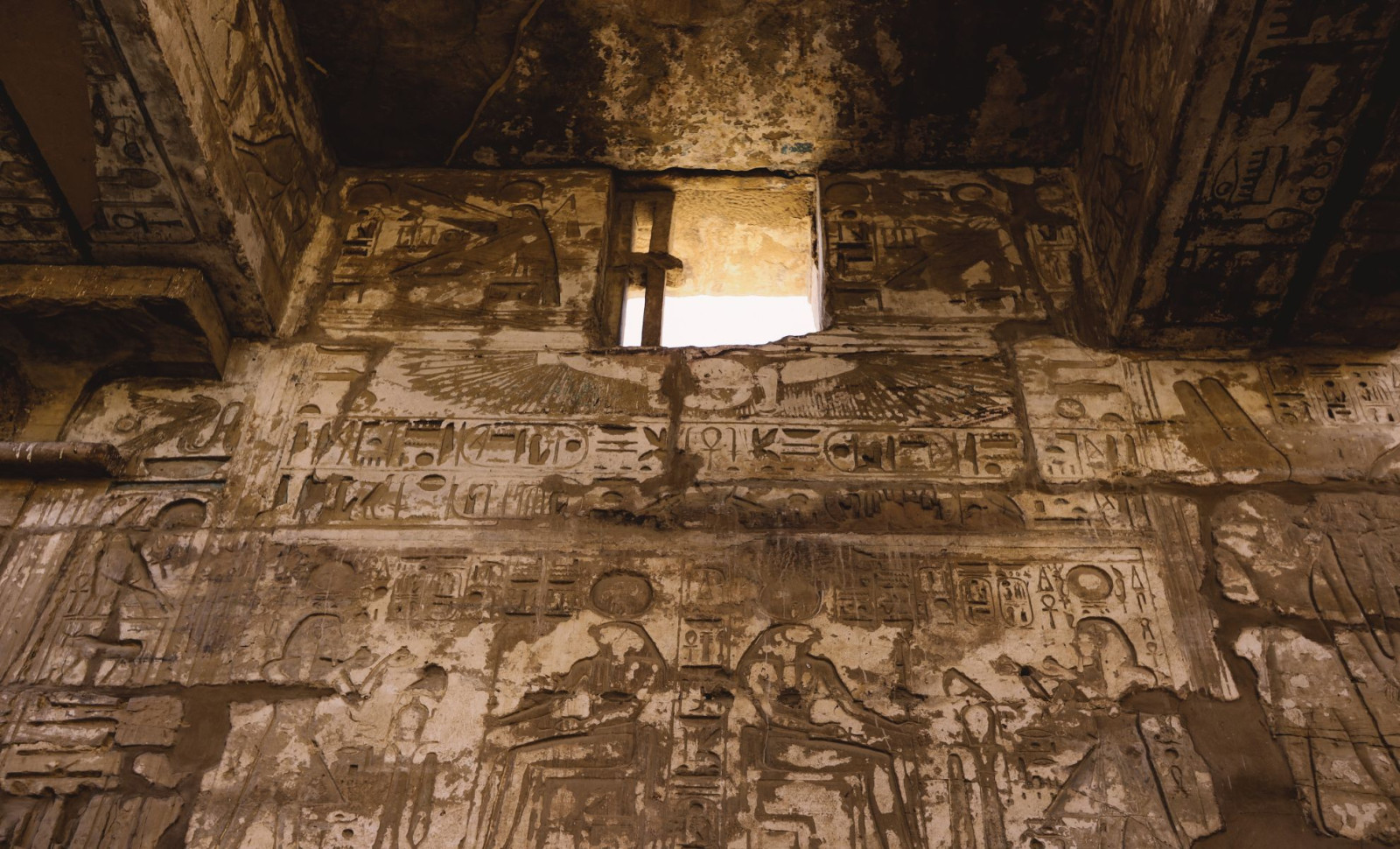
Within the site, archaeologists found various religious items. Several amulets depict deities such as Isis, Horus, Bes, and Wadjet, the latter closely associated with Buto. One rare amulet features a hybrid depiction combining a baboon, falcon, and the dwarf god Pataikos. Additionally, a steatite scarab inscribed with the name of Thutmose III was discovered, believed to have functioned as a seal and regarded as a significant find.
Other recovered relics include a small offering basin, a relief portraying Hathor, and several figurines, suggesting the structure played a spiritual or ceremonial role, though its precise purpose remains uncertain.
An Engineered Landscape Shaped by Water and Planning
The foundation of this structure reflects how ancient engineers adapted to the delta’s challenging, flood-prone environment. Researchers reported that a uniform sand layer was intentionally laid down to level the terrain before building commenced, reflecting careful preparation and architectural planning.
The investigation also uncovered a hiatus of about 1,500 years in habitation at Buto, likely caused by shifts in the waterways impacting the area’s habitability.
When settlement resumed, inhabitants moved eastwards into previously unused zones, where smaller installations and ovens were found. Upper stratigraphy revealed artifacts from the Ptolemaic and Roman times, including fragments of pottery, mud bricks, and limestone rubble.
- Categories:
- Science


0 comments
Sign in to Comment