
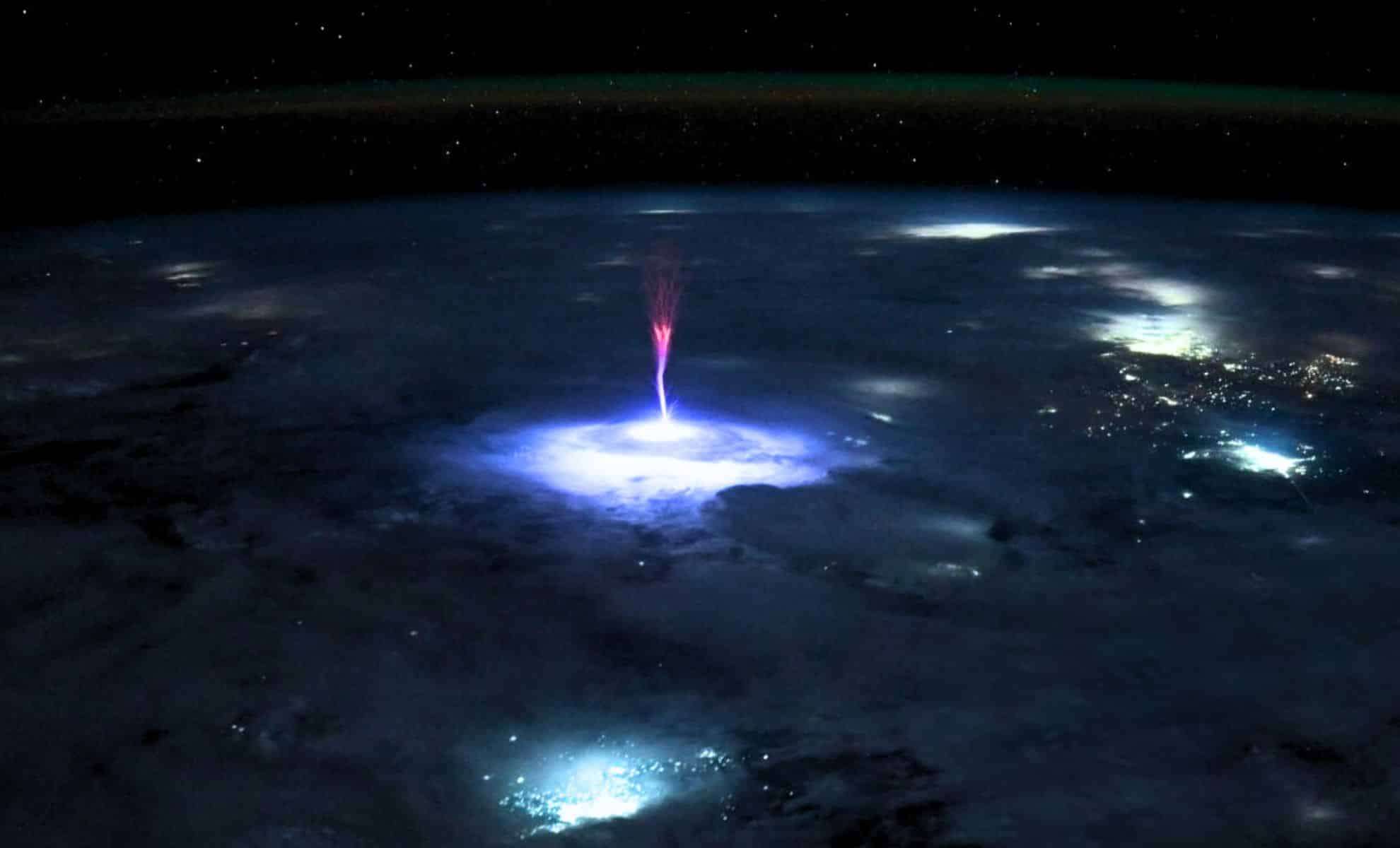
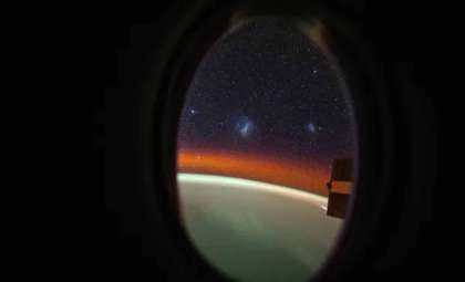
In early July 2025, astronauts aboard the International Space Station (ISS) documented a remarkable phenomenon occurring nearly 400 kilometers above Earth’s surface. This unusual event captured worldwide interest among scientists and weather experts. The striking image taken by astronaut Nichole Ayers reveals an incredible display of light with hues shifting from vibrant red to serene blue. This transient energy discharge, only visible from space, sheds new light on electrical activity in our planet’s upper atmosphere.
Exploring the Upper Layers of Earth’s Atmosphere
Ayers’ shared photograph highlights a spectacular lightning-like event, resembling a powerful energy surge descending toward Earth. What sets this occurrence apart is the vivid array of colors presented in the jet, blending from pinkish-red to bright white, complemented by violet and blue shades. At the phenomenon’s base, the energy beam seems to connect with the Earth, illuminating the clouds below with a radiant glow.
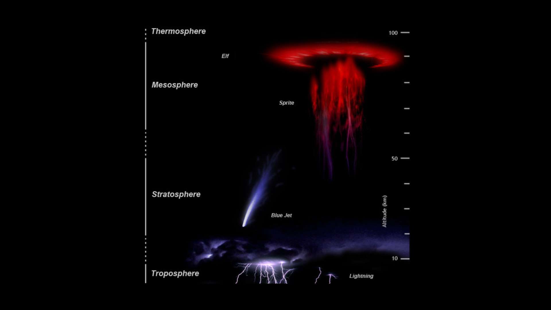
This manifestation, termed a sprite or farfadet, ranks among the rarest forms of Transient Luminous Events (TLEs). Such events appear in the upper atmosphere above regular thunderstorms and are triggered by strong electrical discharges originating from storms beneath. Unlike ordinary lightning occurring in the troposphere, sprites develop in the mesosphere, typically between 50 and 80 kilometers altitude.

Understanding Transient Luminous Events in the Atmosphere
Transient Luminous Events, or TLEs, are brief, luminous flashes of various types such as sprites, elves, and jets. Though studied for many years, these quick high-altitude displays remain challenging to observe and comprehend because of their fleeting presence and extreme altitudes. The sprite observed by Ayers represents a notable example, granting researchers a unique glimpse of an extremely short-lived phenomenon.
Such TLEs occur well above the thunderstorms responsible for their creation, usually found in the mesosphere, positioned between the stratosphere and the thermosphere. These jets can accelerate at velocities ranging from 10 to 145 kilometers per second, forming a link between the storm clouds below and the upper atmospheric layers. Though momentary, these events release immense energy, producing striking visual effects and providing key scientific insights.
The Difficulty of Photographing High-Altitude Lightning
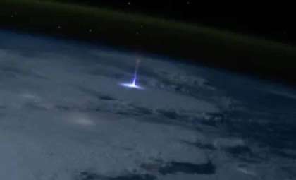
Snapping a sharp image of a high-altitude lightning event poses significant challenges. These phenomena are mostly invisible from the ground and short-lived, appearing for just fractions of a second. Even for astronauts or orbiting satellites positioned strategically, capturing such transient events is demanding. The image by Nichole Ayers stands out as one of the most detailed photos ever recorded of a giant jet.
Meteorologist Matthew Cappucci praised Ayers’ image as the “clearest photo ever taken of a gigantic jet seen from above.” The exceptional clarity of this photograph is vital for deepening understanding of TLEs, which remain elusive due to their swift nature. These energetic jets can ascend to altitudes between 80 and 95 kilometers, bridging the space from thunderclouds to upper atmospheric layers, delivering vital clues about storm interactions with the atmosphere.
Enhancing Our Knowledge of Atmospheric Phenomena
The shot, captured during the ISS’s passage over Mexico and the southern U.S., is more than just a stunning visual; it’s a valuable asset for atmospheric research. This photograph showcases a giant jet, part of a broad class of elusive high-altitude lightning phenomena. Scientists hope that images like this will advance the study of the formation, behavior, and characteristics of TLEs, improving insight into these dynamic atmospheric events.
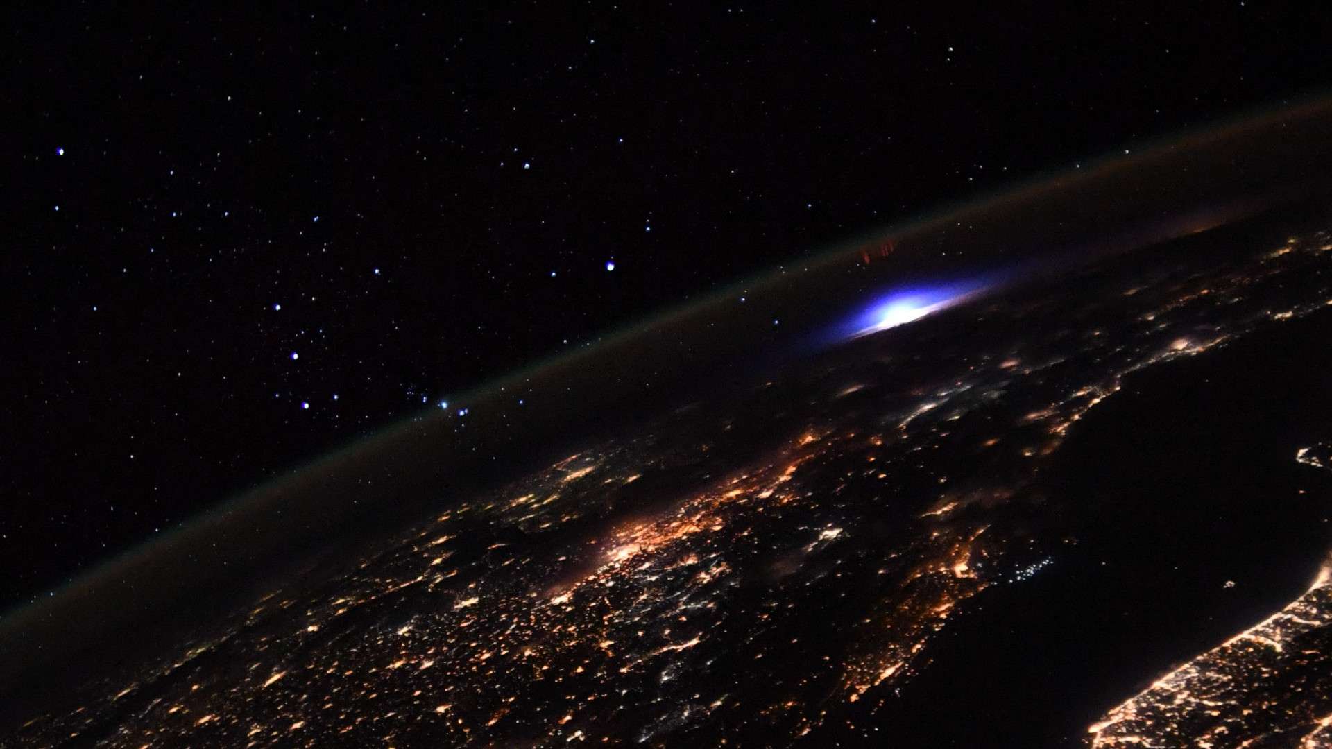
While similar phenomena were previously recorded—for example, by astronaut Thomas Pesquet in 2021—the image captured by Ayers surpasses earlier ones in detail and sharpness. This photograph is expected to become a crucial resource for future investigations into electrical phenomena in Earth’s upper atmosphere and their connections to storms below.
- Categories:
- News


0 comments
Sign in to Comment