

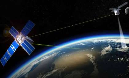
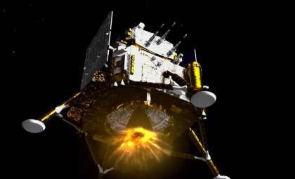
Researchers in China have announced plans to build a sophisticated communication and navigation system linking Earth and the moon.
This ambitious framework is designed to advance China’s lunar exploration initiatives, ensuring safer and more effective missions in space. The concept involves a constellation of satellites and terrestrial stations capable of delivering real-time communication, positioning, and monitoring services for lunar activities.
Building a Space Communication Corridor
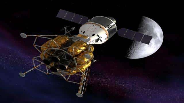
Scientists from the China Academy of Space Technology (CAST) along with the Beijing Institute of Spacecraft System Engineering have presented a strategic plan to create an information corridor extending from Earth to the moon. The proposed arrangement includes 30 satellites and three lunar ground stations, which together will facilitate simultaneous communication and navigation support for up to 20 users.

Yang Mengfei, lead designer behind China’s Chang’e-5 mission, emphasized the project's significance: “Cislunar space represents an emerging arena for human endeavors. Activities in this area are expected to escalate over the coming decade, igniting fierce global competition.” This infrastructure will provide essential positioning, navigation, and timing (PNT) services to support crewed and robotic missions alike.
Establishing this network is a cornerstone for China’s expansive space exploration ambitions. It promises precise and dependable communication, navigation, and data transmission capabilities essential for conducting lunar operations. Maintaining continuous navigation and communication links will be vital for the future of lunar expeditions and potential settlement efforts.
Development Phases
The project is divided into three progressive stages, each enhancing the network’s capabilities:
Phase One: Focuses on enabling communication for robotic and crewed lunar missions with two satellites in elliptical lunar orbits and a lunar surface control station. This setup will support communication with the moon's south pole region for at least 10 simultaneous users, establishing foundational channels for upcoming missions.
Phase Two: Introduces 10 satellites positioned around the moon, Earth, and key Earth-moon Lagrange points. A second lunar ground station will boost data transmission rates up to 5 gigabytes per second and improve lunar south pole navigation accuracy to 100 meters. This phase aims to extend network coverage and enhance performance to support diverse mission profiles.
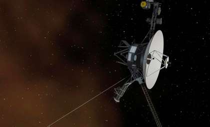
Phase Three: Completes the network with 30 satellites and three lunar stations, delivering data speeds of 10 gigabytes per second. Navigation precision will be refined to 10 meters on the lunar surface and 50 meters for Earth-moon travel. Additionally, a Very Long Baseline Interferometry system will track spacecraft up to 900 million kilometers away with sub-kilometer accuracy, facilitating deep-space missions to Jupiter and beyond. “Our roadmap illustrates a gradual expansion from the lunar south pole across the entire moon,” stated Peng Jing, deputy chief designer of China’s Chang’e-5 mission.
Achieving Precise Lunar Navigation
Alongside communication, Chinese researchers are developing a satellite navigation system, often dubbed Lunar GPS, tailored for lunar operations. This network will enhance navigation and positioning accuracy for missions involving surface traversal, landings, and departures.
The system will be rolled out over three stages, deploying satellites across four orbital patterns. Its design emphasizes sustainability and cost-efficiency while delivering reliable and accurate coverage. Peng Jing explained, “A constellation orbiting near the moon can provide continuous, high-precision navigation data, critical for surface activities and supporting frequent human missions in the long term.”
This navigation capability will be instrumental for future lunar endeavors, ensuring secure landings, effective surface movement, and safe returns. Moreover, its accuracy will support scientific investigations, resource gathering, and potential colonization efforts on the lunar surface.
Global Race and Opportunities for Cooperation
The concept of building infrastructure in cislunar space is gaining popularity internationally, with countries such as the US, Europe, and Japan proposing similar systems to back their lunar ambitions. Notably, the US Air Force is developing the Cislunar Highway Patrol System to monitor artificial objects in lunar orbit.
China’s initiative aims to establish leadership in the nascent cislunar economy, aligning with its broader aspirations as a space power. The project seeks to optimize resource use and avoid redundant developments to support missions including manned moon landings, international lunar research stations, and outer solar system expeditions.
As interest grows, collaboration across nations might become essential. Sharing technologies, data, and expertise could enhance the efficiency and sustainability of lunar exploration efforts, fostering peaceful and cooperative advancement in space.
- Categories:
- Astronomy ,
- News ,
- Space ,
- Aircraft


0 comments
Sign in to Comment