
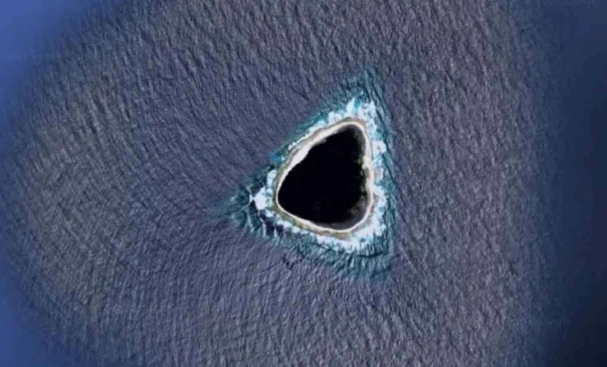
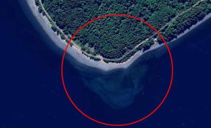
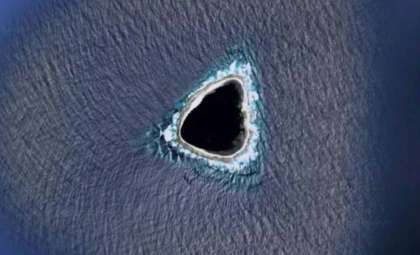
An isolated, uninhabited island in the Pacific Ocean has captured attention after Google Earth displayed it with a peculiar, hollow-like appearance. Known as Vostok Island, this secluded spot has ignited curiosity among conspiracy enthusiasts and digital explorers alike.
Curious Google Earth View Fuels Theories of a ‘Hollow’ Island
The intrigue started when users examining Vostok Island on Google Earth spotted a notably dark, empty-seeming area at its center. This visual anomaly led to widespread speculation about the possibility of hidden features beneath its thick jungle or even a concealed crater or water body. The image’s shadowy, indistinct core quickly prompted the label “hollow,” sparking conversation across online forums and social media platforms.
However, such visual inconsistencies are relatively common in satellite imagery. Google Earth occasionally renders incomplete or obscured sections due to satellite coverage gaps, image processing limitations, or privacy restrictions. For Vostok Island, the apparent “void” is most likely caused by dense foliage combined with low-resolution imaging, rather than an actual hollow cavity or secret compartment.

From Online Enigma to Ecological Sanctuary
As fascination with the island escalated, so too did the rumors. Over time, some theories have linked the image to hidden military operations, extraterrestrial bases, or mysterious portals. Yet, careful investigation debunks these claims.
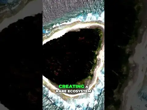
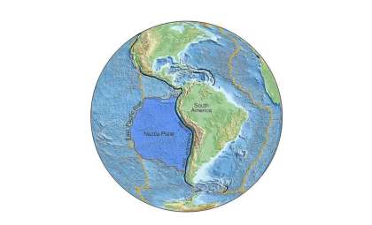
Vostok Island lies within the Republic of Kiribati, a nation made up of dispersed atolls and islands across the central Pacific Ocean. Though seldom visited due to its remote location, Vostok is a designated conservation area. The island hosts vibrant coral reefs, abundant seabird colonies, and pristine ecosystems, making it a critical habitat for scientific study and nature preservation.
Divers Capture Authentic Scenes of Vibrant Reef Life
Recent underwater footage shared by divers and organizations like National Geographic brings clarity to the island’s true character. Divers report flourishing coral formations and diverse marine species inhabiting the surrounding waters. This lively underwater ecosystem contradicts the ghostly dark patch seen in satellite images.
While the digital depiction sparked fantastical theories, direct observations consistently highlight Vostok as an untouched natural refuge valued for its ecological richness rather than mysterious digital shadows.
The Internet’s Fascination with Satellite Image Oddities
The interest in Vostok Island exemplifies a wider trend of online enthusiasm for peculiar Google Earth visuals. From alleged Antarctic “pyramids” to supposed “UFO sightings” near celebrities like Harry and Meghan, satellite imagery regularly inspires imaginative speculation.
Such curiosity often brings distant and rarely seen locations into public view, linking modern mapping technology with real-world environments. In the case of Vostok, what began as a shadow on a screen has evolved into a chance to explore one of the Pacific’s most isolated and least understood islands.
- Categories:
- News


0 comments
Sign in to Comment