

Scientists have harnessed data from the NASA-French Surface Water and Ocean Topography (SWOT) satellite to observe and analyze extensive river flood waves advancing along major waterways in the United States, signifying a groundbreaking achievement in hydrology. This research, reported on May 14, 2025, in Geophysical Research Letters, highlights how cutting-edge space radar systems can now precisely measure the height and velocity of flood waves with remarkable clarity. These waves, typically caused by heavy rains or ice dam releases, hold key information for flood forecasting and water management, especially in areas without widespread flood control networks.
Advanced Satellite Tools Reveal River Wave Dynamics
The SWOT satellite, developed through collaboration between NASA and the French agency CNES, employs its innovative Ka-band Radar Interferometer (KaRIn) to capture water surface heights and widths across lakes and rivers around the globe. Unlike standard river gauges that offer point-specific measurements, SWOT provides broad, near-real-time views of water dynamics over extensive river stretches. “Besides monitoring overall water volume in lakes and rivers, we focus on the movement and transformation of water bodies,” said Nadya Vinogradova Shiffer, SWOT program scientist at NASA Headquarters. This unique ability transforms our comprehension of how river waves travel vast distances, transporting nutrients as well as flood risks downstream.
Uncovering the Origins and Patterns of River Flood Waves
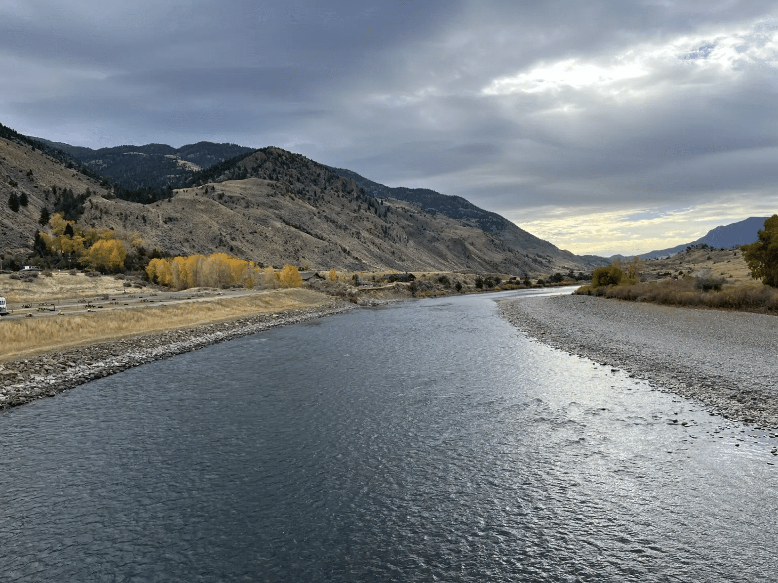
Virginia Tech’s lead researcher Hana Thurman identified three unique flood waves using SWOT observations, including a remarkable instance on Montana’s Yellowstone River in April 2023. The satellite recorded a 9.1-foot-high wave crest stretching nearly 7 miles as it headed toward the Missouri River, caused by a rapid ice jam collapse upstream. Two other major waves were linked to intense rainfall runoff: one on the Colorado River near Austin, Texas, towering over 30 feet and covering 166 miles, and another on the Ocmulgee River by Macon, Georgia, over 20 feet tall and extending for 100 miles. These findings illuminate the powerful influence of weather and natural phenomena on river flood wave formation, supplying vital information for hazard assessment and infrastructure design. “While ocean waves are familiar to us, river waves are crucial conveyors of Earth’s lifeblood. Understanding their behavior is essential,” remarked Cedric David, hydrologist at NASA’s Jet Propulsion Laboratory and coauthor of the paper.

Enhancing Flood Prediction and Water Resource Management
Tracking flood waves from orbit complements ground-based river gauges, which are often lacking in many regions. George Allen, hydrologist and remote sensing specialist at Virginia Tech, likened traditional gauges to "toll booths recording passing cars," whereas SWOT acts as a "traffic helicopter taking aerial snapshots of the highway." By determining the height, velocity, and shape of these river waves, scientists can refine flood forecasts and provide critical early warning. “Our growing insights into how flow waves evolve and move along extensive river sections will help answer questions like the speed of flood arrival and potential risks to infrastructure,” said Thurman. This spaceborne perspective could guide future engineering and policy efforts toward smarter, more resilient water management systems.
Broadening SWOT’s Impact on Global Hydrology
Since its 2022 launch, SWOT has been circling Earth multiple times daily, gathering data on freshwater bodies and oceans using its sophisticated radar technology. Its mission seeks to detect around 55% of significant flood events over their timeline, delivering near real-time alerts on emerging flood threats. Besides mapping water surface elevations, SWOT sensors capture subtle water movements, deepening our grasp of Earth's complex water cycles. This international effort involves NASA’s Jet Propulsion Laboratory, CNES, the Canadian Space Agency, and the UK Space Agency, collectively advancing the field of satellite hydrology. The insights obtained through SWOT mark a transformative step toward improved global flood monitoring and water resource stewardship.
- Categories:
- News


0 comments
Sign in to Comment