
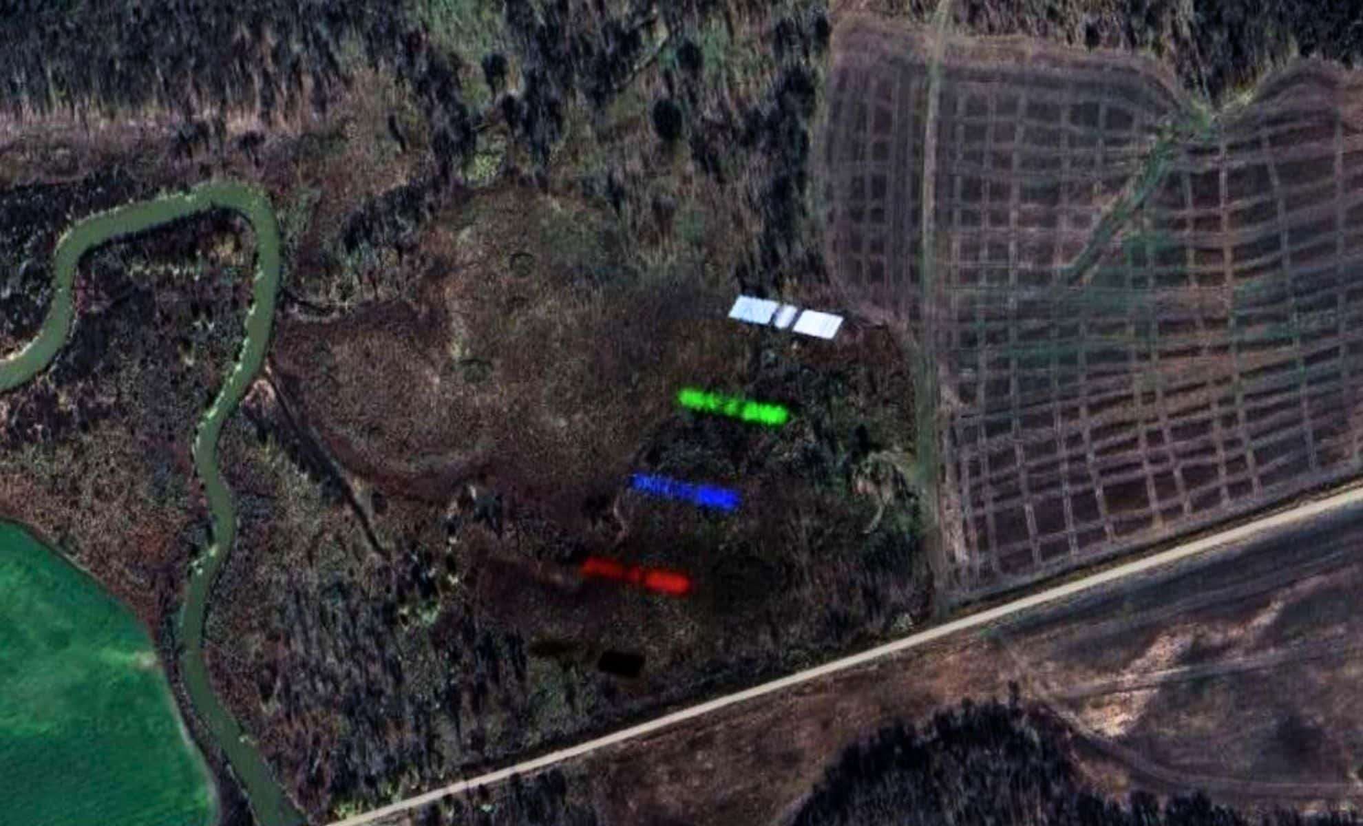
A surprising image from space has unveiled the intricate environment of Earth’s low orbit. Recently found on Google Earth, a photo shows a Starlink satellite, launched by SpaceX, crossing right in front of a high-definition Pléiades satellite camera managed by Airbus Defence and Space. Captured over Texas, this rare shot presents a clear view of a Starlink craft in transit—an uncommon opportunity for the public.
A Rare Moment of Orbital Intersection Captured
As reported originally by Futura Sciences, an internet user exploring Google Earth spotted this unique capture. Different from typical aircraft photobombs, this event stands out due to the high velocity and altitude involved. Starlink satellites orbit roughly 550 kilometers above Earth, whereas Pléiades satellites, which provide detailed imagery for platforms like Google Earth, operate at altitudes between 600 and 800 kilometers.
The incident is remarkable because the Pléiades satellite photographs the ground in multiple spectral bands—blue, green, red, panchromatic, and near-infrared—in rapid succession. During the Starlink satellite’s passage, each spectral capture recorded a slightly shifted position, producing a colorful, layered streak of the satellite across the image.

In-Depth Look at Starlink’s Design
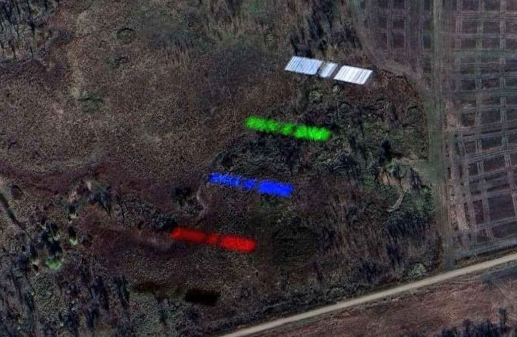
The image reveals the Starlink spacecraft with its fully extended solar panels stretching approximately 30 meters across. This view is exceptional as SpaceX seldom publishes photos of Starlink once deployed in orbit, usually sharing only launch images. As noted by Futura Sciences, this multi-band chronophotograph serves as both an intriguing artifact and a novel way to study satellite structure in great detail.
Although another satellite from China was near the area during the imaging, the configuration and flight path strongly suggest the observed object is indeed a Starlink unit.
Rising Satellite Traffic in Earth’s Orbit
This one-of-a-kind capture brings attention to a growing challenge as the population of satellites around Earth rapidly expands. There are now over 10,000 satellites in low Earth orbit, with more than 7,000 Starlink satellites alone. As the number grows, collisions between satellite imaging fields will become increasingly frequent, leading to unintended captures of other orbiting craft.
Such overlaps aren’t merely visual curiosities; they raise concerns for astronomers and space operators. Reflected light from Starlink satellites has already disrupted observations by ground-based telescopes and even the Hubble Space Telescope. With further deployment of mega-constellations, these encounters could become routine obstacles.
Scientific and Surveillance Ramifications
The segmented spectral path created by the passing satellite might have applications beyond visual interest. The report mentions such images could “also serve espionage purposes,” offering rare data on satellite design and movement. This demonstrates that remote sensing instruments designed for Earth can effectively track and analyze fast-moving satellites.
This transient event over Texas exemplifies how crowded low Earth orbit has become. With so many satellites sharing overlapping altitudes, even advanced Earth imaging satellites face challenges in obtaining unobstructed views.
- Categories:
- News


0 comments
Sign in to Comment