
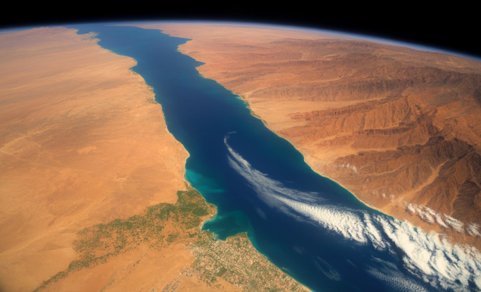
Approximately 6.2 million years ago, the Red Sea—a crucial maritime corridor today—underwent a drastic change, disappearing entirely for a prolonged period. Once teeming with marine life, this basin transformed into a salt-encrusted desert under the harsh Miocene sun. It stayed dry for thousands of years until a massive flood from the Indian Ocean reshaped the seafloor, forming a huge underwater canyon and restoring the sea’s connection to the global ocean.
Scientists have now precisely dated the scale and speed of this transformation. Recent findings published in Communications Earth & Environment by researchers at the King Abdullah University of Science and Technology (KAUST) reveal that the Red Sea was fully dried out before being rapidly refilled in a dramatic marine event that took less than 100,000 years.
“Our findings show that the Red Sea basin records one of the most extreme environmental events on Earth, when it dried out completely and was then suddenly reflooded about 6.2 million years ago,” said lead author Dr. Tihana Pensa, geologist at KAUST.
Add Cosmo Herald as a Preferred Source

This flooding event took place nearly one million years before the famous Zanclean flood that reconnected the Mediterranean Sea with the Atlantic Ocean. Previously underestimated, the Red Sea’s dramatic cycle of drying and refilling now stands out as one of the most pivotal episodes in Earth's hydrological history.
A Vanishing Sea and a Unique Global Phenomenon
The disappearance of the Red Sea coincided with the widespread Messinian Salinity Crisis, a time marked by fluctuating sea levels that altered many marine regions throughout the Mediterranean basin and North Africa. However, evidence suggests the Red Sea’s cutoff happened even before the Mediterranean Basin became desiccated.
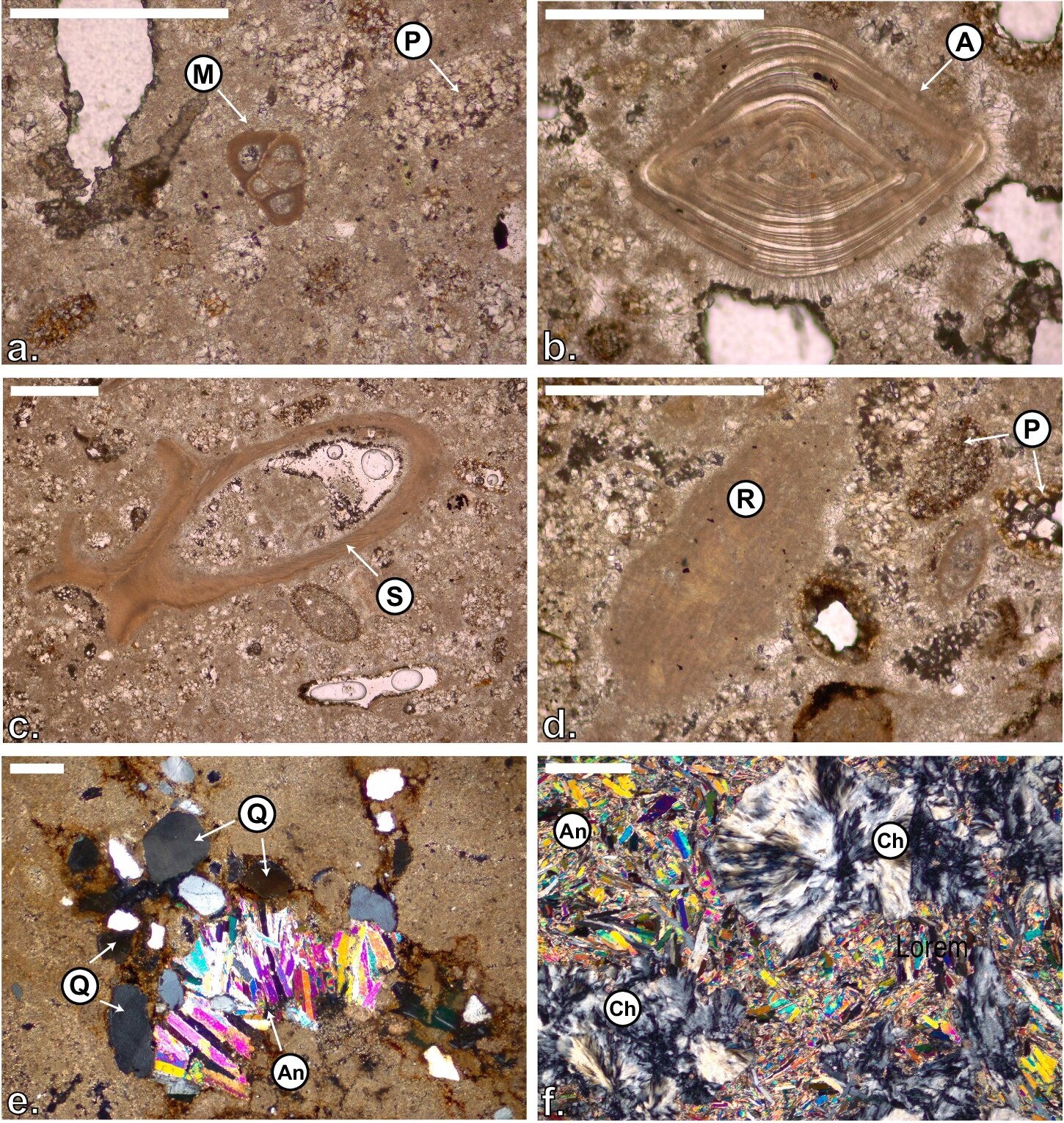
Integrating seismic surveys, well core analyses, and strontium isotope dating across the region, researchers identified a sharply defined angular boundary known as the S-reflector. This separates biologically barren salt deposits of the Miocene era from the fossil-rich Pliocene marine layers above.
The limestone above the S-reflector contains marine fossils from shallow waters and dates precisely to 6.2 ± 0.2 million years ago, while the lower strata are dominated by anhydrite and halite, indicating extreme saline conditions with no life.
These findings confirm that the basin underwent a complete evaporation event. With global sea levels falling and tectonic shifts disrupting marine inflow, water supply ceased and evaporation rates outpaced replenishment, turning the once vibrant rift basin into a salt desert.
The Underwater Canyon That Tells the Story
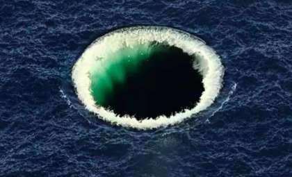
At about 6.2 million years ago, the Indian Ocean finally breached the Hanish volcanic sill near the present-day Bab el-Mandeb Strait. This resulted in a sudden, massive flood that carved a 320-kilometer-long submarine canyon, a geological scar still apparent in today’s seafloor maps.
KAUST researchers explain that this flood reestablished marine conditions and permanently linked the Red Sea with the Indian Ocean, fundamentally altering the region’s hydrology and ecosystems.
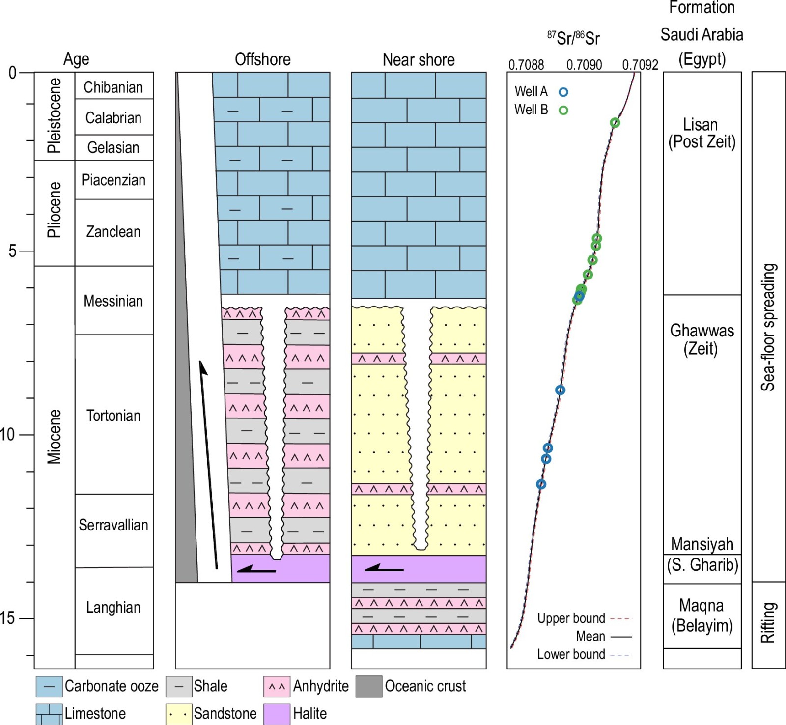
Seismic imaging reveals this unconformity spans hundreds of thousands of square kilometers at depths between 500 and 1,500 meters, backed by large salt deposits and layered anhydrite. The erosional features and salt deformation imply a period of full exposure to air followed by a rapid marine refilling.
Significantly, this sequence predates the well-known Zanclean flood that reopened the Strait of Gibraltar and refilled the Mediterranean Sea. These results call for reconsidering the timing and interaction of Messinian events throughout the Afro-Arabian region.
Interplay of Tectonics and Climate in the Red Sea’s Origin
The Red Sea originated roughly 30 million years ago as a rift separating the African and Arabian tectonic plates. Initially consisting of isolated lakes, it expanded as the plates diverged. Around 23 million years ago, Mediterranean waters briefly inundated the basin, fostering a thriving marine ecosystem, as shown by fossilized reefs near the Saudi coastline.
However, persistent arid climate conditions combined with tectonic changes led to a decline in seawater circulation between 16 and 6 million years ago. During this time, evaporation intensified, and the basin accumulated between 2 and 4 kilometers of salt deposits, which later deformed into structures such as diapirs, canopies, and nappes.
“Salt tectonics is key to understanding the geometry of the unconformity,” Pensa’s team explains in the Communications Earth & Environment. “The S-reflector truncates tilted Late Miocene evaporite layers and overlies flat-lying marine sediments from the Pliocene. This pattern is characteristic of extensive erosion during basin desiccation, followed by marine refilling.”
The basin’s marine life rebounded quickly after reflooding, with fossils of foraminifera, nanofossils, and pteropods appearing soon in upper sediment layers. The presence of shallow marine carbonate deposits more than 1,000 meters beneath current sea level indicates sea levels were dramatically lower when the basin was restored.
- Categories:
- Science


0 comments
Sign in to Comment