
In a rugged mountainous area straddling the Iran–Pakistan border, satellite sensors have detected subtle shifts in the Earth's surface. These changes are imperceptible to the naked eye, yet precise enough to draw the attention of remote geophysical monitoring teams.
Located far from populated regions and lacking local instrumentation, this site revealed a pattern of gradual alteration over several months, suggesting activity beneath a long-dormant volcano. Only satellite data provides continuous monitoring in this remote location, capturing delicate ground motions otherwise unnoticed.
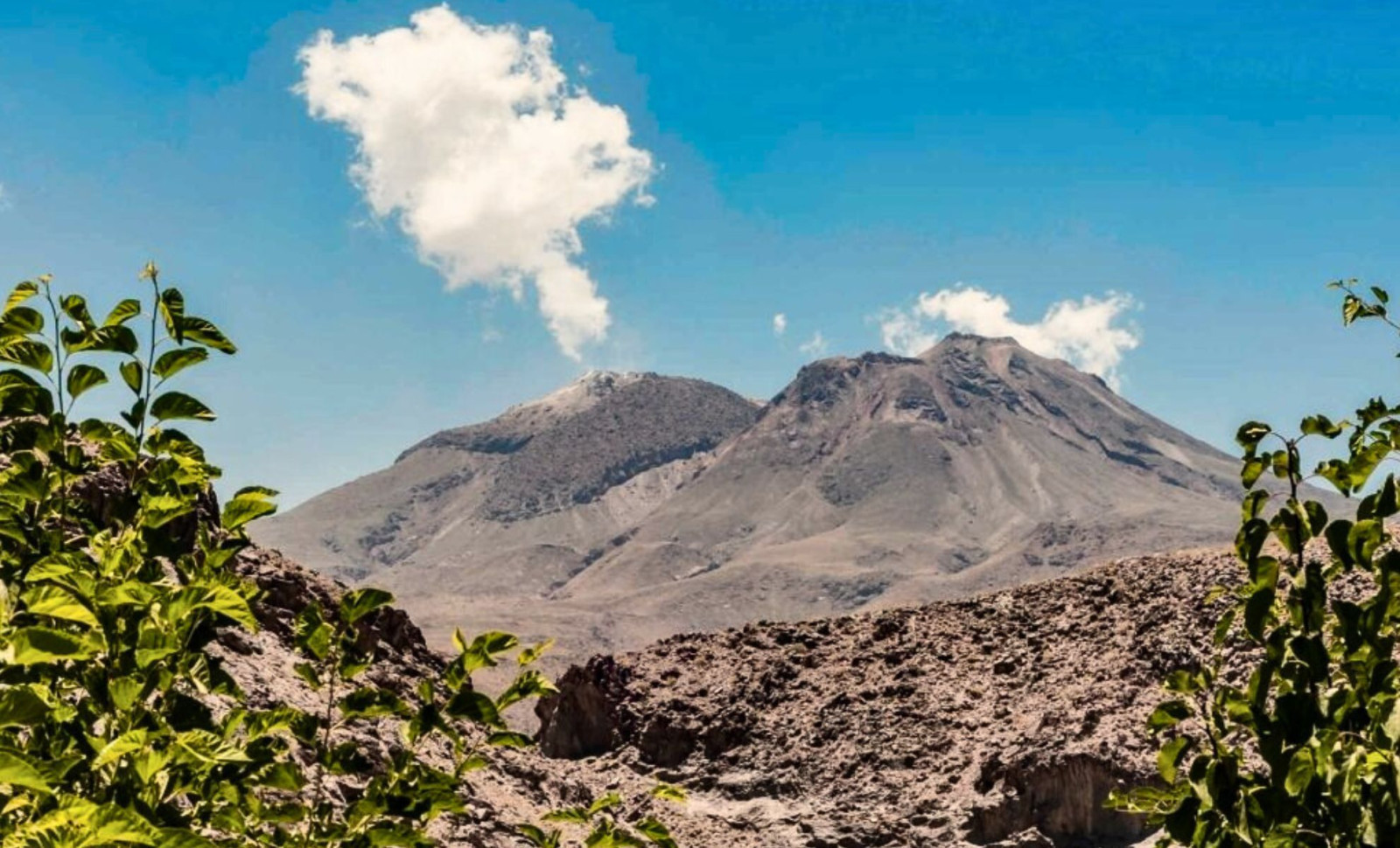
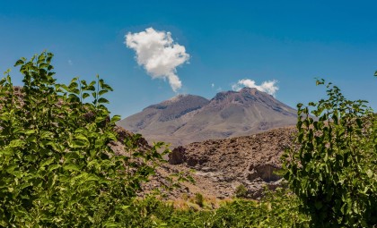
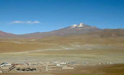
The focus of these observations is Taftan, a secluded stratovolcano in Iran's southeast, which has displayed no confirmed volcanic activity for hundreds of millennia.

Gradual Ground Rise Detected by Satellites
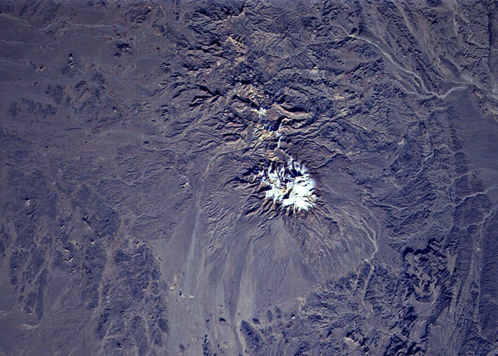
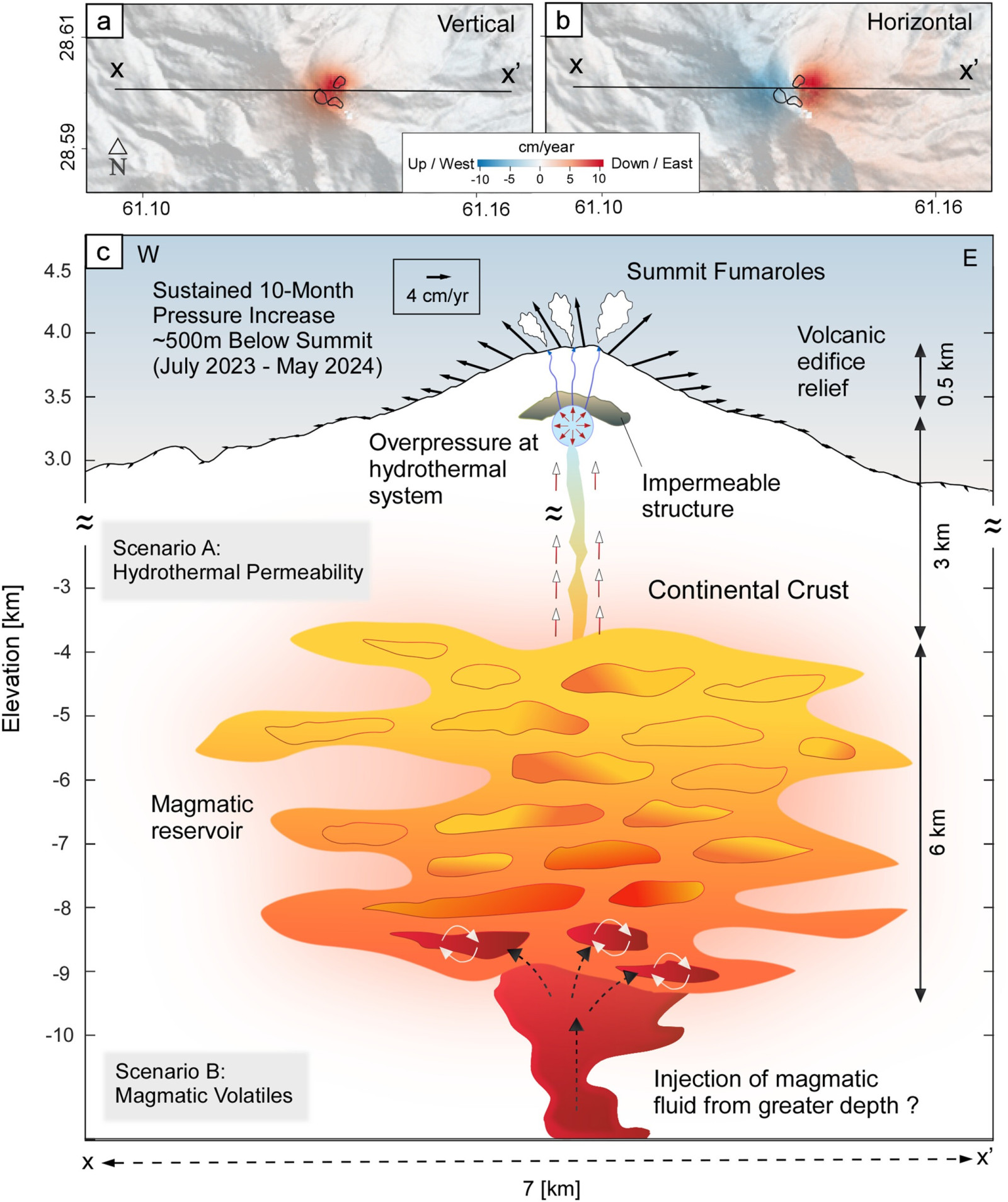
From July 2023 to May 2024, the summit of Taftan experienced a cumulative uplift of roughly 3.5 inches (9 cm). This subtle deformation was identified through InSAR (Interferometric Synthetic Aperture Radar), which uses radar imagery from space to measure fine surface displacements. Data from the Sentinel-1 satellite, part of the Copernicus Programme run by the European Space Agency (ESA), was instrumental in this analysis.
The deformation persisted consistently over nearly a year without retraction. A November 2025 article in Geophysical Research Letters estimated the source at depths between 490 and 630 meters below the peak. Findings suggest the uplift stems from pressure changes within a hydrothermal system—networks of heated fluids and gases circulating underground.
The researchers ruled out rainfall, earthquakes, or other external factors as causes. Instead, the uplift likely results from gas accumulating within fractures or a minor injection of magma releasing volatile compounds into shallow layers.
Reassessing Taftan’s Dormant Status
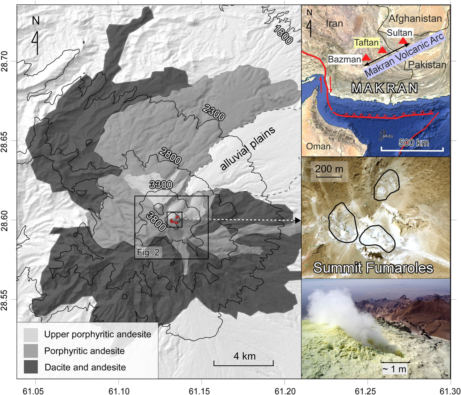
At an elevation of 3,940 meters, Taftan ranks among Iran’s highest volcanoes and is part of the Makran-Chagai volcanic arc, formed by the subduction of the Arabian Plate beneath the Eurasian Plate. Its summit vents continuously emit sulfur-rich gases via fumaroles that have remained active for decades. Still, no confirmed eruptions have occurred in recent geological history.
Historical accounts mention intense gas emissions in 1902 with visible nighttime glows near the volcano. A lava flow was reported in 1993, but records from the Smithsonian Global Volcanism Program suggest it might have been molten sulfur rather than lava.
Radiometric dating of summit rock, using zircon and potassium-argon methods, places the last confirmed magmatic activity between 700,000 and 800,000 years ago. Although this categorizes Taftan as a Pleistocene stratovolcano, volcanologists caution that prolonged dormancy is common. Worldwide, multiple volcanoes have exhibited surface changes after sustained quiet periods.
This newly observed ground deformation classifies Taftan among volcanoes that remain dormant yet exhibit detectable subterranean activity, which could precede more significant phenomena even without surface eruptions.
Monitoring Challenges in a Remote Location
Situated in the isolated Sistan and Baluchestan Province, characterized by dry and sparsely inhabited terrain, Taftan has no station-based scientific monitoring like seismographs, GPS networks, or gas emission sensors. Consequently, satellite observation remains the main method for tracking changes.
The Sentinel-1 satellite fleet, highlighted by NASA Earthdata, is vital for overcoming these limitations. Its radar instruments can detect subtle surface deformation regardless of weather or light conditions, revisiting targets approximately every six days. This frequency permits detailed time-series analyses of gradual geological shifts.
The Geophysical Research Letters research team advocates establishing a local sensor network to measure emissions of sulfur dioxide, carbon dioxide, and water vapor. Such ground-based data would clarify whether underground pressures are easing or intensifying.
Understanding the Hazards of Shallow Pressure Build-Up
No eruptions have been seen, and scientists emphasize that the uplift alone doesn’t signal imminent volcanic activity. Yet the pattern of deformation suggests potential for phreatic explosions—steam-driven eruptions caused when overheated groundwater quickly expands near the surface.
Phreatic events usually do not produce lava flows but can eject ash and gases over short distances. They are notoriously unpredictable, often occurring without advance warning. Risks increase when shallow gas pressure accumulates in confined spaces beneath the volcano.
The fumaroles at Taftan’s summit remain active. Residents of nearby Khash, located about 50 kilometers away, have occasionally noticed sulfur-like odors carried by winds. According to an article on Earth.com, these emissions indicate ongoing subterranean activity despite no visible surface changes.
- Categories:
- News


0 comments
Sign in to Comment