
The beginning of 2026 has intensified interest in how satellites track extreme oceanic phenomena. Widespread reports highlight satellite detections of extraordinarily large waves in the Pacific Ocean, raising questions about whether these observations indicate new oceanic dangers or simply reflect advancements in technology.
A particular satellite mission has gained attention for capturing different notable events close together. On one occasion, it recorded the subtle footprint of a significant tsunami traversing the open ocean. In another case, the same satellite captured severe storm-generated waves formed by strong atmospheric disturbances. The focus on the common technology rather than the underlying oceanic processes has complicated public interpretations.
Validated findings confirm that these are not signs of increasing ocean hazards but demonstrate enhanced capabilities to observe long-studied ocean dynamics. Progress in satellite altimetry technology now offers spatial detail previously attainable only through limited in-situ data, broadening scientific understanding while sometimes causing confusion.

Groundbreaking Satellite Insights into a Major Pacific Tsunami
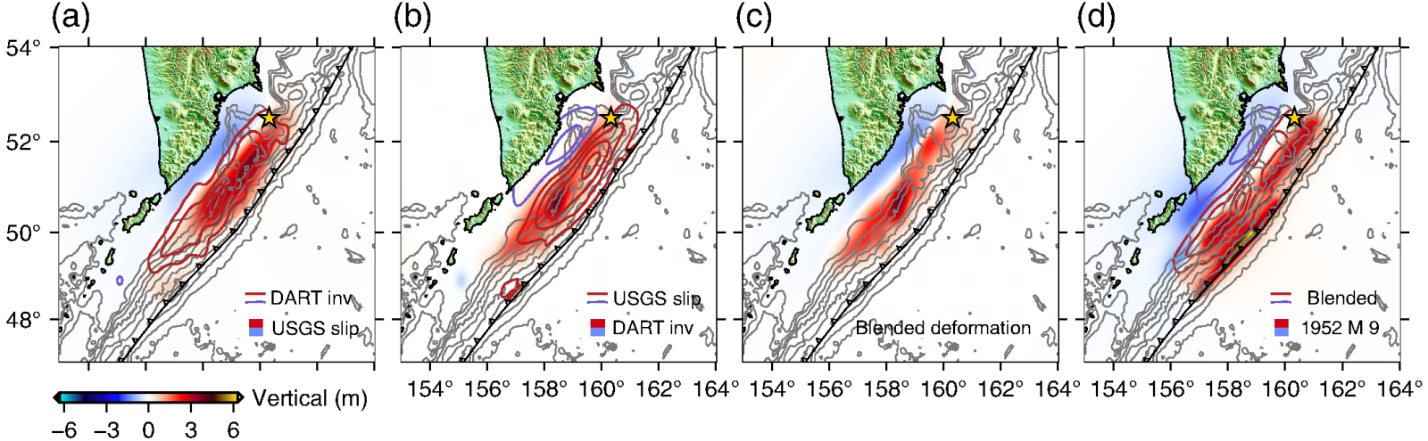
One of the most thoroughly analyzed cases was published in The Seismic Record, detailing the tsunami triggered by the 2025 magnitude 8.8 earthquake near Kamchatka.
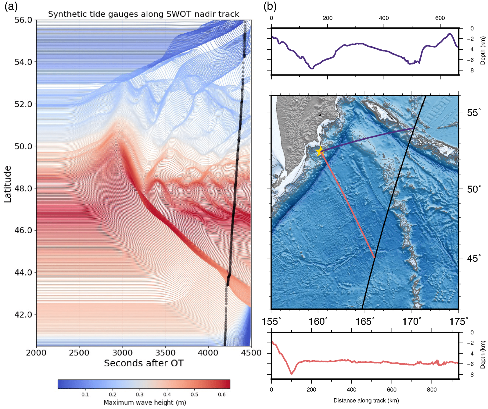
During this event, the Surface Water and Ocean Topography (SWOT) satellite crossed the northern Pacific and captured the tsunami's wavefield in deep waters. The full scientific discussion is presented in the journal covering SWOT's altimetric data and tsunami modeling, published by the Seismological Society of America.
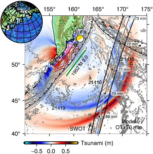
Researchers reported that SWOT detected consistent variations in sea surface elevation over an extensive area, with wave heights ranging from a few centimeters to several tens of centimeters. These measurements align with well-established tsunami models predicting long-wavelength, low-amplitude waves in deep ocean settings. Unlike traditional altimeter satellites that scan narrow tracks, SWOT produced a two-dimensional view of the traveling wave system.
These satellite observations corresponded closely with independent data from the DART deep-ocean detection network operated by NOAA. DART buoys utilize seafloor pressure sensors to detect tsunamis nearly in real-time; however, SWOT's data were reviewed after the event and not used for immediate warnings.
Combining altimetry with seismic and geodetic records allowed researchers to better characterize the earthquake's rupture dynamics, including detailed fault displacement patterns. This marks progress in reconstructing earthquake events post-occurrence. NASA highlights that SWOT was intended as a scientific research tool for mapping ocean surfaces, not as a real-time hazard detection system.
The Role of Storm Waves in the Debate
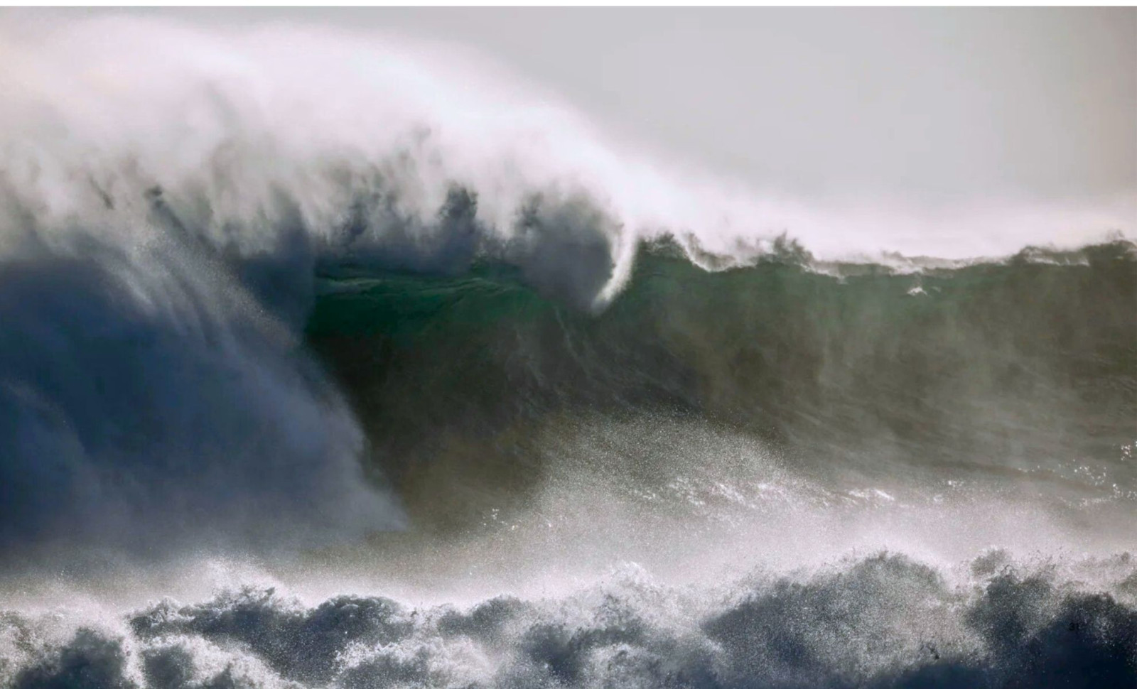
Another prominent story involved reports of satellites detecting waves nearly 35 meters high in the Pacific. These claims stem from altimetry data collected during a powerful North Pacific storm in late 2025. The key measurement was significant wave height, which averages the highest third of waves in a changing sea state.
During that storm, satellite sensors recorded significant wave heights approaching 20 meters. Ocean wave theory indicates individual waves in such conditions can occasionally surpass this average considerably. Media extrapolations have suggested the possibility of waves exceeding 30 meters in height.
Experts clarify these wave heights do not describe tsunami behavior nor represent direct satellite observation of a single extreme wave crest. Storm waves form through wind energy, have shorter periods, and dissipate as weather systems change. Tsunamis originate from sudden seafloor shifts and travel as long-period waves across ocean basins, following distinct physics.
The storm wave heights fall within ranges documented by earlier satellites and ship reports. What's novel is the detailed spatial resolution now achievable by modern altimeters, revealing ocean wave patterns with unprecedented clarity over wide areas.
Enhancing Ocean Observations with Satellite Altimetry
Radar altimetry satellites have contributed to global ocean monitoring since the 1990s, supporting weather forecasting, climate research, and maritime activities. Earlier satellites collected sea surface data along narrow footprints, leaving spatial gaps. SWOT’s interferometric radar design maps broad swaths, exposing spatial wave structures that previous methods inferred indirectly. NASA highlights this as a core scientific aim.
However, SWOT’s observational cadence involves revisiting locations every several days, and its measurements require extensive calibration and analysis. Therefore, SWOT primarily serves research and retrospective event studies rather than real-time hazard alerts. Operational tsunami warnings depend on direct sensor networks like the DART buoy system, and storm warnings rely on meteorological data and computational models.
The tsunami investigation addressed uncertainties such as ocean background noise and the infrequent optimal satellite positioning. These limitations are inherent to the measurement approach rather than shortcomings of the satellite itself.
- Categories:
- Science


0 comments
Sign in to Comment