

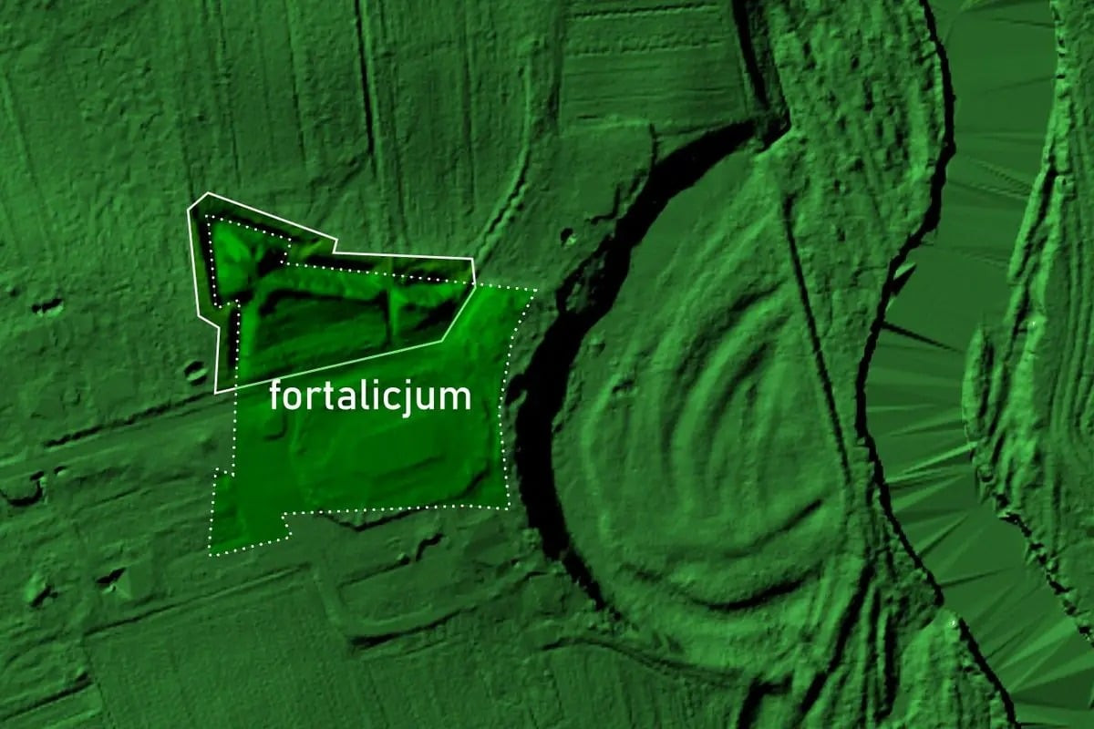
Experts have uncovered a previously unidentified fortress situated in eastern Poland using airborne LiDAR technology to analyze subtle land elevations. This finding exposes the remains of a bastion-style defensive structure located in Chełm County that had remained unnoticed for centuries.
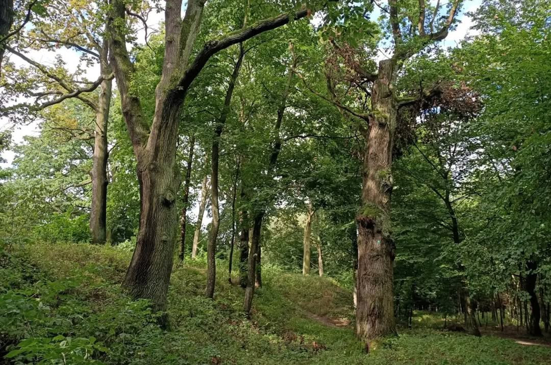
The archaeological site is positioned within a historic manorial estate and landscaped park, where faint embankments had been observed historically but never fully understood. Earlier assumptions proposed that these earthworks might have been associated with a horseshoe-shaped formation.
As detailed by HeritageDaily, detailed remote sensing investigations have now validated that the earthworks represent a bastioned fortification system, or fortalicium. This discovery carries significance due to the region’s turbulent military history in the early modern era.

LiDAR Technology Unveils the Buried Fortress
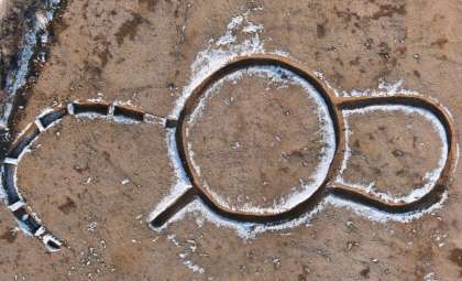
Utilizing airborne laser imaging, commonly known as LiDAR, researchers detected subtle topographical variations not easily visible from the ground. These revealed the defensive earthwork outlines previously misidentified.
The team at the Lublin Voivodeship Conservator of Monuments indicated that the remaining ruins constitute part of a bastion-style defense system characteristic of early modern military architecture. The surviving segment covers the northwestern corner of what was once a rectangular fortress with bastions at each corner.
This design aligns with widespread European fortification principles of the time, notably linked to the French engineering school of fortifications. The Lublin Conservator specialists remarked:
“The finding provides a new perspective on the regional defensive actions taken up along the Bug River frontier, at one of the most tumultuous episodes in the Polish-Lithuanian Commonwealth’s history.”
Fortress Dimensions Evident from Remaining Earthworks
While much of the original fortress has vanished, the remaining embankments still rise up to two meters high above the current terrain. A regional report estimates the surviving section covers roughly 0.4 hectares, providing insight into the original structure’s footprint.
Scholars think the entire complex was significantly larger. According to an analysis presented on Earth.com, the fortress likely spread over approximately 1.5 hectares, with dimensions near 120 by 140 meters. This indicates a semi-permanent or permanent defensive installation designed to protect a strategic zone by the Bug River.
Historical Cartography Corroborates the Fortress Location
Archival maps confirm that this is the fort’s site. An Austrian military survey from 1801 to 1804, known as the “West Galizien” map, labels the fort as a ruin.
Records indicate the fortress probably ceased functioning by the late 18th century. Over the 19th century, cartographical evidence shows the earthworks progressively disappearing, likely due to agricultural development and land modification.
Additional historical references to a fortification in the vicinity include a 1694 document mentioning a “trench” near the Bug River and an 18th-century account describing a field referred to by locals as “the shaft.” Researchers, as cited by HeritageDaily, consider these writings as lingering reminders of when the fortress actively guarded this frontier.
- Categories:
- News


0 comments
Sign in to Comment