
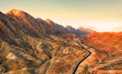
In Iran, expansive regions are undergoing a dramatic and continuous sinking of the land surface. Certain areas are subsiding at rates approaching 30 centimeters annually, the most rapid pace observed anywhere worldwide. This gradual but relentless phenomenon is quietly transforming the nation's landscape from below the surface.
A new study featured in the Journal of Geophysical Research: Solid Earth reveals that more than 31,000 square kilometers of Iranian land—an area similar in size to Belgium—is affected by subsidence. The dominant factor driving this land sinking is the extensive and rapid extraction of groundwater reserves, predominantly within farming zones where water withdrawal outpaces natural replenishment.
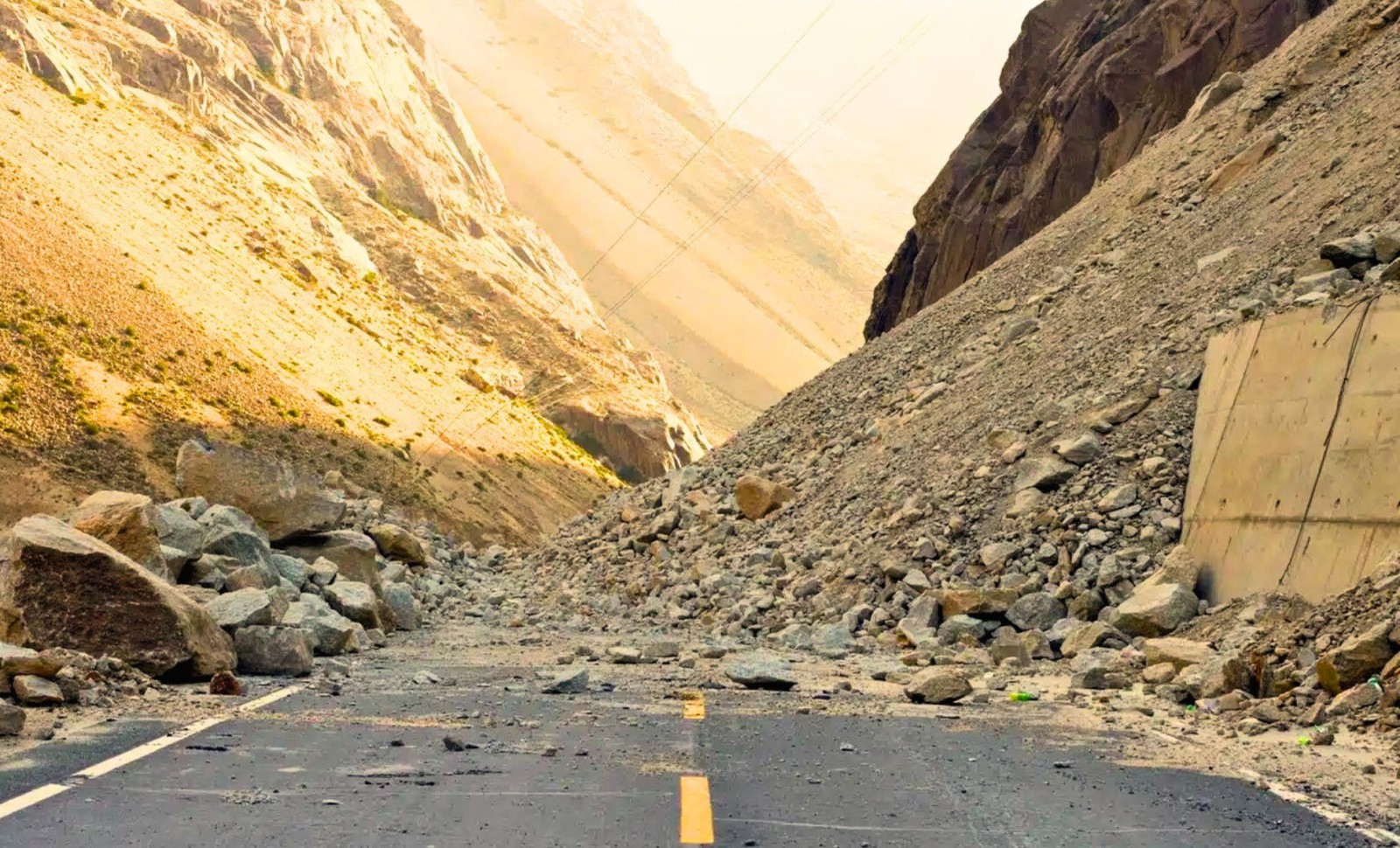
This persistent earth subsidence poses grave risks beyond geological changes. It has already started causing structural failures in buildings, infrastructure, and roadways. Critically, it endangers Iran's future water availability. Once aquifers are compacted, their capacity to store water is irretrievably diminished, even if surface water conditions improve.

Warning signals are stacking up. Official meteorological data indicates that precipitation for the 2024–2025 hydrological cycle is about 45% below normal levels. Coupled with decades of uncontrolled groundwater pumping, vast swathes of the country are now in active subsidence.
Satellite Insights into Iran’s Disappearing Ground
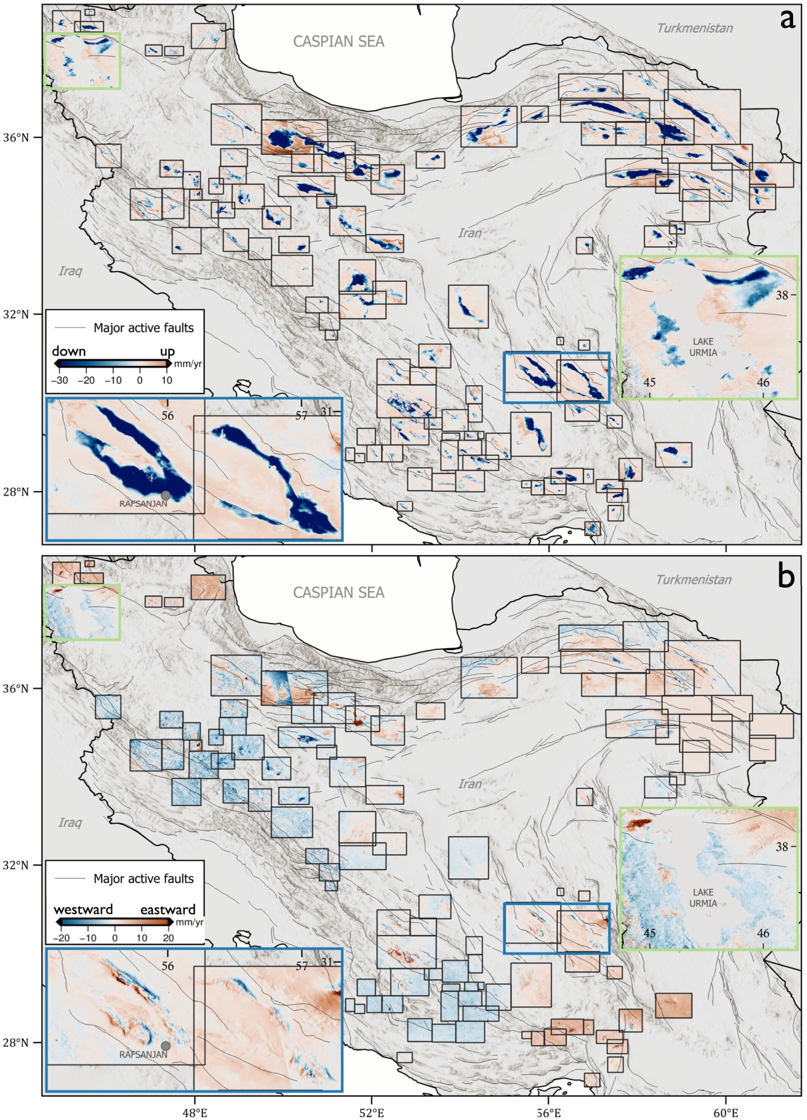
Between 2014 and 2022, scientists analyzed Iran’s terrain using radar imagery collected by the European Space Agency’s Sentinel-1 satellites. This research, led by Jessica Payne at the University of Leeds, discovered 106 significant zones of land subsidence.
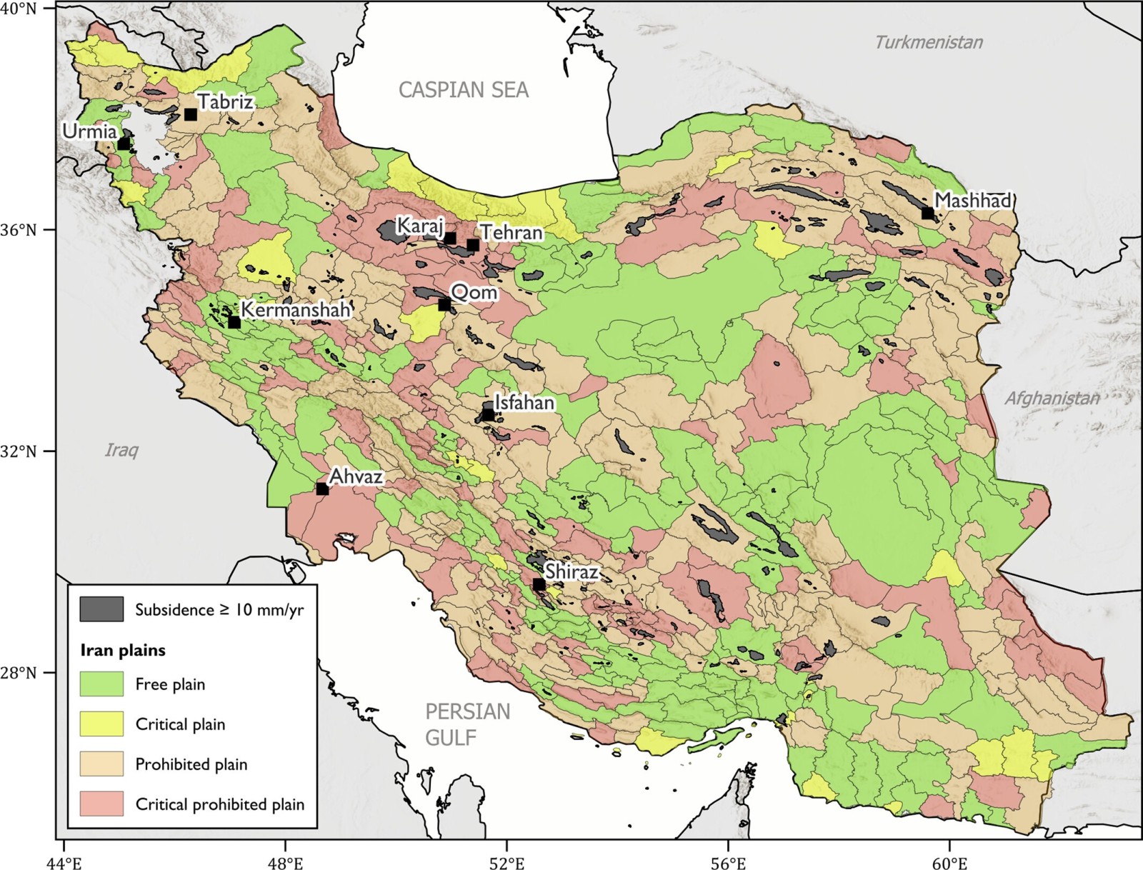
The findings underscore how far Iran’s subsidence rates surpass international safety limits. While European nations consider a yearly sinking between 5 and 8 millimeters to be alarming, Iran has over 100 locations sinking faster than 10 millimeters per year. Some places, such as near Rafsanjan in Kerman province, experience ground loss exceeding 35 centimeters annually.
This southeastern region, critical for pistachio cultivation, perfectly illustrates the conflicts between intensive farming and water scarcity. Heavy irrigation relying on depleted underground water has drastically lowered the water table, causing the surface to subside.
Urban Areas Feeling the Strain
Although the most obvious damages appear across rural agricultural zones, urban environments are also affected. The city of Karaj, with a population exceeding four million, has over 23,000 inhabitants residing in regions declared highly vulnerable to subsidence. Other major cities such as Tehran, Mashhad, Isfahan, and Shiraz report increasing incidents of cracked buildings, warped roads, and failing sewage infrastructure.
Combined satellite data and interferometric synthetic aperture radar (InSAR) analyses confirm ongoing ground deformation beneath these urban centers, raising alarms about their structural longevity. Although official disclosures remain limited, accumulating research is exposing the full scope of these risks.
Government responses have lagged behind the escalating crisis. Iran's Ministry of Energy has acknowledged the situation broadly, but enforcement measures on groundwater drilling and extraction remain patchy and uneven.
Subsurface Aquifers Under Severe Stress
The dynamics driving land sinking create lasting damage. Iran’s underground aquifers mainly consist of fine-grained alluvial materials including sand, silt, and clay. These sediments form porous networks holding groundwater like sponges. Excessive water extraction causes the supporting pressure in these pores to decline.
As the sediment compacts, pore spaces close permanently. This leads to sinking of the ground surface and an irreversible loss in the aquifer’s water storage potential. Even if water levels recover, the compacted sediments cannot expand back to their original capacity.
This irreversible process, called inelastic compaction, poses a dire threat because roughly 60% of Iran’s drinking and irrigation water depends on these underground reservoirs, according to UNESCO.
Iran’s current predicament stems from decades of expanding agriculture, population increases, and short-term water management policies, especially during drought and sanctions periods. The proliferation of tens of thousands of unregulated wells drilled without proper oversight has exacerbated the collapse.
A Global Phenomenon Beyond Iran
While Iran's situation is among the most extreme, similar land subsidence is occurring worldwide. Notable cases include California’s Central Valley, Mexico City, northern China, and Italy's Po Valley. In fact, in 2021, subsidence triggered the collapse of a metro line in Mexico City, resulting in 26 fatalities.
The U.S. Geological Survey estimates more than 17,000 square miles of land in the United States are affected by subsidence mainly due to groundwater extraction. Similar trends accelerate across Asia and Latin America as drought, climate change, and rising urban demands strain water sources.
What makes Iran’s case unique is the unprecedented extent, velocity, and severity of its subsidence. While steps such as improved irrigation, groundwater recharge, and regulatory enforcement can help, collapsed aquifers cannot be restored. The impacts are permanently etched into the geology.
- Categories:
- News


0 comments
Sign in to Comment