
Yellowstone National Park, sprawling mainly across northwestern Wyoming and extending into parts of Montana and Idaho, hosts one of the globe’s most scrutinized volcanic systems. Renowned for its dynamic nature and historic supervolcanic eruptions, recent investigations by the U.S. Geological Survey (USGS) alongside Oregon State University have unveiled a clearer image of the subsurface magma chambers beneath the park.
Geophysicist Ninfa Bennington spearheaded a study using magnetotelluric surveys to map the underground structures, detecting four separate magma reservoirs beneath Yellowstone. Among these, the reservoir in the northeast maintains enough residual heat to stay partially molten over extended periods, marking it as the prime location for possible volcanic activity in the future.
A Legacy of Massive Volcanic Events
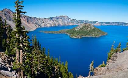
Yellowstone’s volcanic past includes three significant eruptions within a timeframe of 2.1 million years. Each event created a caldera, a vast depression on the surface formed when magma empties from the chamber and the overlying ground collapses. The resulting Yellowstone Caldera spans roughly 30 by 45 miles (48 by 72 km).

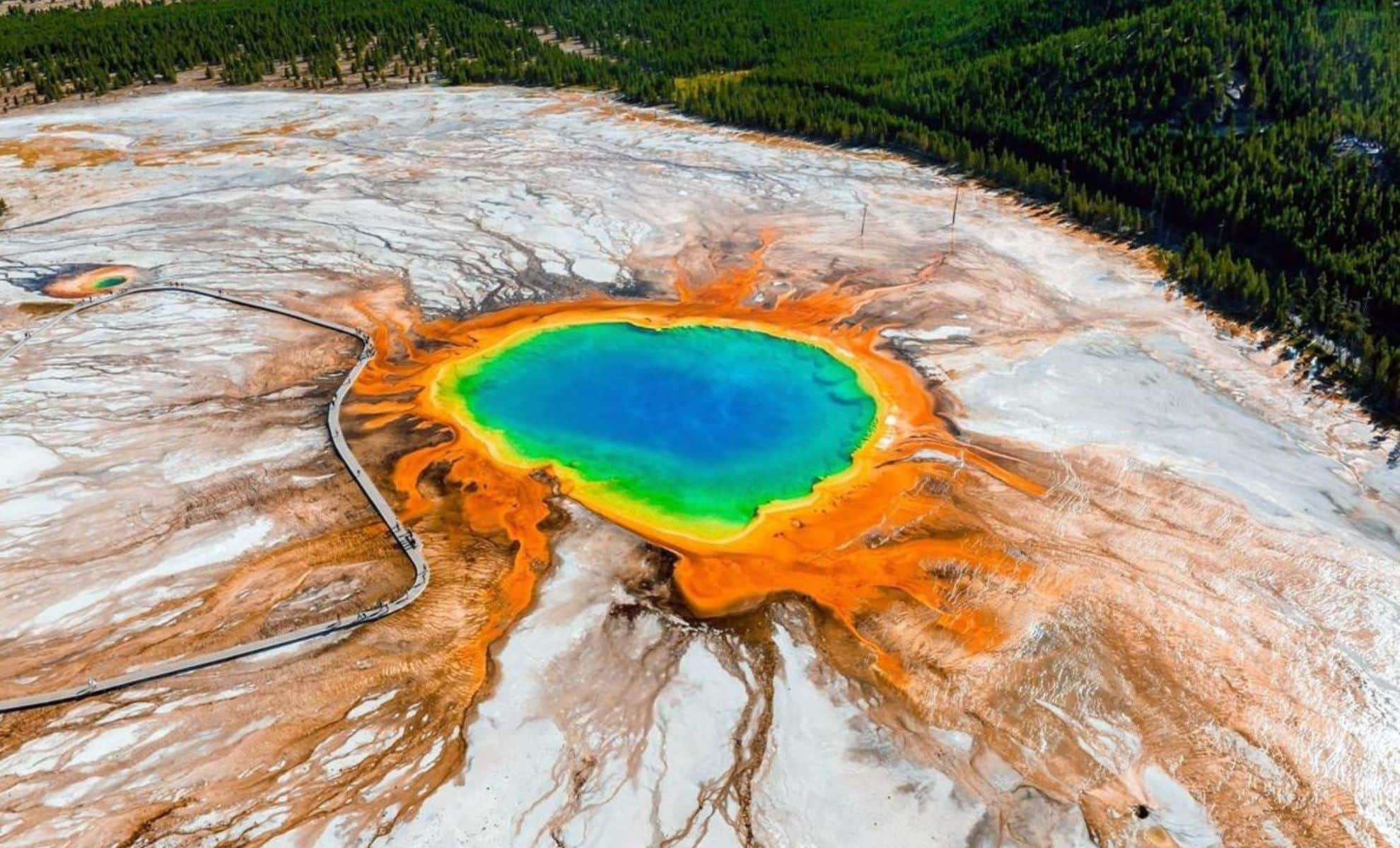
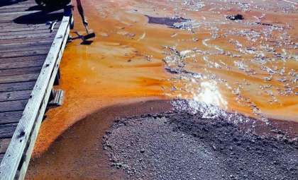
The most recent colossal eruption, known as the Lava Creek event about 631,000 years ago, sculpted a terrain rich in geothermal features like geysers and fumaroles, accompanied by hot springs. These phenomena reflect the underlying intense heat reservoir beneath Yellowstone. Researchers continue to monitor these geothermal zones to glean insights into shifts occurring underground.
Probing the Magma Network
Employing magnetotelluric technology to measure subtle changes in electrical conductivity below the surface, scientists successfully mapped out magma concentrations without invasive drilling.
The data illustrates that rhyolitic magma is clustered within distinct pockets beneath the caldera, indicating uneven distribution rather than a singular magma body. The reservoir in the northeast section beneath the Yellowstone Caldera stands out as the only one maintaining prolonged heat retention, making it central to ongoing observation efforts.
A simplified volcanic map of Yellowstone highlights critical geothermal zones:
- Lower Geyser Basin (LGB)
- Norris Geyser Basin (NGB)
- Hot Springs Basin (HSB)
These surface regions serve as visible indicators of subsurface heat sources and align well with mapped magma locations.
Focus on the Northeastern Reservoir
While four magma chambers were identified under the park, only the northeastern body shows signs of sustained partial melting over long timeframes. This finding narrows down previous predictions that considered multiple zones for future eruptions.
Bennington emphasized, “We suggest that the locus of future rhyolitic volcanism has shifted to northeast Yellowstone Caldera.” This directs future geological monitoring and risk evaluation specifically to this locale.
No immediate eruption threats are evident, yet pinpointing where magma accumulates grants invaluable understanding of Yellowstone’s volcanic processes and possible evolution.
Supervolcano Comparisons Worldwide
Yellowstone’s supervolcanic activity is often benchmarked against other giant volcanic systems like Toba in Indonesia, famous for its massive eruption around 74,000 years ago that triggered widespread climatic effects such as a volcanic winter. Investigating supervolcanoes globally helps scientists identify shared characteristics in magma behavior and eruption cycles.
Examining sites like Toba, Taupō (New Zealand), and Campi Flegrei (Italy) reveals that subterranean magma dynamics vary by geological setting. These variations enhance the precision of predictive models for volcanic eruptions worldwide.
Volcanic Surveillance and Public Awareness
The Yellowstone Volcano Observatory (YVO), a collaborative effort among the USGS, University of Utah, and National Park Service, continuously observes the park for volcanic unrest. YVO monitors several key indicators, including:
- Seismic activity: Earthquake patterns that may indicate magma migration.
- Ground deformation: Changes in surface elevation signaling underground processes.
- Gas emissions: Variations in sulfur dioxide release that could suggest fresh magma influx.
YVO ensures public safety by providing up-to-date information through its website and scientific bulletins, fostering transparency and awareness.
Clarifying Eruption Risks at Yellowstone
Despite public concerns, geologists stress that an extraordinary Yellowstone eruption is highly improbable in the near future. The specific conditions required for such an eruption are rare and currently not aligned.
Most magma beneath Yellowstone is either solid or only partly molten, making conditions unfavorable for a large-scale eruption. Routine ground shifts and hydrothermal activity are common in volcanic regions with active heat sources and do not signify imminent danger.
The full study is accessible in Nature.
- Categories:
- News


0 comments
Sign in to Comment