
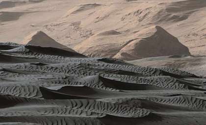
NASA’s Mars Reconnaissance Orbiter (MRO) has captured striking images of a blue-tinted dune that challenge our understanding of Martian winds, sediments, and surface geology. Although the coloration is artificially enhanced, the distinctive characteristics of these dunes, found in two separate craters, are genuinely remarkable.
Recently, NASA shared high-resolution photos taken by the HiRISE camera aboard the MRO, showcasing dune fields inside Lyot Crater and Gamboa Crater. These photos provide more than eye-catching imagery—they offer a valuable glimpse into how Martian winds interact with local materials. Notably, the dunes exhibit unusual shapes, ripple formations, and orientations that could help decode past surface processes and environmental conditions on Mars.
The enhanced colors in these photos are created using false-color processing techniques to emphasize subtle differences in surface materials that are otherwise invisible.

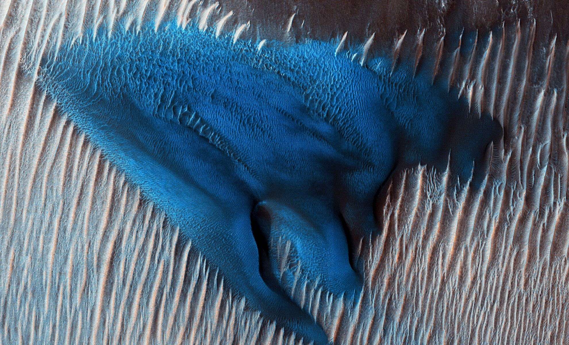
Variations in Dunes at Lyot Crater
Within Lyot Crater, the MRO captured classic crescent-shaped barchan dunes, which form under steady wind regimes. Just south of these formations lies a large individual dune with intricate structural details and distinctive coloring. Unlike the surrounding sand, this dune displays a turquoise blue hue, indicative of a differing mineral makeup or grain size.
NASA clarifies that the blue color is not natural but results from image enhancement that highlights fine particles or unique chemical constituents. This variation in composition suggests a distinct formation history. The images were processed as stereo pairs by the University of Arizona, which oversees the HiRISE camera operation on the MRO spacecraft.
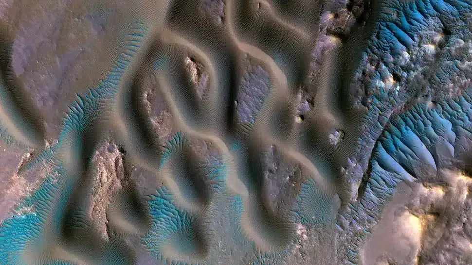
The Influence of Wind Patterns at Gamboa Crater
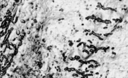
Far from Lyot, the MRO took a false-color image of the Gamboa Crater region, unveiling another fascinating dune landscape. As reported by Space.com citing NASA, the picture reveals fine ripple patterns spaced merely a few feet apart on the crests of bigger dunes. These small ripples aggregate into large sand waves approximately 9 meters (30 feet) apart from peak to peak.
The terrain features several Transverse Aeolian Ridges (TARs), bright, roughly parallel lines made of coarse sand. NASA notes that these TAR structures appear brighter blue in enhanced color on one side, likely caused by active wind processes removing darker dust and increasing reflectivity. By analyzing the alignment and spacing of these ridges, scientists can infer historical wind directions that shaped Mars’ surface.
MRO’s Ongoing Contributions to Martian Exploration
The Mars Reconnaissance Orbiter, orbiting Mars for over sixteen years, continues to deliver groundbreaking data. Though initially designed to detect ancient water signatures, the mission has expanded its role. It also serves as a communication relay for rovers like Perseverance and Curiosity, while simultaneously performing detailed surface studies from orbit.
NASA emphasizes the importance of the onboard HiRISE camera, created by Ball Aerospace & Technologies Corp. and operated by the University of Arizona. This instrument is critical for landing site identification, surface monitoring, and mineral detection.
Research focused on areas such as Lyot and Gamboa Crater continues to enrich our understanding of Mars’ climate history and the processes—like wind, sediment transport, and dust dynamics—that have actively shaped its terrain.
- Categories:
- News


0 comments
Sign in to Comment