
A significant Maya urban center concealed beneath the dense forests of eastern Campeche, Mexico, has come to light—not through fieldwork, but by revisiting archived lidar imagery originally gathered for a different study. This site, now termed Valeriana, remained overlooked within a 2013 ecological survey dataset for over ten years.
Published in the journal Antiquity, this revelation draws attention not only because of the city's scale but also due to its discovery method—no new expeditions were needed; researchers simply analyzed existing digital records.
In recent years, lidar technology has revolutionized Maya archaeology by exposing structures shrouded by thick vegetation. Valeriana hints that future breakthroughs may increasingly stem from mining and reinterpreting these prior datasets instead of conducting fresh field surveys.

Graduate Research Unveils Missed Archaeological Treasure
Doctoral candidate Luke Auld-Thomas from Tulane University initiated the discovery. While exploring publicly available data, he stumbled upon a lidar survey conducted in 2013 by a conservation group focused on forest and carbon ecosystem tracking.
“I was on something like page 16 of Google search and found a laser survey done by a Mexican organisation for environmental monitoring,” he said.
According to the article in Antiquity, the original lidar dataset was gathered without archaeological objectives. Nonetheless, applying archaeological analysis revealed clear patterns suggesting human-made features far beyond natural landforms.
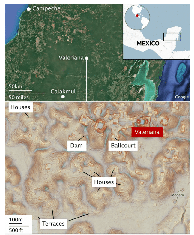
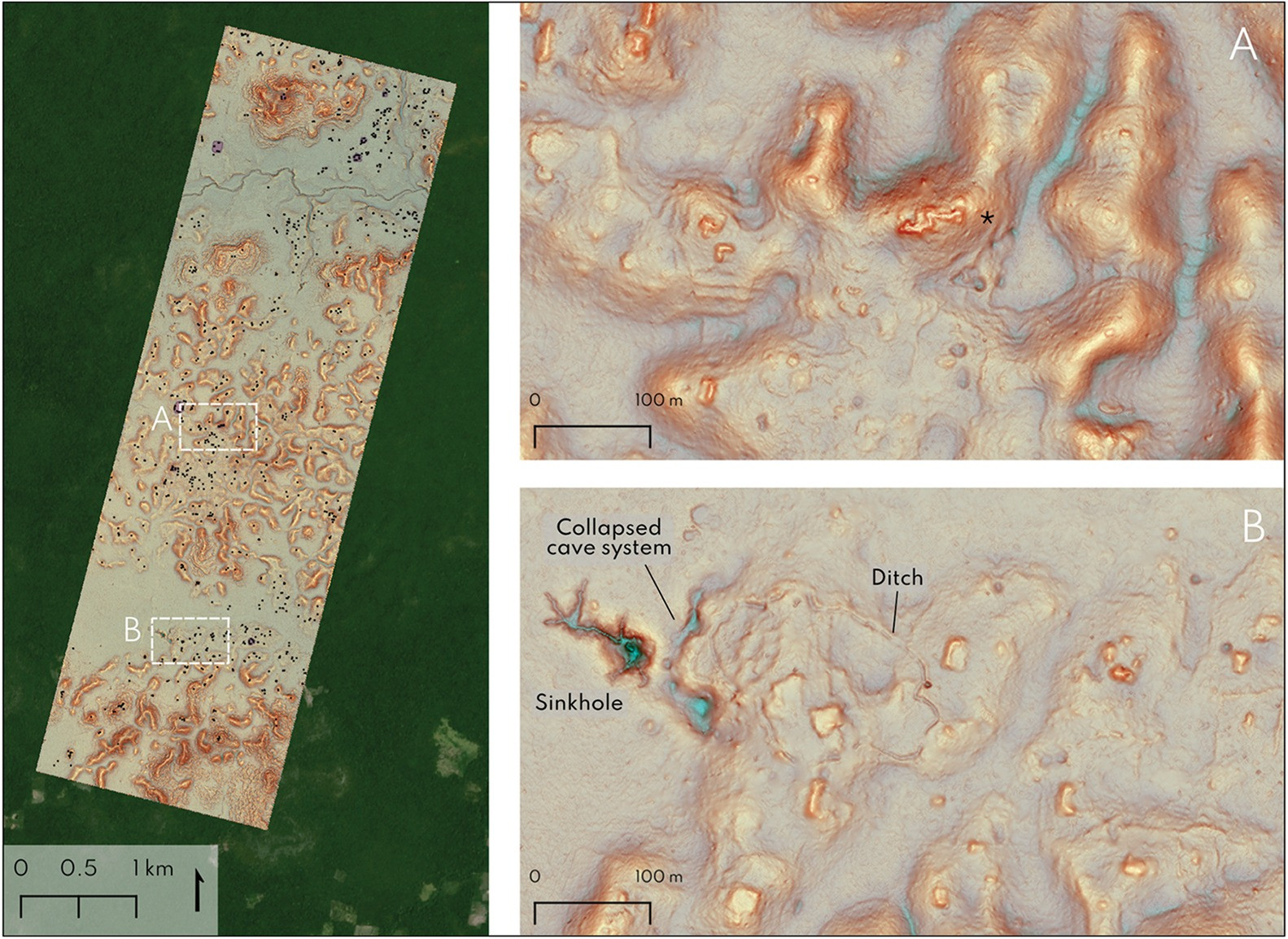
Lidar technology operates by sending thousands of laser pulses from an aircraft toward the ground, some penetrating gaps in the forest canopy. Removing the vegetation digitally then exposes underlying archaeological structures. Covering nearly 122 square kilometers, the survey detected 6,764 distinct structures, averaging about 55 buildings per square kilometer. Beneath the jungle canopy, the data revealed a sprawling Maya metropolis.
Exploring Valeriana’s Hidden Urban Infrastructure
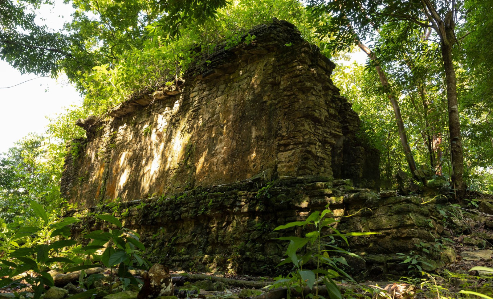
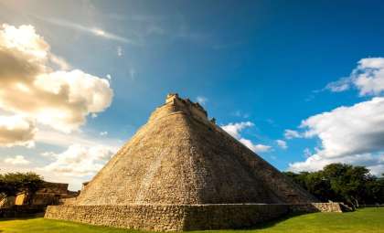
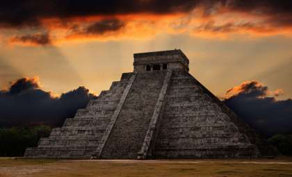
The lidar imagery showcased typical features expected in a prominent Classic Maya city. Among the finds are two major precincts, vast plazas linked by a broad causeway, temple pyramids, a ballcourt, and a reservoir formed by damming a seasonal river.
Information referenced by the BBC estimates the city’s population at its apex between 30,000 and 50,000 inhabitants, dating from approximately 750 to 850 AD. These calculations are derived from structure density rather than direct excavation.
The original name used by the city's residents has been lost to history. Researchers currently refer to the site as Valeriana, named after a neighboring lagoon, within a region long known for Maya artifacts.
As noted in source interviews, Auld-Thomas stated this discovery aligns with anticipated regional patterns rather than challenging existing theories.
Significance Lies in Reinterpreting Existing Data
This lidar dataset had been available for years before experts analyzed it from an archaeological angle. The research team emphasizes that lidar surveys are commonly conducted for environmental conservation, agriculture, mining, and infrastructure but often remain uninvestigated by archaeologists.
Valeriana is notable as it emerged from data initially collected for non-archaeological aims, later reexamined to reveal ancient remains.
Future expeditions are planned to confirm these findings on-site. While lidar exposes architectural outlines, physical excavation is essential to establish occupation timelines and contextualize Valeriana within Maya history.
“I’ve got to go to Valeriana at some point. It’s so close to the road, how could you not? But I can’t say we will do a project there,” stated Auld-Thomas.”One of the downsides of discovering lots of new Maya cities in the era of Lidar is that there are more of them than we can ever hope to study.”
- Categories:
- News


0 comments
Sign in to Comment